


<< Text Pages >> Laccaneddu Tomba di Giganti - Chambered Tomb in Italy in Sardinia (Sardegna)
Submitted by AlexHunger on Saturday, 25 March 2006 Page Views: 2638
Neolithic and Bronze AgeSite Name: Laccaneddu Tomba di Giganti Alternative Name: Lacaneddu Giants TombCountry: Italy
NOTE: This site is 2.742 km away from the location you searched for.
Region: Sardinia (Sardegna) Type: Chambered Tomb
Nearest Town: Sassari Nearest Village: Villanova Monteleone
Latitude: 40.511670N Longitude: 8.438100E
Condition:
| 5 | Perfect |
| 4 | Almost Perfect |
| 3 | Reasonable but with some damage |
| 2 | Ruined but still recognisable as an ancient site |
| 1 | Pretty much destroyed, possibly visible as crop marks |
| 0 | No data. |
| -1 | Completely destroyed |
| 5 | Superb |
| 4 | Good |
| 3 | Ordinary |
| 2 | Not Good |
| 1 | Awful |
| 0 | No data. |
| 5 | Can be driven to, probably with disabled access |
| 4 | Short walk on a footpath |
| 3 | Requiring a bit more of a walk |
| 2 | A long walk |
| 1 | In the middle of nowhere, a nightmare to find |
| 0 | No data. |
| 5 | co-ordinates taken by GPS or official recorded co-ordinates |
| 4 | co-ordinates scaled from a detailed map |
| 3 | co-ordinates scaled from a bad map |
| 2 | co-ordinates of the nearest village |
| 1 | co-ordinates of the nearest town |
| 0 | no data |
Internal Links:
External Links:
Chambered Tomb in Sardegna
Megalithic tomb.
You may be viewing yesterday's version of this page. To see the most up to date information please register for a free account.
Do not use the above information on other web sites or publications without permission of the contributor.
Nearby Images from Flickr
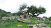
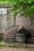
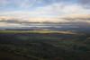
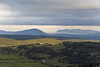
The above images may not be of the site on this page, but were taken nearby. They are loaded from Flickr so please click on them for image credits.
Click here to see more info for this site
Nearby sites
Click here to view sites on an interactive map of the areaKey: Red: member's photo, Blue: 3rd party photo, Yellow: other image, Green: no photo - please go there and take one, Grey: site destroyed
Download sites to:
KML (Google Earth)
GPX (GPS waypoints)
CSV (Garmin/Navman)
CSV (Excel)
To unlock full downloads you need to sign up as a Contributory Member. Otherwise downloads are limited to 50 sites.
Turn off the page maps and other distractions
Nearby sites listing. In the following links * = Image available
5.5km WNW 290° Scala Piccada Domus de Janas Rock Cut Tomb
7.0km S 191° Monte Appiu Stone setting* Misc. Earthwork
7.4km ESE 112° Necropoli Pottu Codinu* Rock Cut Tomb
7.4km SSW 192° Monte Appiu Standing Stones 2* Standing Stones
7.5km SSW 191° Monte Appiu Standing Stones 1* Standing Stones
7.5km SSW 192° Monte Appiu Nuraghe 1* Broch or Nuraghe
7.6km SSW 192° Monte Appiu* Ancient Village or Settlement
7.6km SSW 194° Monte Appiu Tomba di Giganti* Chambered Tomb
7.7km SSW 195° Monte Appiu Dolmens* Burial Chamber or Dolmen
7.7km SSW 195° Monte Appiu Nuraghe 2* Broch or Nuraghe
9.4km NW 312° Monte Carru Nuraghe Broch or Nuraghe
9.7km NW 314° Solaris Nuraghe Broch or Nuraghe
11.6km NW 312° Monte Agnese Nuraghe Broch or Nuraghe
12.8km NNW 347° Santu Pedru Domus de Janas* Rock Cut Tomb
12.8km ENE 59° Cunedda Nuraghe 1* Broch or Nuraghe
12.8km ENE 60° Cunedda Nuraghe 2* Broch or Nuraghe
12.9km ESE 102° Subadru Nuraghe Broch or Nuraghe
13.5km NNE 23° Monte Sant' Elia Nuraghe* Broch or Nuraghe
13.5km NNE 22° Sopra La Miniera Nuraghe Broch or Nuraghe
13.6km ENE 57° Giundali Nuraghe* Broch or Nuraghe
13.7km NNE 26° Sos Isconcados Nuraghe* Broch or Nuraghe
13.9km NNE 22° Monte Ladu Nuraghe* Broch or Nuraghe
13.9km NNW 346° Monte Baranta Menhir* Standing Stone (Menhir)
14.2km NW 313° Miguel Forte Nuraghe Broch or Nuraghe
14.2km NNE 29° Sa Signora Nuraghe Broch or Nuraghe
View more nearby sites and additional images


 We would like to know more about this location. Please feel free to add a brief description and any relevant information in your own language.
 Wir möchten mehr über diese Stätte erfahren. Bitte zögern Sie nicht, eine kurze Beschreibung und relevante Informationen in Deutsch hinzuzufügen.
 Nous aimerions en savoir encore un peu sur les lieux. S'il vous plaît n'hesitez pas à ajouter une courte description et tous les renseignements pertinents dans votre propre langue.
 Quisieramos informarnos un poco más de las lugares. No dude en añadir una breve descripción y otros datos relevantes en su propio idioma.