


<< Our Photo Pages >> Jutulporten - Natural Stone / Erratic / Other Natural Feature in Norway in Oppland
Submitted by kenntha88 on Friday, 22 October 2021 Page Views: 551
Natural PlacesSite Name: JutulportenCountry: Norway
NOTE: This site is 39.867 km away from the location you searched for.
Fylke: Oppland Type: Natural Stone / Erratic / Other Natural Feature
Nearest Town: Sel Nearest Village: Vågamo
Latitude: 61.875985N Longitude: 9.086552E
Condition:
| 5 | Perfect |
| 4 | Almost Perfect |
| 3 | Reasonable but with some damage |
| 2 | Ruined but still recognisable as an ancient site |
| 1 | Pretty much destroyed, possibly visible as crop marks |
| 0 | No data. |
| -1 | Completely destroyed |
| 5 | Superb |
| 4 | Good |
| 3 | Ordinary |
| 2 | Not Good |
| 1 | Awful |
| 0 | No data. |
| 5 | Can be driven to, probably with disabled access |
| 4 | Short walk on a footpath |
| 3 | Requiring a bit more of a walk |
| 2 | A long walk |
| 1 | In the middle of nowhere, a nightmare to find |
| 0 | No data. |
| 5 | co-ordinates taken by GPS or official recorded co-ordinates |
| 4 | co-ordinates scaled from a detailed map |
| 3 | co-ordinates scaled from a bad map |
| 2 | co-ordinates of the nearest village |
| 1 | co-ordinates of the nearest town |
| 0 | no data |
Internal Links:
External Links:
")
Jutulporten "The troll gate" Vågå
Legends say that in this rock the local troll or jutul had his home. It was this jutul that was said to have taken the local man johans blessoms home to Vågå from copenhagen, flying over hills and mountains. (A well known fairytale or sagn)
After johans have come home he was told not to look up if he heard a band but forgot himself and looked up, realizing who had brought him home. From that day his head was fixed in that position. Johans blessoms is however a real person according to local chronicles said to have lived in the 1600s.
Local People is said to have had a sort of friendship to the jutul and sometimes borrowed things from him. The custom then was to throw a stone into a small hole on top of the rock called the keyhole and shout "open up jutul!"
You may be viewing yesterday's version of this page. To see the most up to date information please register for a free account.
")
")
")
")
Do not use the above information on other web sites or publications without permission of the contributor.
Nearby Images from Flickr
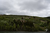

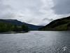


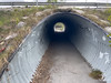
The above images may not be of the site on this page, but were taken nearby. They are loaded from Flickr so please click on them for image credits.
Click here to see more info for this site
Nearby sites
Click here to view sites on an interactive map of the areaKey: Red: member's photo, Blue: 3rd party photo, Yellow: other image, Green: no photo - please go there and take one, Grey: site destroyed
Download sites to:
KML (Google Earth)
GPX (GPS waypoints)
CSV (Garmin/Navman)
CSV (Excel)
To unlock full downloads you need to sign up as a Contributory Member. Otherwise downloads are limited to 50 sites.
Turn off the page maps and other distractions
Nearby sites listing. In the following links * = Image available
1.4km E 83° Sve (Vågå)* Round Barrow(s)
18.7km E 100° Steinberget Hillfort* Hillfort
46.6km SE 132° Vinstra Helleristninger* Rock Art
48.5km SE 129° Grytberget* Rock Art
57.4km SE 127° Sør-Fron-Prestegård* Round Barrow(s)
58.2km SE 127° Tingflata* Stone Circle
58.4km NW 314° Einbu Bautastein* Standing Stone (Menhir)
59.0km SE 128° Hundorp* Ancient Village or Settlement
71.5km SE 126° Høgkleiva* Hillfort
75.7km NNW 327° Sæter Burial Cairns* Barrow Cemetery
79.2km NNE 21° Losvollen* Barrow Cemetery
81.0km NW 325° Oppigård Standing Stone* Standing Stone (Menhir)
83.0km S 188° Kitilhaugen* Round Barrow(s)
85.8km NNE 19° Vang gravfelt* Barrow Cemetery
85.8km S 184° Nordre-Hausåker* Round Barrow(s)
85.9km SSW 199° Sparstad* Standing Stones
86.2km S 184° Lysthaugen Vestre Slidre* Round Barrow(s)
87.4km S 183° Garberg* Barrow Cemetery
87.6km S 184° Timbervegen* Round Barrow(s)
87.8km SSW 198° Vang Runestone* Carving
88.0km S 183° Einangssteinen* Standing Stone (Menhir)
88.6km NNW 347° Løykja Cemetery* Barrow Cemetery
91.2km SW 228° Ytre Moa* Ancient Village or Settlement
92.1km S 181° Rønehaugen* Round Barrow(s)
95.8km NW 315° Horgheim Gravfelt* Barrow Cemetery
View more nearby sites and additional images


 We would like to know more about this location. Please feel free to add a brief description and any relevant information in your own language.
 Wir möchten mehr über diese Stätte erfahren. Bitte zögern Sie nicht, eine kurze Beschreibung und relevante Informationen in Deutsch hinzuzufügen.
 Nous aimerions en savoir encore un peu sur les lieux. S'il vous plaît n'hesitez pas à ajouter une courte description et tous les renseignements pertinents dans votre propre langue.
 Quisieramos informarnos un poco más de las lugares. No dude en añadir una breve descripción y otros datos relevantes en su propio idioma.