


<< Our Photo Pages >> Bärhau Grabhügel - Artificial Mound in Switzerland in Aargau
Submitted by AlexHunger on Saturday, 18 February 2006 Page Views: 4195
Multi-periodSite Name: Bärhau GrabhügelCountry: Switzerland
NOTE: This site is 1.412 km away from the location you searched for.
Canton: Aargau Type: Artificial Mound
Nearest Town: Zürich Nearest Village: Unterlunkhofen
Latitude: 47.323630N Longitude: 8.399000E
Condition:
| 5 | Perfect |
| 4 | Almost Perfect |
| 3 | Reasonable but with some damage |
| 2 | Ruined but still recognisable as an ancient site |
| 1 | Pretty much destroyed, possibly visible as crop marks |
| 0 | No data. |
| -1 | Completely destroyed |
| 5 | Superb |
| 4 | Good |
| 3 | Ordinary |
| 2 | Not Good |
| 1 | Awful |
| 0 | No data. |
| 5 | Can be driven to, probably with disabled access |
| 4 | Short walk on a footpath |
| 3 | Requiring a bit more of a walk |
| 2 | A long walk |
| 1 | In the middle of nowhere, a nightmare to find |
| 0 | No data. |
| 5 | co-ordinates taken by GPS or official recorded co-ordinates |
| 4 | co-ordinates scaled from a detailed map |
| 3 | co-ordinates scaled from a bad map |
| 2 | co-ordinates of the nearest village |
| 1 | co-ordinates of the nearest town |
| 0 | no data |
Internal Links:
External Links:
I have visited· I would like to visit
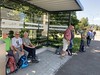
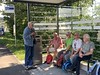
Megalithic89 visited on 3rd Jun 2021 - their rating: Cond: 4 Amb: 5 Access: 4 Quiet, peaceful site.
")
Field of 63 Iron Age tumuli in forest. The largest has two menhirs on top.
You may be viewing yesterday's version of this page. To see the most up to date information please register for a free account.
")
")
")
Do not use the above information on other web sites or publications without permission of the contributor.
Nearby Images from Flickr
The above images may not be of the site on this page, but were taken nearby. They are loaded from Flickr so please click on them for image credits.
Click here to see more info for this site
Nearby sites
Click here to view sites on an interactive map of the areaKey: Red: member's photo, Blue: 3rd party photo, Yellow: other image, Green: no photo - please go there and take one, Grey: site destroyed
Download sites to:
KML (Google Earth)
GPX (GPS waypoints)
CSV (Garmin/Navman)
CSV (Excel)
To unlock full downloads you need to sign up as a Contributory Member. Otherwise downloads are limited to 50 sites.
Turn off the page maps and other distractions
Nearby sites listing. In the following links * = Image available
1.6km SSE 164° Althau Menhirs* Standing Stones
4.9km ENE 63° Wettswil Wannenboden* Stone Row / Alignment
6.2km SE 129° Eggmatt West Steinreihe Stone Row / Alignment
6.4km SE 128° Eggmatt East Steinreihe Stone Row / Alignment
6.4km E 91° Bonstetten Aebertshalden Grabhügel* Artificial Mound
6.4km E 85° Wettswil Grüt* Stone Row / Alignment
6.4km ESE 106° Bonstetten Schladhau Cromlech* Stone Circle
6.5km ESE 109° Bonstetten Schladhau Menhir* Standing Stone (Menhir)
6.5km E 84° Wettswil Sitzholz* Stone Row / Alignment
6.6km SE 130° Steinkreis Bislikerhau* Stone Circle
6.7km SE 130° Bislikerhau Steinreihe B Stone Row / Alignment
6.8km SE 132° Bislikerhau Steinreihe A* Stone Row / Alignment
6.9km WNW 293° Erdmannlisstein* Natural Stone / Erratic / Other Natural Feature
7.0km SE 142° Steinreihe Hochwasserdamm* Stone Row / Alignment
7.0km SE 124° Müliberg Gottert Süd* Stone Row / Alignment
7.2km ENE 61° Sonnenbühl Fürstengrabhügel* Artificial Mound
7.8km SE 140° Würzhau Nord Steinreihe* Stone Row / Alignment
7.8km SE 141° Würzhau West Steinreihe* Stone Row / Alignment
7.9km SE 137° Steinreihe Reservoir* Stone Row / Alignment
8.0km SE 144° Steinreihe Sarhau* Stone Row / Alignment
8.0km SE 144° Sarhau Menhir* Standing Stone (Menhir)
8.1km SE 137° Affoltern Bernhau Steinkreis* Stone Circle
8.1km SE 127° Mühliberg Menhir* Standing Stone (Menhir)
8.1km SE 140° Würzhau Blockhügel* Standing Stones
8.2km SSE 149° Jungholz Steinreihe* Stone Row / Alignment
View more nearby sites and additional images


 We would like to know more about this location. Please feel free to add a brief description and any relevant information in your own language.
 Wir möchten mehr über diese Stätte erfahren. Bitte zögern Sie nicht, eine kurze Beschreibung und relevante Informationen in Deutsch hinzuzufügen.
 Nous aimerions en savoir encore un peu sur les lieux. S'il vous plaît n'hesitez pas à ajouter une courte description et tous les renseignements pertinents dans votre propre langue.
 Quisieramos informarnos un poco más de las lugares. No dude en añadir una breve descripción y otros datos relevantes en su propio idioma.