


<< Our Photo Pages >> Wallburg Wilzenberg - Hillfort in Germany in North Rhine-Westphalia
Submitted by Harald_Platta on Friday, 30 October 2015 Page Views: 1850
Iron Age and Later PrehistorySite Name: Wallburg WilzenbergCountry: Germany
NOTE: This site is 3.527 km away from the location you searched for.
Land: North Rhine-Westphalia Type: Hillfort
Nearest Town: Schmallenberg
Latitude: 51.153639N Longitude: 8.331000E
Condition:
| 5 | Perfect |
| 4 | Almost Perfect |
| 3 | Reasonable but with some damage |
| 2 | Ruined but still recognisable as an ancient site |
| 1 | Pretty much destroyed, possibly visible as crop marks |
| 0 | No data. |
| -1 | Completely destroyed |
| 5 | Superb |
| 4 | Good |
| 3 | Ordinary |
| 2 | Not Good |
| 1 | Awful |
| 0 | No data. |
| 5 | Can be driven to, probably with disabled access |
| 4 | Short walk on a footpath |
| 3 | Requiring a bit more of a walk |
| 2 | A long walk |
| 1 | In the middle of nowhere, a nightmare to find |
| 0 | No data. |
| 5 | co-ordinates taken by GPS or official recorded co-ordinates |
| 4 | co-ordinates scaled from a detailed map |
| 3 | co-ordinates scaled from a bad map |
| 2 | co-ordinates of the nearest village |
| 1 | co-ordinates of the nearest town |
| 0 | no data |
Internal Links:
External Links:
")
The central part of the enclosure measured 5 ha, while additional 7 ha were fortified annexes. The enclosure included also a well. The Wallburg Wilzenberg is the place, where the biggest collection of Iron Age weapons in Westphalia was discovered.
A smaller hillfort was built within the Iron Age enclosure in the 9th century AD.
Several ramparts and parts of the Iron Age dry stone walls are preserved.
Literature:
[01] Zeiler, M.: Wälle und Waffen auf dem Wilzenberg. In: Westalen in der Eisenzeit (2015).
[02] Schubert, A.H.: Der Wilzenberg – Machtzentrum oder Fliehburg? In: Von Anfang an. Archäologie in Nordrhein-Westfalen. Schriften zur Bodendenkmalpflege in Nordrhein-Westfalen 8 (2005).
[03] Berenger, D.: Die eisenzeitlichen Burgen in Westfalen. In: Hinter Schloss und Riegel. Burgen und Befestigungen in Westfalen (1997).
[04] Hömberg, H.: Die Ringwälle auf dem Wilzenberg. In: Beiträge zur Geschichte der Stadt Schmallenberg (1969).
You may be viewing yesterday's version of this page. To see the most up to date information please register for a free account.
")
")
Do not use the above information on other web sites or publications without permission of the contributor.
Nearby Images from Flickr

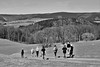
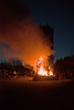
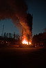
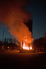

The above images may not be of the site on this page, but were taken nearby. They are loaded from Flickr so please click on them for image credits.
Click here to see more info for this site
Nearby sites
Click here to view sites on an interactive map of the areaKey: Red: member's photo, Blue: 3rd party photo, Yellow: other image, Green: no photo - please go there and take one, Grey: site destroyed
Download sites to:
KML (Google Earth)
GPX (GPS waypoints)
CSV (Garmin/Navman)
CSV (Excel)
To unlock full downloads you need to sign up as a Contributory Member. Otherwise downloads are limited to 50 sites.
Turn off the page maps and other distractions
Nearby sites listing. In the following links * = Image available
4.4km SE 142° Altarstein Latrop* Natural Stone / Erratic / Other Natural Feature
11.0km WSW 243° Heiligenborn Saalhausen Holy Well or Sacred Spring
11.6km SE 132° Wallburg Wemlinghausen* Hillfort
12.4km S 187° Wallburg Aue* Hillfort
16.6km WNW 286° Schoendelt Hexenstein* Rock Art
17.4km NNE 15° Venetianer-Stollen* Ancient Mine, Quarry or other Industry
18.1km WSW 259° Wallburg Kahle* Hillfort
19.7km W 267° Wallburg Weilenscheid* Hillfort
21.2km NE 38° Strücker Stein* Rock Outcrop
21.9km N 9° Veledahöhle* Cave or Rock Shelter
22.9km NNW 339° Stesser Burg* Hillfort
23.2km NNE 20° Bronze Urn of Gevelinghausen* Round Barrow(s)
23.4km W 269° Wallburg Borghausen Hillfort
23.6km NE 38° Ewige Quelle* Holy Well or Sacred Spring
24.0km NE 39° Wallburg Bruchhauser Steine* Hillfort
24.1km NE 38° Bruchhauser Steine.* Rock Outcrop
24.7km S 170° Alte Burg (Wittgenstein)* Hillfort
26.0km WSW 253° Wallburg Hofkühl* Hillfort
26.3km ENE 78° Städtisches Museum Medebach* Museum
26.7km WSW 255° Wallburg Jäckelchen* Hillfort
26.9km SSW 193° Siegquelle* Holy Well or Sacred Spring
27.2km NE 40° Kleinenberg Menhir* Standing Stone (Menhir)
27.3km SSW 207° Alte Burg Obernau* Hillfort
29.8km S 179° Burg von Hesselbach* Hillfort
29.9km S 186° Heilige Ilsequelle* Holy Well or Sacred Spring
View more nearby sites and additional images


 We would like to know more about this location. Please feel free to add a brief description and any relevant information in your own language.
 Wir möchten mehr über diese Stätte erfahren. Bitte zögern Sie nicht, eine kurze Beschreibung und relevante Informationen in Deutsch hinzuzufügen.
 Nous aimerions en savoir encore un peu sur les lieux. S'il vous plaît n'hesitez pas à ajouter une courte description et tous les renseignements pertinents dans votre propre langue.
 Quisieramos informarnos un poco más de las lugares. No dude en añadir una breve descripción y otros datos relevantes en su propio idioma.