


<< Text Pages >> Heeshugh - Round Barrow(s) in Germany in Schleswig-Holstein, Hamburg
Submitted by holger_rix on Monday, 30 July 2007 Page Views: 1912
Neolithic and Bronze AgeSite Name: HeeshughCountry: Germany
NOTE: This site is 1.013 km away from the location you searched for.
Land: Schleswig-Holstein, Hamburg Type: Round Barrow(s)
Nearest Town: Nebel Nearest Village: Norddorf
Latitude: 54.644069N Longitude: 8.351261E
Condition:
| 5 | Perfect |
| 4 | Almost Perfect |
| 3 | Reasonable but with some damage |
| 2 | Ruined but still recognisable as an ancient site |
| 1 | Pretty much destroyed, possibly visible as crop marks |
| 0 | No data. |
| -1 | Completely destroyed |
| 5 | Superb |
| 4 | Good |
| 3 | Ordinary |
| 2 | Not Good |
| 1 | Awful |
| 0 | No data. |
| 5 | Can be driven to, probably with disabled access |
| 4 | Short walk on a footpath |
| 3 | Requiring a bit more of a walk |
| 2 | A long walk |
| 1 | In the middle of nowhere, a nightmare to find |
| 0 | No data. |
| 5 | co-ordinates taken by GPS or official recorded co-ordinates |
| 4 | co-ordinates scaled from a detailed map |
| 3 | co-ordinates scaled from a bad map |
| 2 | co-ordinates of the nearest village |
| 1 | co-ordinates of the nearest town |
| 0 | no data |
Be the first person to rate this site - see the 'Contribute!' box in the right hand menu.
Internal Links:
External Links:
Round Barrow(s) in Schleswig-Holstein, Hamburg
On the German Island of Amrum.
You may be viewing yesterday's version of this page. To see the most up to date information please register for a free account.
Do not use the above information on other web sites or publications without permission of the contributor.
Nearby Images from Flickr
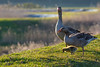
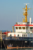
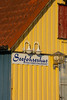
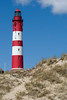
The above images may not be of the site on this page, but were taken nearby. They are loaded from Flickr so please click on them for image credits.
Click here to see more info for this site
Nearby sites
Click here to view sites on an interactive map of the areaKey: Red: member's photo, Blue: 3rd party photo, Yellow: other image, Green: no photo - please go there and take one, Grey: site destroyed
Download sites to:
KML (Google Earth)
GPX (GPS waypoints)
CSV (Garmin/Navman)
CSV (Excel)
To unlock full downloads you need to sign up as a Contributory Member. Otherwise downloads are limited to 50 sites.
Turn off the page maps and other distractions
Nearby sites listing. In the following links * = Image available
872m ESE 104° Krümwal* Misc. Earthwork
950m E 93° Klaffhugh Round Barrow(s)
1.5km ESE 106° Eesenhugh* Round Barrow(s)
1.8km ESE 119° Steenodde Steingrab* Burial Chamber or Dolmen
1.9km N 1° Makkanhugh Round Barrow(s)
2.4km NNW 344° Kloewenhugh Round Barrow(s)
2.6km N 354° Kanshugh Round Barrow(s)
3.2km NW 325° Eisenzeithaus Nebel* Ancient Village or Settlement
3.3km NW 321° Nebel Huenengrab* Long Barrow
4.5km NNW 333° Norddorf (Amrum) Huenengrab* Burial Chamber or Dolmen
8.2km NNE 26° Utersum Ganggrab* Passage Grave
8.4km NNE 31° Suederende Steingrab Passage Grave
8.4km NNE 21° Utersum Steingrab* Burial Chamber or Dolmen
23.8km N 5° Archsum Kolkingehoog* Passage Grave
24.6km N 3° Archsum Steingrab 1* Long Barrow
24.6km N 3° Archsum Merelmerskhoog* Passage Grave
24.6km N 3° Archsum Steingrab 2* Long Barrow
25.0km NNE 14° Morsum Osterende Steingrab* Burial Chamber or Dolmen
27.4km N 360° Taidishoog Round Barrow(s)
27.5km N 4° Harhoog Keitum* Burial Chamber or Dolmen
27.5km N 4° Tipkenhoog* Round Barrow(s)
27.6km N 352° Westerland Langbett 1* Long Barrow
27.6km N 352° Westerland Langbett 2 Long Barrow
27.6km N 0° Klöwenhoog Round Barrow(s)
27.9km N 3° Sylter Heimatmuseum* Museum
View more nearby sites and additional images


 We would like to know more about this location. Please feel free to add a brief description and any relevant information in your own language.
 Wir möchten mehr über diese Stätte erfahren. Bitte zögern Sie nicht, eine kurze Beschreibung und relevante Informationen in Deutsch hinzuzufügen.
 Nous aimerions en savoir encore un peu sur les lieux. S'il vous plaît n'hesitez pas à ajouter une courte description et tous les renseignements pertinents dans votre propre langue.
 Quisieramos informarnos un poco más de las lugares. No dude en añadir una breve descripción y otros datos relevantes en su propio idioma.