 with our Megalithic Portal iPhone app")


<< Our Photo Pages >> Mauzenstein - Rock Art in Germany in Baden-Wuerttemberg
Submitted by IndianaStones on Tuesday, 23 July 2013 Page Views: 2570
Rock ArtSite Name: MauzensteinCountry: Germany
NOTE: This site is 14.89 km away from the location you searched for.
Land: Baden-Wuerttemberg Type: Rock Art
Nearest Town: Bad Herrenalb Nearest Village: Bernbach
Latitude: 48.816416N Longitude: 8.405299E
Condition:
| 5 | Perfect |
| 4 | Almost Perfect |
| 3 | Reasonable but with some damage |
| 2 | Ruined but still recognisable as an ancient site |
| 1 | Pretty much destroyed, possibly visible as crop marks |
| 0 | No data. |
| -1 | Completely destroyed |
| 5 | Superb |
| 4 | Good |
| 3 | Ordinary |
| 2 | Not Good |
| 1 | Awful |
| 0 | No data. |
| 5 | Can be driven to, probably with disabled access |
| 4 | Short walk on a footpath |
| 3 | Requiring a bit more of a walk |
| 2 | A long walk |
| 1 | In the middle of nowhere, a nightmare to find |
| 0 | No data. |
| 5 | co-ordinates taken by GPS or official recorded co-ordinates |
| 4 | co-ordinates scaled from a detailed map |
| 3 | co-ordinates scaled from a bad map |
| 2 | co-ordinates of the nearest village |
| 1 | co-ordinates of the nearest town |
| 0 | no data |
Internal Links:
External Links:
I have visited· I would like to visit
Ievelyn would like to visit
")
A very strange stone of 4,7 m length with cups, not going inside but outside, like bowls. These cups are also on the sides of the stone! It has lots of signs on it like crosses and lines.
Der Mauzenstein ist ein wirklich seltsamer Stein von 4,7 m Länge. Die Schälchen gehen bei diesem Stein eigenartigerweise nicht nach innen, sondern nach außen. Es ist rätselhalft, wie das entstanden ist. Das verschnörktelte Zeichen wird als Werk einer Studentenbewegung vermutet, genaues weiß man nicht. Die Schälchen werden inkl. der auf den Seiten befindlichen als verschiedene Sternbilder gedeutet.
You may be viewing yesterday's version of this page. To see the most up to date information please register for a free account.
")
")
Do not use the above information on other web sites or publications without permission of the contributor.
Nearby Images from Flickr
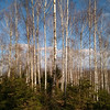


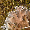


The above images may not be of the site on this page, but were taken nearby. They are loaded from Flickr so please click on them for image credits.
Click here to see more info for this site
Nearby sites
Click here to view sites on an interactive map of the areaKey: Red: member's photo, Blue: 3rd party photo, Yellow: other image, Green: no photo - please go there and take one, Grey: site destroyed
Download sites to:
KML (Google Earth)
GPX (GPS waypoints)
CSV (Garmin/Navman)
CSV (Excel)
To unlock full downloads you need to sign up as a Contributory Member. Otherwise downloads are limited to 50 sites.
Turn off the page maps and other distractions
Nearby sites listing. In the following links * = Image available
14.5km SSW 196° Giersteine Natural Stone / Erratic / Other Natural Feature
19.1km NE 37° Schlangenrainwald Grabhügelfeld Barrow Cemetery
19.3km E 98° Schwarzenberg Steinkreis Modern Stone Circle etc
21.9km N 360° Badisches Landesmuseum Museum
22.9km W 264° Heiligenbuck Artificial Mound
22.9km NNE 30° Pfinztal Grabhügel Artificial Mound
23.3km ENE 69° Summstein Pforzheim Modern Stone Circle etc
24.3km N 354° Dürkheimerstrasse Grabhügel Artificial Mound
24.7km NE 39° Grossen Wald Grabhügelgruppe (Königsbach-Stein) Barrow Cemetery
26.9km ESE 115° Summstein Calw* Modern Stone Circle etc
27.4km NNE 15° Weingarten Grabhügelfeld Barrow Cemetery
27.7km ESE 118° Rudersberg Höhensiedlung Hillfort
27.9km NNW 333° Bienwald Hügelgräberfeld Barrow Cemetery
28.2km ESE 106° Ottenbronn Grabhügelfeld Barrow Cemetery
30.9km WSW 256° Greffern Menhir II Standing Stone (Menhir)
30.9km WSW 256° Greffern Menhir I Standing Stone (Menhir)
31.1km ENE 57° Dürrn Grabhügelfeld Barrow Cemetery
32.1km NNE 21° Michelsberg Höhensiedlung Hillfort
33.2km NNE 28° Grosse Wald Grabhügelgruppe Barrow Cemetery
34.5km NE 39° Lehrwald Grabhügel Artificial Mound
36.0km E 100° Blammerberg Hillfort
36.3km S 170° Summstein Hallwangen I Modern Stone Circle etc
36.6km NW 318° Schaidter Hinkelstein* Standing Stone (Menhir)
37.1km SE 142° Krautbühl Artificial Mound
37.6km NNW 342° Huegelgraeber Klingbachwald Barrow Cemetery
View more nearby sites and additional images


 We would like to know more about this location. Please feel free to add a brief description and any relevant information in your own language.
 Wir möchten mehr über diese Stätte erfahren. Bitte zögern Sie nicht, eine kurze Beschreibung und relevante Informationen in Deutsch hinzuzufügen.
 Nous aimerions en savoir encore un peu sur les lieux. S'il vous plaît n'hesitez pas à ajouter une courte description et tous les renseignements pertinents dans votre propre langue.
 Quisieramos informarnos un poco más de las lugares. No dude en añadir una breve descripción y otros datos relevantes en su propio idioma.