


<< Our Photo Pages >> Riesi Seengen Pile Dwelling - Ancient Village or Settlement in Switzerland in Aargau
Submitted by Megalithic89 on Wednesday, 24 March 2021 Page Views: 412
Neolithic and Bronze AgeSite Name: Riesi Seengen Pile Dwelling Alternative Name: Pfahlbausiedlung und Pfahlbauhaus Riesi SeengenCountry: Switzerland
NOTE: This site is 11.693 km away from the location you searched for.
Canton: Aargau Type: Ancient Village or Settlement
Nearest Town: Aarau Nearest Village: Seengen
Latitude: 47.316990N Longitude: 8.202800E
Condition:
| 5 | Perfect |
| 4 | Almost Perfect |
| 3 | Reasonable but with some damage |
| 2 | Ruined but still recognisable as an ancient site |
| 1 | Pretty much destroyed, possibly visible as crop marks |
| 0 | No data. |
| -1 | Completely destroyed |
| 5 | Superb |
| 4 | Good |
| 3 | Ordinary |
| 2 | Not Good |
| 1 | Awful |
| 0 | No data. |
| 5 | Can be driven to, probably with disabled access |
| 4 | Short walk on a footpath |
| 3 | Requiring a bit more of a walk |
| 2 | A long walk |
| 1 | In the middle of nowhere, a nightmare to find |
| 0 | No data. |
| 5 | co-ordinates taken by GPS or official recorded co-ordinates |
| 4 | co-ordinates scaled from a detailed map |
| 3 | co-ordinates scaled from a bad map |
| 2 | co-ordinates of the nearest village |
| 1 | co-ordinates of the nearest town |
| 0 | no data |
Internal Links:
External Links:
I have visited· I would like to visit
Megalithic89 visited on 16th Mar 2021 - their rating: Cond: 2 Amb: 4 Access: 4
")
Riesi Seengen is one of the 56 pile dwelling sites in Switzerland. They are part of the 111 sites UNESCO gave World Culture Heritage Status in 2011. The settlement was inhabited between 1050 BC and 850 BC. The remains of the settlement lie under water.
Canton of Aargau Archaeology, the Municipality of Seengen, The Burghalde Museum Lenzburg and The Rotary Club Lenzburg and Lenzburg-Seetal decided to make a faithful reconstruction of a house to make the Unesco World Heritage visible. It is near the place of the former palafitte settlement. It is being built during winter and spring 2020/2021.
The new palafitte house has a Bronze Age appearance. It is slightly raised off the ground and has a block construction substructure. This corresponds to the archaeological findings and protects the house during floods.
The house is receiving wattle and daub walls this spring.
The house reconstruction stands on the opposite side of Lake Hallwil, on a footpath called “Seeweg”, at 47.31888N 8.20491E .
Source: Canton of Aargau Archaeology, CH-5200 Brugg.
You may be viewing yesterday's version of this page. To see the most up to date information please register for a free account.
")
Do not use the above information on other web sites or publications without permission of the contributor.
Nearby Images from Flickr
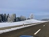
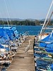
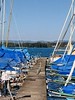
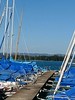
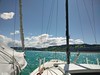
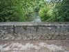
The above images may not be of the site on this page, but were taken nearby. They are loaded from Flickr so please click on them for image credits.
Click here to see more info for this site
Nearby sites
Click here to view sites on an interactive map of the areaKey: Red: member's photo, Blue: 3rd party photo, Yellow: other image, Green: no photo - please go there and take one, Grey: site destroyed
Download sites to:
KML (Google Earth)
GPX (GPS waypoints)
CSV (Garmin/Navman)
CSV (Excel)
To unlock full downloads you need to sign up as a Contributory Member. Otherwise downloads are limited to 50 sites.
Turn off the page maps and other distractions
Nearby sites listing. In the following links * = Image available
4.7km E 99° Zigiholz Grabhügel* Barrow Cemetery
5.4km NW 319° Fornholz Grabhügel* Round Barrow(s)
5.8km ESE 103° Niesenberg Grabhügel Artificial Mound
6.2km NNW 327° Niederholz Grabhügel* Artificial Mound
7.8km N 349° Burghalde Museum Museum
7.8km N 349° Goffersberg Gräberfelder Chambered Tomb
9.1km ENE 68° Erdmannlisstein* Natural Stone / Erratic / Other Natural Feature
14.8km E 87° Bärhau Grabhügel* Artificial Mound
15.3km E 93° Althau Menhirs* Standing Stones
17.5km NE 37° Würenlos Menhir* Standing Stone (Menhir)
17.9km N 4° Windisch Schalenstein* Rock Art
18.4km SE 130° Reussegg Steinreihe Stone Row / Alignment
19.2km ESE 112° Gräberfeld Tambrig Dachlissen* Artificial Mound
19.4km E 81° Wettswil Wannenboden* Stone Row / Alignment
19.6km ESE 114° Grabhügel Unterholz* Artificial Mound
19.6km ESE 114° Unterholz Steinreihe* Stone Row / Alignment
19.7km ESE 104° Steinreihe Hochwasserdamm* Stone Row / Alignment
19.8km ESE 110° Rembrig Steinreihe* Stone Row / Alignment
19.8km ESE 109° Plattenhölzli North* Stone Row / Alignment
19.9km E 99° Eggmatt West Steinreihe Stone Row / Alignment
19.9km ESE 111° Buechhölzli-Eigi Steinreihe* Stone Row / Alignment
19.9km ESE 109° Plattenhölzli East* Stone Row / Alignment
20.0km ESE 108° Jungholz Steinreihe* Stone Row / Alignment
20.0km E 99° Eggmatt East Steinreihe Stone Row / Alignment
20.1km ESE 113° Allmend Alignment* Stone Row / Alignment
View more nearby sites and additional images


 We would like to know more about this location. Please feel free to add a brief description and any relevant information in your own language.
 Wir möchten mehr über diese Stätte erfahren. Bitte zögern Sie nicht, eine kurze Beschreibung und relevante Informationen in Deutsch hinzuzufügen.
 Nous aimerions en savoir encore un peu sur les lieux. S'il vous plaît n'hesitez pas à ajouter une courte description et tous les renseignements pertinents dans votre propre langue.
 Quisieramos informarnos un poco más de las lugares. No dude en añadir una breve descripción y otros datos relevantes en su propio idioma.