
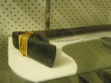

<< Our Photo Pages >> Hiddingsen Galeriegrab - Chambered Tomb in Germany in North Rhine-Westphalia
Submitted by stollentroll on Sunday, 08 June 2008 Page Views: 3006
Neolithic and Bronze AgeSite Name: Hiddingsen Galeriegrab Alternative Name: Hiddingsen SteinkisteCountry: Germany
NOTE: This site is 2.687 km away from the location you searched for.
Land: North Rhine-Westphalia Type: Chambered Tomb
Nearest Town: Soest Nearest Village: Ruploh
Latitude: 51.532610N Longitude: 8.113330E
Condition:
| 5 | Perfect |
| 4 | Almost Perfect |
| 3 | Reasonable but with some damage |
| 2 | Ruined but still recognisable as an ancient site |
| 1 | Pretty much destroyed, possibly visible as crop marks |
| 0 | No data. |
| -1 | Completely destroyed |
| 5 | Superb |
| 4 | Good |
| 3 | Ordinary |
| 2 | Not Good |
| 1 | Awful |
| 0 | No data. |
| 5 | Can be driven to, probably with disabled access |
| 4 | Short walk on a footpath |
| 3 | Requiring a bit more of a walk |
| 2 | A long walk |
| 1 | In the middle of nowhere, a nightmare to find |
| 0 | No data. |
| 5 | co-ordinates taken by GPS or official recorded co-ordinates |
| 4 | co-ordinates scaled from a detailed map |
| 3 | co-ordinates scaled from a bad map |
| 2 | co-ordinates of the nearest village |
| 1 | co-ordinates of the nearest town |
| 0 | no data |
Internal Links:
External Links:
")
You may be viewing yesterday's version of this page. To see the most up to date information please register for a free account.
")
")
Do not use the above information on other web sites or publications without permission of the contributor.
Nearby Images from Flickr
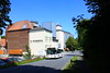
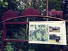
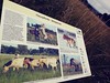
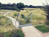
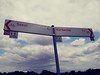
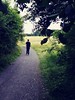
The above images may not be of the site on this page, but were taken nearby. They are loaded from Flickr so please click on them for image credits.
Click here to see more info for this site
Nearby sites
Click here to view sites on an interactive map of the areaKey: Red: member's photo, Blue: 3rd party photo, Yellow: other image, Green: no photo - please go there and take one, Grey: site destroyed
Download sites to:
KML (Google Earth)
GPX (GPS waypoints)
CSV (Garmin/Navman)
CSV (Excel)
To unlock full downloads you need to sign up as a Contributory Member. Otherwise downloads are limited to 50 sites.
Turn off the page maps and other distractions
Nearby sites listing. In the following links * = Image available
4.4km N 350° Erdwerk von Soest Misc. Earthwork
5.1km NNW 335° Soest-Ardey Opferteich Holy Well or Sacred Spring
7.7km WNW 283° Ostönnen Galeriegrab Chambered Tomb
7.7km NE 51° Erdwerk Bad Sassendorf Misc. Earthwork
7.7km WSW 243° Grabhügel in den Bilmer Büschen Barrow Cemetery
10.5km NE 51° Nasenstein* Standing Stone (Menhir)
10.5km SW 226° Grabhügel Große Aupke* Round Barrow(s)
10.7km SW 224° Grabhügelgruppe am Alten Holzweg* Barrow Cemetery
10.7km WSW 257° Ruhner Weg* Ancient Village or Settlement
10.9km NE 52° Schmerlecke (1) Chambered Tomb
11.1km NE 51° Schmerlecke Galeriegrab (3) Passage Grave
11.1km NE 50° Schmerlecke (2) Chambered Tomb
11.3km SW 221° Grabhügelgruppe am Rehbocksweg* Barrow Cemetery
11.4km WSW 255° Gräberfeld von Ense-Bremen* Barrow Cemetery
13.7km ENE 58° Völlinghausen Chambered Tomb
14.1km E 97° Uelde Galeriegrab Chambered Tomb
14.4km W 279° Werl Iron Age Saline Ancient Mine, Quarry or other Industry
14.6km ENE 61° Völlinghausen Galeriegrab Chambered Tomb
15.0km NNW 343° Lippborg Galeriegrab Chambered Tomb
15.5km SSW 193° Sauerland-Museum Arnsberg* Museum
16.3km ESE 108° Summstein Belecke Modern Stone Circle etc
17.6km WSW 257° Wickede (Ruhr) Huegelgrab* Round Barrow(s)
21.8km NNW 345° Beckum 2* Chambered Tomb
21.9km SSE 161° Stesser Burg* Hillfort
22.1km ESE 118° Hoher Stein (bei Suttrop)* Cave or Rock Shelter
View more nearby sites and additional images


 We would like to know more about this location. Please feel free to add a brief description and any relevant information in your own language.
 Wir möchten mehr über diese Stätte erfahren. Bitte zögern Sie nicht, eine kurze Beschreibung und relevante Informationen in Deutsch hinzuzufügen.
 Nous aimerions en savoir encore un peu sur les lieux. S'il vous plaît n'hesitez pas à ajouter une courte description et tous les renseignements pertinents dans votre propre langue.
 Quisieramos informarnos un poco más de las lugares. No dude en añadir una breve descripción y otros datos relevantes en su propio idioma.