

<< Our Photo Pages >> Archaeological Museum of the Canton of Solothurn - Museum in Switzerland in Solothurn
Submitted by Megalithic89 on Saturday, 30 January 2021 Page Views: 553
MuseumsSite Name: Archaeological Museum of the Canton of Solothurn Alternative Name: Archäologisches Museum Kanton SolothurnCountry: Switzerland
NOTE: This site is 9.16 km away from the location you searched for.
Canton: Solothurn Type: Museum
Nearest Town: Olten Nearest Village: Olten
Latitude: 47.350560N Longitude: 7.900700E
Condition:
| 5 | Perfect |
| 4 | Almost Perfect |
| 3 | Reasonable but with some damage |
| 2 | Ruined but still recognisable as an ancient site |
| 1 | Pretty much destroyed, possibly visible as crop marks |
| 0 | No data. |
| -1 | Completely destroyed |
| 5 | Superb |
| 4 | Good |
| 3 | Ordinary |
| 2 | Not Good |
| 1 | Awful |
| 0 | No data. |
| 5 | Can be driven to, probably with disabled access |
| 4 | Short walk on a footpath |
| 3 | Requiring a bit more of a walk |
| 2 | A long walk |
| 1 | In the middle of nowhere, a nightmare to find |
| 0 | No data. |
| 5 | co-ordinates taken by GPS or official recorded co-ordinates |
| 4 | co-ordinates scaled from a detailed map |
| 3 | co-ordinates scaled from a bad map |
| 2 | co-ordinates of the nearest village |
| 1 | co-ordinates of the nearest town |
| 0 | no data |
Internal Links:
External Links:
I have visited· I would like to visit
Megalithic89 visited on 25th Jun 2021 - their rating: Cond: 4 Amb: 4 Access: 5 Modern, well worth the visit.
")
This is a link
Address:
Im Haus der Museen
Konradstrasse 7
4600 Olten
You may be viewing yesterday's version of this page. To see the most up to date information please register for a free account.
Do not use the above information on other web sites or publications without permission of the contributor.
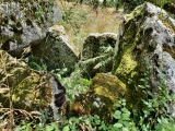
Nearby Images from Flickr
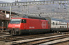
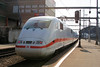
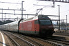
The above images may not be of the site on this page, but were taken nearby. They are loaded from Flickr so please click on them for image credits.
Click here to see more info for this site
Nearby sites
Click here to view sites on an interactive map of the areaKey: Red: member's photo, Blue: 3rd party photo, Yellow: other image, Green: no photo - please go there and take one, Grey: site destroyed
Download sites to:
KML (Google Earth)
GPX (GPS waypoints)
CSV (Garmin/Navman)
CSV (Excel)
To unlock full downloads you need to sign up as a Contributory Member. Otherwise downloads are limited to 50 sites.
Turn off the page maps and other distractions
Nearby sites listing. In the following links * = Image available
15.3km WSW 246° Oensingen Schalenstein* Rock Art
16.5km N 8° Galgenstein (Wegenstetten) Chambered Tomb
16.5km N 8° Schönauer Grenzsteine Standing Stone (Menhir)
19.2km E 89° Fornholz Grabhügel* Round Barrow(s)
19.4km E 86° Niederholz Grabhügel* Artificial Mound
20.6km WSW 242° Oberbipp Dolmen* Burial Chamber or Dolmen
21.6km E 80° Goffersberg Gräberfelder Chambered Tomb
21.6km E 80° Burghalde Museum Museum
22.1km WSW 240° Menhir Wiedlisbach* Modern Stone Circle etc
23.0km N 6° Menhir Bad Säckingen* Standing Stone (Menhir)
23.1km E 99° Riesi Seengen Pile Dwelling* Ancient Village or Settlement
23.8km W 280° Meltingen Schalenstein* Rock Art
24.3km NNW 327° Augusta Raurica* Ancient Village or Settlement
24.5km WSW 241° Attiswil Freistein* Standing Stone (Menhir)
26.7km SW 217° Findling grosse Fluh* Natural Stone / Erratic / Other Natural Feature
27.0km N 355° Heidenstein (Schwörstadt)* Burial Chamber or Dolmen
27.8km E 99° Zigiholz Grabhügel* Barrow Cemetery
27.9km ENE 60° Windisch Schalenstein* Rock Art
28.2km WNW 298° Aesch Dolmen* Chambered Tomb
28.7km NW 322° Hornfels* Hillfort
28.8km E 100° Niesenberg Grabhügel Artificial Mound
29.3km N 356° Hunnenstein (Dossenbach)* Standing Stone (Menhir)
29.6km WSW 243° Schildchrott - Solothurner Megalithweg* Natural Stone / Erratic / Other Natural Feature
29.6km WSW 243° Steinsetzungen - Solothurner Megalithweg* Natural Stone / Erratic / Other Natural Feature
29.7km WSW 243° Rütschelistein - Solothurner Megalithweg* Natural Stone / Erratic / Other Natural Feature
View more nearby sites and additional images


 We would like to know more about this location. Please feel free to add a brief description and any relevant information in your own language.
 Wir möchten mehr über diese Stätte erfahren. Bitte zögern Sie nicht, eine kurze Beschreibung und relevante Informationen in Deutsch hinzuzufügen.
 Nous aimerions en savoir encore un peu sur les lieux. S'il vous plaît n'hesitez pas à ajouter une courte description et tous les renseignements pertinents dans votre propre langue.
 Quisieramos informarnos un poco más de las lugares. No dude en añadir una breve descripción y otros datos relevantes en su propio idioma.