


<< Our Photo Pages >> Turkestovhaugen - Cairn in Norway in Sogn og Fjordane
Submitted by kenntha88 on Thursday, 21 October 2021 Page Views: 269
Neolithic and Bronze AgeSite Name: TurkestovhaugenCountry: Norway
NOTE: This site is 10.027 km away from the location you searched for.
Fylke: Sogn og Fjordane Type: Cairn
Latitude: 61.075852N Longitude: 7.899310E
Condition:
| 5 | Perfect |
| 4 | Almost Perfect |
| 3 | Reasonable but with some damage |
| 2 | Ruined but still recognisable as an ancient site |
| 1 | Pretty much destroyed, possibly visible as crop marks |
| 0 | No data. |
| -1 | Completely destroyed |
| 5 | Superb |
| 4 | Good |
| 3 | Ordinary |
| 2 | Not Good |
| 1 | Awful |
| 0 | No data. |
| 5 | Can be driven to, probably with disabled access |
| 4 | Short walk on a footpath |
| 3 | Requiring a bit more of a walk |
| 2 | A long walk |
| 1 | In the middle of nowhere, a nightmare to find |
| 0 | No data. |
| 5 | co-ordinates taken by GPS or official recorded co-ordinates |
| 4 | co-ordinates scaled from a detailed map |
| 3 | co-ordinates scaled from a bad map |
| 2 | co-ordinates of the nearest village |
| 1 | co-ordinates of the nearest town |
| 0 | no data |
Internal Links:
External Links:
")
The two cairns are close together, around 2 metres apart. They are 10 and 12 metres in diameter and both are 1,6 metres in height according to the kulturminnesøk website. They have been a little damaged in the sides. They also have some larger leaf trees growing on top.
You may be viewing yesterday's version of this page. To see the most up to date information please register for a free account.
")
Do not use the above information on other web sites or publications without permission of the contributor.
Nearby Images from Flickr
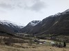
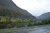
The above images may not be of the site on this page, but were taken nearby. They are loaded from Flickr so please click on them for image credits.
Click here to see more info for this site
Nearby sites
Click here to view sites on an interactive map of the areaKey: Red: member's photo, Blue: 3rd party photo, Yellow: other image, Green: no photo - please go there and take one, Grey: site destroyed
Download sites to:
KML (Google Earth)
GPX (GPS waypoints)
CSV (Garmin/Navman)
CSV (Excel)
To unlock full downloads you need to sign up as a Contributory Member. Otherwise downloads are limited to 50 sites.
Turn off the page maps and other distractions
Nearby sites listing. In the following links * = Image available
940m NNW 330° Spenning Cairn and Standing Stone* Standing Stone (Menhir)
7.6km WSW 243° Nedre Kvame Gravfelt* Barrow Cemetery
12.3km W 260° Bjørkum* Ancient Village or Settlement
15.3km WSW 258° Ljøsne-Øst Cairn* Cairn
15.6km WSW 258° Øvre Ljøsne* Barrow Cemetery
19.3km NW 311° Hovland* Barrow Cemetery
19.5km NW 311° Homannhaugen* Cairn
19.9km NW 312° Skjorahaugen* Barrow Cemetery
20.2km W 263° Mosvegen* Cairn
27.1km N 352° Ytre Moa* Ancient Village or Settlement
35.9km WNW 289° Amla Runestone* Carving
36.7km E 81° Vang Runestone* Carving
36.9km ENE 78° Sparstad* Standing Stones
39.9km NW 308° Ragnvaldshaug* Round Barrow(s)
39.9km NW 309° Urnes Standing Stone* Standing Stone (Menhir)
40.7km WNW 291° Nordnes standing stone* Standing Stone (Menhir)
42.1km WSW 243° Kaffihaugen-Ospehaugen* Round Barrow(s)
42.2km WSW 243° Skuleveien* Round Barrow(s)
42.3km WSW 243° Sogn Hagebruksskule* Round Barrow(s)
42.8km WSW 244° Leikarvollen* Round Barrow(s)
43.7km NW 305° Borhaug* Standing Stone (Menhir)
46.1km WNW 292° Stedje Runestone* Carving
48.9km WNW 292° Eggja Runestone* Carving
49.2km WSW 240° Flåmdalsvegen* Cist
49.2km WSW 239° Flåmselvi* Standing Stones
View more nearby sites and additional images


 We would like to know more about this location. Please feel free to add a brief description and any relevant information in your own language.
 Wir möchten mehr über diese Stätte erfahren. Bitte zögern Sie nicht, eine kurze Beschreibung und relevante Informationen in Deutsch hinzuzufügen.
 Nous aimerions en savoir encore un peu sur les lieux. S'il vous plaît n'hesitez pas à ajouter une courte description et tous les renseignements pertinents dans votre propre langue.
 Quisieramos informarnos un poco más de las lugares. No dude en añadir una breve descripción y otros datos relevantes en su propio idioma.