


<< Text Pages >> Saimaly-Tash - Rock Art in Kyrgyzstan
Submitted by KaiHofmann on Saturday, 18 April 2015 Page Views: 1875
Rock ArtSite Name: Saimaly-Tash Alternative Name: Saimaluu TashCountry: Kyrgyzstan
NOTE: This site is 22.879 km away from the location you searched for.
Type: Rock Art
Nearest Town: Kosh-Dobo Nearest Village: Taran-Bazar
Latitude: 41.179162N Longitude: 73.814246E
Condition:
| 5 | Perfect |
| 4 | Almost Perfect |
| 3 | Reasonable but with some damage |
| 2 | Ruined but still recognisable as an ancient site |
| 1 | Pretty much destroyed, possibly visible as crop marks |
| 0 | No data. |
| -1 | Completely destroyed |
| 5 | Superb |
| 4 | Good |
| 3 | Ordinary |
| 2 | Not Good |
| 1 | Awful |
| 0 | No data. |
| 5 | Can be driven to, probably with disabled access |
| 4 | Short walk on a footpath |
| 3 | Requiring a bit more of a walk |
| 2 | A long walk |
| 1 | In the middle of nowhere, a nightmare to find |
| 0 | No data. |
| 5 | co-ordinates taken by GPS or official recorded co-ordinates |
| 4 | co-ordinates scaled from a detailed map |
| 3 | co-ordinates scaled from a bad map |
| 2 | co-ordinates of the nearest village |
| 1 | co-ordinates of the nearest town |
| 0 | no data |
Internal Links:
External Links:
Rock Art in Kyrgyzstan
A petroglyph site 3200m above sea-level with over 10.000 engravings. The oldest are from 2000BCE. It shows animals (e.g. ibex), humans and abstract signs.
On the UNESCO World Heritage tentative list - Saimaly-Tash Petroglyphs.
You may be viewing yesterday's version of this page. To see the most up to date information please register for a free account.
Do not use the above information on other web sites or publications without permission of the contributor.
Nearby Images from Flickr
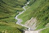
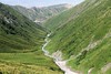

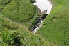
The above images may not be of the site on this page, but were taken nearby. They are loaded from Flickr so please click on them for image credits.
Click here to see more info for this site
Nearby sites
Click here to view sites on an interactive map of the areaKey: Red: member's photo, Blue: 3rd party photo, Yellow: other image, Green: no photo - please go there and take one, Grey: site destroyed
Download sites to:
KML (Google Earth)
GPX (GPS waypoints)
CSV (Garmin/Navman)
CSV (Excel)
To unlock full downloads you need to sign up as a Contributory Member. Otherwise downloads are limited to 50 sites.
Turn off the page maps and other distractions
Nearby sites listing. In the following links * = Image available
132.2km WSW 236° The Heavenly Horses Rock Art
148.6km ENE 62° East Song Köl Balbal* Sculptured Stone
199.8km NNE 19° State Historical Museum of Kyrgyz Republic, Bishkek* Museum
211.0km NNE 34° Balasagun stone Balbas Sculptured Stone
269.4km SE 129° Mor Stupas* Ancient Temple
285.5km NNE 33° Targan Barrow Cemetery Barrow Cemetery
324.1km NNE 25° Tamgaly Petroglyphs* Rock Art
345.0km NE 47° The Central State Museum of the Republic of Kazakhstan* Museum
389.1km SSE 162° Jirzankal cemetery* Barrow Cemetery
397.6km SSE 162° Tashkurgan* Ancient Village or Settlement
406.2km ENE 67° Karakol Regional Museum* Museum
406.9km ENE 67° Karakol Park* Sculptured Stone
471.7km NE 48° Complex Besshatyr* Artificial Mound
545.6km S 172° Hunza Valley Petroglyphs* Rock Art
569.5km WSW 253° Sarazm Ancient Village or Settlement
585.6km SW 222° Ai-Khanoum Ancient Village or Settlement
587.1km S 176° Kargah Buddha* Rock Art
613.9km WSW 238° Dalverzin Tepe Ancient Village or Settlement
619.6km SSW 197° Chitral Graves Ancient Village or Settlement
701.0km SE 128° Dandan Oilik* Ancient Village or Settlement
704.7km W 266° Kara-Karga* Rock Art
718.4km WSW 237° Kampirtepa Ancient Village or Settlement
726.7km E 82° Kizil Caves of 1000 Buddhas* Cave or Rock Shelter
732.7km S 191° Ghalegay Caves Cave or Rock Shelter
732.7km S 191° Swat Buddha Sculptured Stone
View more nearby sites and additional images


 We would like to know more about this location. Please feel free to add a brief description and any relevant information in your own language.
 Wir möchten mehr über diese Stätte erfahren. Bitte zögern Sie nicht, eine kurze Beschreibung und relevante Informationen in Deutsch hinzuzufügen.
 Nous aimerions en savoir encore un peu sur les lieux. S'il vous plaît n'hesitez pas à ajouter une courte description et tous les renseignements pertinents dans votre propre langue.
 Quisieramos informarnos un poco más de las lugares. No dude en añadir una breve descripción y otros datos relevantes en su propio idioma.