


<< Text Pages >> Der Dicke Stein Bohlsbach - Standing Stone (Menhir) in Germany in Baden-Wuerttemberg
Submitted by KaiHofmann on Monday, 04 November 2013 Page Views: 1474
Neolithic and Bronze AgeSite Name: Der Dicke Stein BohlsbachCountry: Germany
NOTE: This site is 4.85 km away from the location you searched for.
Land: Baden-Wuerttemberg Type: Standing Stone (Menhir)
Nearest Town: Offenburg Nearest Village: Bohlsbach
Latitude: 48.496104N Longitude: 7.980341E
Condition:
| 5 | Perfect |
| 4 | Almost Perfect |
| 3 | Reasonable but with some damage |
| 2 | Ruined but still recognisable as an ancient site |
| 1 | Pretty much destroyed, possibly visible as crop marks |
| 0 | No data. |
| -1 | Completely destroyed |
| 5 | Superb |
| 4 | Good |
| 3 | Ordinary |
| 2 | Not Good |
| 1 | Awful |
| 0 | No data. |
| 5 | Can be driven to, probably with disabled access |
| 4 | Short walk on a footpath |
| 3 | Requiring a bit more of a walk |
| 2 | A long walk |
| 1 | In the middle of nowhere, a nightmare to find |
| 0 | No data. |
| 5 | co-ordinates taken by GPS or official recorded co-ordinates |
| 4 | co-ordinates scaled from a detailed map |
| 3 | co-ordinates scaled from a bad map |
| 2 | co-ordinates of the nearest village |
| 1 | co-ordinates of the nearest town |
| 0 | no data |
Internal Links:
External Links:
Standing Stone (Menhir) in Baden-Wuerttemberg
A small remnant of a standing stone (1.1m, 1.1m, 90cm) in a forest north east of Offenburg.
You may be viewing yesterday's version of this page. To see the most up to date information please register for a free account.
Do not use the above information on other web sites or publications without permission of the contributor.
Nearby Images from Flickr
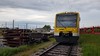
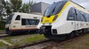
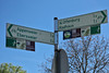
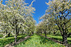
The above images may not be of the site on this page, but were taken nearby. They are loaded from Flickr so please click on them for image credits.
Click here to see more info for this site
Nearby sites
Click here to view sites on an interactive map of the areaKey: Red: member's photo, Blue: 3rd party photo, Yellow: other image, Green: no photo - please go there and take one, Grey: site destroyed
Download sites to:
KML (Google Earth)
GPX (GPS waypoints)
CSV (Garmin/Navman)
CSV (Excel)
To unlock full downloads you need to sign up as a Contributory Member. Otherwise downloads are limited to 50 sites.
Turn off the page maps and other distractions
Nearby sites listing. In the following links * = Image available
1.9km WSW 238° Brücklesbünd Menhir* Standing Stone (Menhir)
5.7km S 184° Bibelistein* Standing Stone (Menhir)
12.6km SSE 158° Heidenplatz und Steinsofa Schwaibach* Rock Art
15.6km WNW 284° Dolmen du Stockfeld Chambered Tomb
17.2km SE 140° Summstein Oberharmersbach Modern Stone Circle etc
18.5km SSE 155° Summstein am Egelwaldweg Modern Stone Circle etc
19.3km WNW 299° Palais de Rohan Musee Archeologique Museum
27.2km SSW 212° Keltisches Fürstengrab von Kappel* Round Barrow(s)
28.1km N 2° Greffern Menhir II Standing Stone (Menhir)
28.1km N 2° Greffern Menhir I Standing Stone (Menhir)
34.2km NNE 14° Heiligenbuck Artificial Mound
34.5km W 277° Langenstein de Dorlisheim* Standing Stone (Menhir)
34.8km NE 51° Giersteine Natural Stone / Erratic / Other Natural Feature
37.7km E 90° Summstein Hallwangen I Modern Stone Circle etc
40.4km NNW 348° Forêt de Haguenau Necropolis Barrow Cemetery
42.0km SSE 157° Summstein Schonach* Modern Stone Circle etc
42.2km SSW 204° Mithraeum Riegel* Ancient Temple
42.4km E 91° Summstein Waldachtal II Modern Stone Circle etc
42.4km E 91° Summstein Waldachtal I Modern Stone Circle etc
42.5km SSE 158° Schalensteinpfad Schonach* Sculptured Stone
42.6km SSE 151° Schalensteine Gremmelsbach* Rock Art
42.9km W 262° Mont St. Odile* Hillfort
43.0km W 261° Fountain Sainte-Odile* Holy Well or Sacred Spring
43.2km W 260° Rocher Robert Forrer* Ancient Mine, Quarry or other Industry
43.4km W 260° Grotte Des Druides* Cave or Rock Shelter
View more nearby sites and additional images


 We would like to know more about this location. Please feel free to add a brief description and any relevant information in your own language.
 Wir möchten mehr über diese Stätte erfahren. Bitte zögern Sie nicht, eine kurze Beschreibung und relevante Informationen in Deutsch hinzuzufügen.
 Nous aimerions en savoir encore un peu sur les lieux. S'il vous plaît n'hesitez pas à ajouter une courte description et tous les renseignements pertinents dans votre propre langue.
 Quisieramos informarnos un poco más de las lugares. No dude en añadir una breve descripción y otros datos relevantes en su propio idioma.