


<< Text Pages >> Löffelskreuz - Ancient Cross in Germany in Rhineland-Palatinate
Submitted by KaiHofmann on Friday, 07 February 2014 Page Views: 1435
Early Medieval (Dark Age)Site Name: LöffelskreuzCountry: Germany
NOTE: This site is 5.087 km away from the location you searched for.
Land: Rhineland-Palatinate Type: Ancient Cross
Nearest Town: Bad Bergzabern Nearest Village: Bobenthal
Latitude: 49.052400N Longitude: 7.880130E
Condition:
| 5 | Perfect |
| 4 | Almost Perfect |
| 3 | Reasonable but with some damage |
| 2 | Ruined but still recognisable as an ancient site |
| 1 | Pretty much destroyed, possibly visible as crop marks |
| 0 | No data. |
| -1 | Completely destroyed |
| 5 | Superb |
| 4 | Good |
| 3 | Ordinary |
| 2 | Not Good |
| 1 | Awful |
| 0 | No data. |
| 5 | Can be driven to, probably with disabled access |
| 4 | Short walk on a footpath |
| 3 | Requiring a bit more of a walk |
| 2 | A long walk |
| 1 | In the middle of nowhere, a nightmare to find |
| 0 | No data. |
| 5 | co-ordinates taken by GPS or official recorded co-ordinates |
| 4 | co-ordinates scaled from a detailed map |
| 3 | co-ordinates scaled from a bad map |
| 2 | co-ordinates of the nearest village |
| 1 | co-ordinates of the nearest town |
| 0 | no data |
Internal Links:
External Links:
Ancient Cross in Rhineland-Palatinate
Remains (stone pillar) of an early cross.
You may be viewing yesterday's version of this page. To see the most up to date information please register for a free account.
Do not use the above information on other web sites or publications without permission of the contributor.
Nearby Images from Flickr
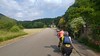
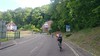

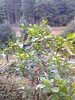

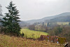
The above images may not be of the site on this page, but were taken nearby. They are loaded from Flickr so please click on them for image credits.
Click here to see more info for this site
Nearby sites
Click here to view sites on an interactive map of the areaKey: Red: member's photo, Blue: 3rd party photo, Yellow: other image, Green: no photo - please go there and take one, Grey: site destroyed
Download sites to:
KML (Google Earth)
GPX (GPS waypoints)
CSV (Garmin/Navman)
CSV (Excel)
To unlock full downloads you need to sign up as a Contributory Member. Otherwise downloads are limited to 50 sites.
Turn off the page maps and other distractions
Nearby sites listing. In the following links * = Image available
4.8km SSW 201° Climbronn Holy Well or Sacred Spring
5.7km NE 40° Steinerner Tisch Rock Art
12.3km NNW 333° Burg Altdahn* Promontory Fort / Cliff Castle
12.5km W 270° Maimont Keltenring* Hillfort
12.5km W 270° Maimont Opferschale* Natural Stone / Erratic / Other Natural Feature
13.6km NNE 16° Völkersweiler Kreuz Ancient Cross
13.9km E 86° Schaidter Hinkelstein* Standing Stone (Menhir)
14.3km NE 37° Ringwall Heidenschuh Hillfort
14.5km WSW 248° Steinkopf Polissoir* Polissoir
15.6km N 9° Runder Hut Rock Outcrop
15.7km WSW 246° Le Grand Gres* Modern Stone Circle etc
17.2km W 276° Summstein Rösselsquelle Modern Stone Circle etc
17.3km N 3° Wetzrillen Wilgartswiesen Polissoir
17.5km N 6° Hünerstein Rindsberg Rock Outcrop
18.4km N 3° Weidentalhoehle* Cave or Rock Shelter
18.5km WSW 256° L´Homme* Natural Stone / Erratic / Other Natural Feature
18.7km NNW 328° Teufelstisch Pfalz* Natural Stone / Erratic / Other Natural Feature
19.2km N 4° Wilgartaburg Promontory Fort / Cliff Castle
19.9km WSW 254° Heidenkopf Standing Stone (Menhir)
20.0km W 261° Hirschfelsen* Natural Stone / Erratic / Other Natural Feature
20.5km SW 235° La Maison de l'Archéologie des Vosges du Nord Museum
21.0km WSW 248° La Liese* Rock Art
21.2km WSW 244° Ziegenberg Camp Celtique* Ancient Village or Settlement
21.7km WSW 252° Hagelbusch* Standing Stone (Menhir)
21.8km WSW 242° Wasembourg temple* Ancient Temple
View more nearby sites and additional images


 We would like to know more about this location. Please feel free to add a brief description and any relevant information in your own language.
 Wir möchten mehr über diese Stätte erfahren. Bitte zögern Sie nicht, eine kurze Beschreibung und relevante Informationen in Deutsch hinzuzufügen.
 Nous aimerions en savoir encore un peu sur les lieux. S'il vous plaît n'hesitez pas à ajouter une courte description et tous les renseignements pertinents dans votre propre langue.
 Quisieramos informarnos un poco más de las lugares. No dude en añadir una breve descripción y otros datos relevantes en su propio idioma.