


<< Text Pages >> Altenbamberg Grabhuegelfeld - Barrow Cemetery in Germany in Rhineland-Palatinate
Submitted by KaiHofmann on Wednesday, 20 November 2013 Page Views: 1421
Neolithic and Bronze AgeSite Name: Altenbamberg GrabhuegelfeldCountry: Germany
NOTE: This site is 2.596 km away from the location you searched for.
Land: Rhineland-Palatinate Type: Barrow Cemetery
Nearest Town: Bad Kreuznach Nearest Village: Altenbamberg
Latitude: 49.791391N Longitude: 7.863709E
Condition:
| 5 | Perfect |
| 4 | Almost Perfect |
| 3 | Reasonable but with some damage |
| 2 | Ruined but still recognisable as an ancient site |
| 1 | Pretty much destroyed, possibly visible as crop marks |
| 0 | No data. |
| -1 | Completely destroyed |
| 5 | Superb |
| 4 | Good |
| 3 | Ordinary |
| 2 | Not Good |
| 1 | Awful |
| 0 | No data. |
| 5 | Can be driven to, probably with disabled access |
| 4 | Short walk on a footpath |
| 3 | Requiring a bit more of a walk |
| 2 | A long walk |
| 1 | In the middle of nowhere, a nightmare to find |
| 0 | No data. |
| 5 | co-ordinates taken by GPS or official recorded co-ordinates |
| 4 | co-ordinates scaled from a detailed map |
| 3 | co-ordinates scaled from a bad map |
| 2 | co-ordinates of the nearest village |
| 1 | co-ordinates of the nearest town |
| 0 | no data |
Internal Links:
External Links:
Barrow Cemetery in Rhineland-Palatinate
Barrow cemetery with 18 mounds. On one of the mounds a small burial stele (around 0.4m high) is located.
You may be viewing yesterday's version of this page. To see the most up to date information please register for a free account.
Do not use the above information on other web sites or publications without permission of the contributor.
Nearby Images from Flickr
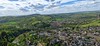
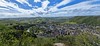
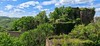
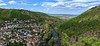
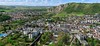
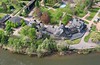
The above images may not be of the site on this page, but were taken nearby. They are loaded from Flickr so please click on them for image credits.
Click here to see more info for this site
Nearby sites
Click here to view sites on an interactive map of the areaKey: Red: member's photo, Blue: 3rd party photo, Yellow: other image, Green: no photo - please go there and take one, Grey: site destroyed
Download sites to:
KML (Google Earth)
GPX (GPS waypoints)
CSV (Garmin/Navman)
CSV (Excel)
To unlock full downloads you need to sign up as a Contributory Member. Otherwise downloads are limited to 50 sites.
Turn off the page maps and other distractions
Nearby sites listing. In the following links * = Image available
636m WNW 281° Der Lange Mann Bad Kreuznach Standing Stone (Menhir)
2.4km NNW 344° Ringwall Gans Hillfort
4.6km E 92° Galgenberg Neu-Bamberg Hillfort
8.0km SSW 209° Alsenz Hinkelstein* Standing Stone (Menhir)
8.4km SW 234° Langer Stein von Obermoschel* Standing Stone (Menhir)
9.6km ENE 75° Hinkelstein von Gumbsheim* Standing Stone (Menhir)
11.0km ESE 116° Nack Monolith* Standing Stone (Menhir)
12.3km SW 235° Lettweiler Hinkelstein Standing Stone (Menhir)
12.5km SE 136° Vorholz Kreisgrabenanlage Henge
12.7km ENE 58° Wißberg Ancient Village or Settlement
12.8km N 3° Grossgrabhügel Nekropole Langenlonsheim Barrow Cemetery
13.6km E 84° Armsheimer Menhir* Standing Stone (Menhir)
13.6km SE 133° Vorholz Grabhuegelgruppe Barrow Cemetery
13.8km E 84° Hinkelstein Armsheim* Standing Stone (Menhir)
13.9km N 349° Wallburg Windesheim* Hillfort
14.2km E 90° Langer Stein Flonheim* Standing Stone (Menhir)
14.3km E 83° Dicke Stein* Standing Stone (Menhir)
14.3km E 83° Spitze Stein* Standing Stone (Menhir)
15.1km NNW 345° Grabhügelfeld Kleine Heide Barrow Cemetery
15.7km SSW 200° Stahlberg Langenstein* Standing Stone (Menhir)
15.9km NNW 346° Grabhügelfeld Grosse Heide Barrow Cemetery
18.6km SSE 164° Hinkelstein Donnersberg* Standing Stone (Menhir)
18.7km SE 134° Rittersheim Lange Stein* Standing Stone (Menhir)
19.0km SSE 166° Donnersberg (Dannenfels)* Ancient Village or Settlement
19.5km SE 146° Bolanden Hinkelstein* Standing Stone (Menhir)
View more nearby sites and additional images


 We would like to know more about this location. Please feel free to add a brief description and any relevant information in your own language.
 Wir möchten mehr über diese Stätte erfahren. Bitte zögern Sie nicht, eine kurze Beschreibung und relevante Informationen in Deutsch hinzuzufügen.
 Nous aimerions en savoir encore un peu sur les lieux. S'il vous plaît n'hesitez pas à ajouter une courte description et tous les renseignements pertinents dans votre propre langue.
 Quisieramos informarnos un poco más de las lugares. No dude en añadir una breve descripción y otros datos relevantes en su propio idioma.