 with our Megalithic Portal iPhone app")


<< Our Photo Pages >> Archäologisches Museum Colombischlössle - Museum in Germany in Baden-Wuerttemberg
Submitted by Harald_Platta on Friday, 12 February 2016 Page Views: 1987
MuseumsSite Name: Archäologisches Museum ColombischlössleCountry: Germany
NOTE: This site is 4.155 km away from the location you searched for.
Land: Baden-Wuerttemberg Type: Museum
Nearest Town: Freiburg im Breisgau
Latitude: 47.997778N Longitude: 7.846111E
Condition:
| 5 | Perfect |
| 4 | Almost Perfect |
| 3 | Reasonable but with some damage |
| 2 | Ruined but still recognisable as an ancient site |
| 1 | Pretty much destroyed, possibly visible as crop marks |
| 0 | No data. |
| -1 | Completely destroyed |
| 5 | Superb |
| 4 | Good |
| 3 | Ordinary |
| 2 | Not Good |
| 1 | Awful |
| 0 | No data. |
| 5 | Can be driven to, probably with disabled access |
| 4 | Short walk on a footpath |
| 3 | Requiring a bit more of a walk |
| 2 | A long walk |
| 1 | In the middle of nowhere, a nightmare to find |
| 0 | No data. |
| 5 | co-ordinates taken by GPS or official recorded co-ordinates |
| 4 | co-ordinates scaled from a detailed map |
| 3 | co-ordinates scaled from a bad map |
| 2 | co-ordinates of the nearest village |
| 1 | co-ordinates of the nearest town |
| 0 | no data |
Internal Links:
External Links:
I have visited· I would like to visit
Harald_Platta visited on 16th Feb 2016 - their rating: Cond: 5 Amb: 5 Access: 4
")
The permanent exhibition displays finds from the Paleolithic, Neolithic, Bronze Age, the Celts, Romans and from medieval times.
Homepage: Archäologisches Museum Colombischlössle
You may be viewing yesterday's version of this page. To see the most up to date information please register for a free account.
")
Do not use the above information on other web sites or publications without permission of the contributor.
Nearby Images from Flickr
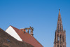
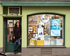


The above images may not be of the site on this page, but were taken nearby. They are loaded from Flickr so please click on them for image credits.
Click here to see more info for this site
Nearby sites
Click here to view sites on an interactive map of the areaKey: Red: member's photo, Blue: 3rd party photo, Yellow: other image, Green: no photo - please go there and take one, Grey: site destroyed
Download sites to:
KML (Google Earth)
GPX (GPS waypoints)
CSV (Garmin/Navman)
CSV (Excel)
To unlock full downloads you need to sign up as a Contributory Member. Otherwise downloads are limited to 50 sites.
Turn off the page maps and other distractions
Nearby sites listing. In the following links * = Image available
637m SE 134° Bleu de Vire (Freiburg)* Modern Stone Circle etc
2.4km NW 308° Summstein Seepark* Modern Stone Circle etc
11.5km ESE 110° Tarodonum Keltische Oppidum Hillfort
13.9km WNW 283° Gaisbuck Barrow Cemetery
14.2km WNW 285° Grossteinen Grabhügelgruppe Barrow Cemetery
14.7km W 274° Heid Grabhügelgruppe Barrow Cemetery
16.2km WNW 285° Löhbücke Grabhügelgruppe Barrow Cemetery
18.5km NNW 336° Mithraeum Riegel* Ancient Temple
20.6km NW 317° Gräberfeld Königschaffhausen* Barrow Cemetery
22.1km NW 307° Gräberfeld der Rössener Kultur Jechtingen* Barrow Cemetery
24.5km NW 313° Oppidum Sasbach Ancient Village or Settlement
30.7km ENE 58° Schalensteinpfad Schonach* Sculptured Stone
31.3km ENE 57° Summstein Schonach* Modern Stone Circle etc
32.8km N 352° Keltisches Fürstengrab von Kappel* Round Barrow(s)
33.1km SE 131° Schluchsee Steinkreise Stone Circle
33.5km NW 308° Hoelmatt Tumulus* Artificial Mound
35.9km ENE 59° Schalensteine Gremmelsbach* Rock Art
36.9km NW 317° Mussig Tumuli* Artificial Mound
36.9km NW 317° Nachtweide Tumuli* Artificial Mound
39.3km W 278° Ricoh Tumuli* Artificial Mound
40.7km SSW 209° Katzenberg Grabhügelgruppe* Barrow Cemetery
42.1km ESE 119° Summstein Bonndorf Modern Stone Circle etc
42.1km S 177° Der Stein Dossenbach* Standing Stone (Menhir)
42.3km ESE 102° Guldenen Grabhügelgruppe Barrow Cemetery
42.5km NNE 25° Summstein am Egelwaldweg Modern Stone Circle etc
View more nearby sites and additional images


 We would like to know more about this location. Please feel free to add a brief description and any relevant information in your own language.
 Wir möchten mehr über diese Stätte erfahren. Bitte zögern Sie nicht, eine kurze Beschreibung und relevante Informationen in Deutsch hinzuzufügen.
 Nous aimerions en savoir encore un peu sur les lieux. S'il vous plaît n'hesitez pas à ajouter une courte description et tous les renseignements pertinents dans votre propre langue.
 Quisieramos informarnos un poco más de las lugares. No dude en añadir una breve descripción y otros datos relevantes en su propio idioma.