


<< Our Photo Pages >> Grabhügel Weisel - Round Barrow(s) in Germany in Rhineland-Palatinate
Submitted by KaiHofmann on Wednesday, 29 June 2016 Page Views: 1108
Neolithic and Bronze AgeSite Name: Grabhügel WeiselCountry: Germany
NOTE: This site is 6.382 km away from the location you searched for.
Land: Rhineland-Palatinate Type: Round Barrow(s)
Nearest Town: Wiesbaden Nearest Village: Weisel
Latitude: 50.113848N Longitude: 7.804744E
Condition:
| 5 | Perfect |
| 4 | Almost Perfect |
| 3 | Reasonable but with some damage |
| 2 | Ruined but still recognisable as an ancient site |
| 1 | Pretty much destroyed, possibly visible as crop marks |
| 0 | No data. |
| -1 | Completely destroyed |
| 5 | Superb |
| 4 | Good |
| 3 | Ordinary |
| 2 | Not Good |
| 1 | Awful |
| 0 | No data. |
| 5 | Can be driven to, probably with disabled access |
| 4 | Short walk on a footpath |
| 3 | Requiring a bit more of a walk |
| 2 | A long walk |
| 1 | In the middle of nowhere, a nightmare to find |
| 0 | No data. |
| 5 | co-ordinates taken by GPS or official recorded co-ordinates |
| 4 | co-ordinates scaled from a detailed map |
| 3 | co-ordinates scaled from a bad map |
| 2 | co-ordinates of the nearest village |
| 1 | co-ordinates of the nearest town |
| 0 | no data |
Internal Links:
External Links:
")
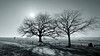
Reconstructed Gallo-Roman burial mound of the 2nd century CE.
You may be viewing yesterday's version of this page. To see the most up to date information please register for a free account.
")
Do not use the above information on other web sites or publications without permission of the contributor.
Nearby Images from Flickr


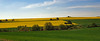
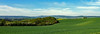
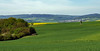
The above images may not be of the site on this page, but were taken nearby. They are loaded from Flickr so please click on them for image credits.
Click here to see more info for this site
Nearby sites
Click here to view sites on an interactive map of the areaKey: Red: member's photo, Blue: 3rd party photo, Yellow: other image, Green: no photo - please go there and take one, Grey: site destroyed
Download sites to:
KML (Google Earth)
GPX (GPS waypoints)
CSV (Garmin/Navman)
CSV (Excel)
To unlock full downloads you need to sign up as a Contributory Member. Otherwise downloads are limited to 50 sites.
Turn off the page maps and other distractions
Nearby sites listing. In the following links * = Image available
6.8km NW 308° Befestigung auf dem Hünenberg Hillfort
11.1km SW 234° Breitscheid Grabhuegel Round Barrow(s)
13.5km SSE 167° Alte Schanz Ohligs-Berg* Hillfort
16.1km W 270° Flammensäule Pfalzfeld* Sculptured Stone
18.6km N 0° Alte Burg Singhofen* Hillfort
18.9km ESE 104° Ringwall Dreibornskopf* Hillfort
20.4km S 179° Grabhügelfeld Grosse Heide Barrow Cemetery
21.3km W 267° Grabhügelgruppe Beltheim Barrow Cemetery
21.3km S 179° Grabhügelfeld Kleine Heide Barrow Cemetery
22.3km S 176° Wallburg Windesheim* Hillfort
22.7km W 281° Gondershausen paleolithic horse engravings* Rock Art
23.6km SSE 168° Grossgrabhügel Nekropole Langenlonsheim Barrow Cemetery
24.3km SE 128° Kaiserpfalz Ingelheim Ancient Palace
24.4km SW 220° Reizenborn Quelle Holy Well or Sacred Spring
25.1km SE 132° Hinkelstein Ober-Ingelheim Standing Stone (Menhir)
25.4km NW 312° Bruder Tönnes Hügel* Round Barrow(s)
25.6km NW 310° Grabhügelfeld Waldesch* Barrow Cemetery
26.6km E 86° Altenstein Taunusstein Rock Outcrop
26.7km E 85° Spitzenstein Taunusstein Rock Outcrop
27.2km WSW 249° Grabhügelfeld Alterkülz Barrow Cemetery
27.3km E 101° Summstein Freudenberg Modern Stone Circle etc
27.5km SE 128° Wackernheim Menhir* Standing Stone (Menhir)
27.5km WSW 257° Bell Huegelgraeber Barrow Cemetery
27.6km NW 325° Wallanlage Dommelberg* Hillfort
28.7km WNW 301° Keltenburg Alken Hillfort
View more nearby sites and additional images


 We would like to know more about this location. Please feel free to add a brief description and any relevant information in your own language.
 Wir möchten mehr über diese Stätte erfahren. Bitte zögern Sie nicht, eine kurze Beschreibung und relevante Informationen in Deutsch hinzuzufügen.
 Nous aimerions en savoir encore un peu sur les lieux. S'il vous plaît n'hesitez pas à ajouter une courte description et tous les renseignements pertinents dans votre propre langue.
 Quisieramos informarnos un poco más de las lugares. No dude en añadir una breve descripción y otros datos relevantes en su propio idioma.