 with our Megalithic Portal iPhone app")


<< Text Pages >> Heilger Brunnen Halscheid - Holy Well or Sacred Spring in Germany in North Rhine-Westphalia
Submitted by Harald_Platta on Thursday, 28 January 2016 Page Views: 780
Springs and Holy WellsSite Name: Heilger Brunnen HalscheidCountry: Germany
NOTE: This site is 2.003 km away from the location you searched for.
Land: North Rhine-Westphalia Type: Holy Well or Sacred Spring
Nearest Town: Windeck
Latitude: 50.804728N Longitude: 7.667296E
Condition:
| 5 | Perfect |
| 4 | Almost Perfect |
| 3 | Reasonable but with some damage |
| 2 | Ruined but still recognisable as an ancient site |
| 1 | Pretty much destroyed, possibly visible as crop marks |
| 0 | No data. |
| -1 | Completely destroyed |
| 5 | Superb |
| 4 | Good |
| 3 | Ordinary |
| 2 | Not Good |
| 1 | Awful |
| 0 | No data. |
| 5 | Can be driven to, probably with disabled access |
| 4 | Short walk on a footpath |
| 3 | Requiring a bit more of a walk |
| 2 | A long walk |
| 1 | In the middle of nowhere, a nightmare to find |
| 0 | No data. |
| 5 | co-ordinates taken by GPS or official recorded co-ordinates |
| 4 | co-ordinates scaled from a detailed map |
| 3 | co-ordinates scaled from a bad map |
| 2 | co-ordinates of the nearest village |
| 1 | co-ordinates of the nearest town |
| 0 | no data |
Internal Links:
External Links:
Heiliger Brunnen in Halscheid is a supposed holy well in Windeck (North Rhine-Westphalia, Germany).
Early reports suggest, that the site was used as pagan sanctuary in early history. Also in modern times, the water of the well has been proposed to be healthy. The water basin contained many leeches, that were used by the villagers to clean their blood.
According to a local legend, evil quacksalver poisoned the well in order to sell their own medicine to the villagers. Because of this, the well had been filled up for a long time.
The well was rebuilt again in 2005.
Literature:
[01] Haenel, M.: Windeck-Halscheid – Heiliger Brunnen. In: Wasserquellen-Atlas [Webpage].
[02] Kölner Stadtanzeiger (Hrsg.): Heiliger Brunnen sprudelt wieder (03.10.2005).
You may be viewing yesterday's version of this page. To see the most up to date information please register for a free account.
Do not use the above information on other web sites or publications without permission of the contributor.
Nearby Images from Flickr
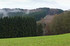

The above images may not be of the site on this page, but were taken nearby. They are loaded from Flickr so please click on them for image credits.
Click here to see more info for this site
Nearby sites
Click here to view sites on an interactive map of the areaKey: Red: member's photo, Blue: 3rd party photo, Yellow: other image, Green: no photo - please go there and take one, Grey: site destroyed
Download sites to:
KML (Google Earth)
GPX (GPS waypoints)
CSV (Garmin/Navman)
CSV (Excel)
To unlock full downloads you need to sign up as a Contributory Member. Otherwise downloads are limited to 50 sites.
Turn off the page maps and other distractions
Nearby sites listing. In the following links * = Image available
8.7km WSW 255° Heilbrunnen am Ohmbach* Holy Well or Sacred Spring
9.9km SSE 151° Altburg Stein-Wingert* Hillfort
14.8km NW 323° Summstein Nümbrecht Modern Stone Circle etc
15.5km E 99° Abschnittsbefestigung Alsdorf* Promontory Fort / Cliff Castle
17.1km E 94° Druidenstein Kirchen* Natural Stone / Erratic / Other Natural Feature
17.2km NNE 29° Dreiherrenstein am Kamp* Marker Stone
19.5km SE 144° Steinkistengrab Oberzeuzheim* Chambered Tomb
21.2km W 276° Teufelskiste* Natural Stone / Erratic / Other Natural Feature
22.0km ENE 72° Siegen La Tène Ironworks Ancient Mine, Quarry or other Industry
23.1km ESE 102° Wallburg Hohenseelenbachskopf Hillfort
24.0km N 2° Heiliger Brunnen Wiedenest* Holy Well or Sacred Spring
25.3km E 95° Zeppenfeld Iron Age Forge Ancient Mine, Quarry or other Industry
26.7km ENE 73° Siegerlandmuseum* Museum
29.1km ESE 105° Burg von Burbach* Hillfort
31.0km W 273° Grabhügelgruppe Lohmarer Wald* Barrow Cemetery
32.0km NNW 331° Zwergenhöhle Lindlar* Cave or Rock Shelter
32.1km NW 316° Summstein Lindlar Modern Stone Circle etc
33.6km W 276° Ringwall Gueldenberg* Hillfort
34.0km ESE 114° Ketzersteine* Natural Stone / Erratic / Other Natural Feature
34.7km E 85° Höllenrain Iron Age Forge Ancient Mine, Quarry or other Industry
34.9km WSW 248° Ringwall Petersberg* Hillfort
35.0km WNW 294° Ringwall Luederich* Hillfort
35.4km WSW 251° Oberdollendorfer Steinkreis* Stone Circle
35.5km WSW 257° Grabhügelgruppe Niederholtorf* Barrow Cemetery
35.8km WSW 243° Drachenfelsquelle* Holy Well or Sacred Spring
View more nearby sites and additional images


 We would like to know more about this location. Please feel free to add a brief description and any relevant information in your own language.
 Wir möchten mehr über diese Stätte erfahren. Bitte zögern Sie nicht, eine kurze Beschreibung und relevante Informationen in Deutsch hinzuzufügen.
 Nous aimerions en savoir encore un peu sur les lieux. S'il vous plaît n'hesitez pas à ajouter une courte description et tous les renseignements pertinents dans votre propre langue.
 Quisieramos informarnos un poco más de las lugares. No dude en añadir una breve descripción y otros datos relevantes en su propio idioma.