


<< Text Pages >> Löhbücke Grabhügelgruppe - Barrow Cemetery in Germany in Baden-Wuerttemberg
Submitted by AlexHunger on Tuesday, 13 September 2005 Page Views: 2295
Neolithic and Bronze AgeSite Name: Löhbücke GrabhügelgruppeCountry: Germany
NOTE: This site is 1.174 km away from the location you searched for.
Land: Baden-Wuerttemberg Type: Barrow Cemetery
Nearest Town: Freiburg Nearest Village: Ihringen in Breisach
Latitude: 48.036010N Longitude: 7.635740E
Condition:
| 5 | Perfect |
| 4 | Almost Perfect |
| 3 | Reasonable but with some damage |
| 2 | Ruined but still recognisable as an ancient site |
| 1 | Pretty much destroyed, possibly visible as crop marks |
| 0 | No data. |
| -1 | Completely destroyed |
| 5 | Superb |
| 4 | Good |
| 3 | Ordinary |
| 2 | Not Good |
| 1 | Awful |
| 0 | No data. |
| 5 | Can be driven to, probably with disabled access |
| 4 | Short walk on a footpath |
| 3 | Requiring a bit more of a walk |
| 2 | A long walk |
| 1 | In the middle of nowhere, a nightmare to find |
| 0 | No data. |
| 5 | co-ordinates taken by GPS or official recorded co-ordinates |
| 4 | co-ordinates scaled from a detailed map |
| 3 | co-ordinates scaled from a bad map |
| 2 | co-ordinates of the nearest village |
| 1 | co-ordinates of the nearest town |
| 0 | no data |
Be the first person to rate this site - see the 'Contribute!' box in the right hand menu.
Internal Links:
External Links:
Tumuli in Baden-Württemberg
IMPORTANT NOTE: Site believed to be near this position. Large tumuli field dating to between the Bronze and the Iron age
You may be viewing yesterday's version of this page. To see the most up to date information please register for a free account.
Do not use the above information on other web sites or publications without permission of the contributor.
Nearby Images from Flickr
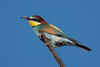
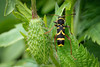
The above images may not be of the site on this page, but were taken nearby. They are loaded from Flickr so please click on them for image credits.
Click here to see more info for this site
Nearby sites
Click here to view sites on an interactive map of the areaKey: Red: member's photo, Blue: 3rd party photo, Yellow: other image, Green: no photo - please go there and take one, Grey: site destroyed
Download sites to:
KML (Google Earth)
GPX (GPS waypoints)
CSV (Garmin/Navman)
CSV (Excel)
To unlock full downloads you need to sign up as a Contributory Member. Otherwise downloads are limited to 50 sites.
Turn off the page maps and other distractions
Nearby sites listing. In the following links * = Image available
2.1km ESE 106° Grossteinen Grabhügelgruppe Barrow Cemetery
2.4km ESE 118° Gaisbuck Barrow Cemetery
3.3km SSE 162° Heid Grabhügelgruppe Barrow Cemetery
9.1km NNW 347° Gräberfeld der Rössener Kultur Jechtingen* Barrow Cemetery
10.9km N 8° Gräberfeld Königschaffhausen* Barrow Cemetery
12.6km N 349° Oppidum Sasbach Ancient Village or Settlement
14.0km ESE 101° Summstein Seepark* Modern Stone Circle etc
15.1km NNE 33° Mithraeum Riegel* Ancient Temple
16.2km ESE 105° Archäologisches Museum Colombischlössle* Museum
16.8km ESE 106° Bleu de Vire (Freiburg)* Modern Stone Circle etc
19.5km NW 326° Hoelmatt Tumulus* Artificial Mound
23.3km W 274° Ricoh Tumuli* Artificial Mound
24.5km NNW 336° Mussig Tumuli* Artificial Mound
24.5km NNW 336° Nachtweide Tumuli* Artificial Mound
27.7km ESE 107° Tarodonum Keltische Oppidum Hillfort
27.7km W 259° Pierre du Diable du Teufelstein Rock Outcrop
27.7km W 274° La Fontaine de la Dame* Holy Well or Sacred Spring
27.8km W 273° Rocher Turenne* Natural Stone / Erratic / Other Natural Feature
27.9km W 260° Table des Druides Schauenberg* Rock Outcrop
30.3km NNE 21° Keltisches Fürstengrab von Kappel* Round Barrow(s)
32.1km WSW 254° Longue Pierre De Soultzmatt* Standing Stone (Menhir)
32.7km NW 309° Rocher de la Paix d'Udine* Rock Outcrop
33.0km NW 309° Roche de la Garde* Rock Outcrop
33.4km NW 309° Mur Païen* Promontory Fort / Cliff Castle
33.6km NW 309° La Roche Pointue* Rock Outcrop
View more nearby sites and additional images


 We would like to know more about this location. Please feel free to add a brief description and any relevant information in your own language.
 Wir möchten mehr über diese Stätte erfahren. Bitte zögern Sie nicht, eine kurze Beschreibung und relevante Informationen in Deutsch hinzuzufügen.
 Nous aimerions en savoir encore un peu sur les lieux. S'il vous plaît n'hesitez pas à ajouter une courte description et tous les renseignements pertinents dans votre propre langue.
 Quisieramos informarnos un poco más de las lugares. No dude en añadir una breve descripción y otros datos relevantes en su propio idioma.