


<< Text Pages >> The Path of the Souls - Rock Art in Italy in Piemonte
Submitted by routenostalgie on Tuesday, 06 September 2016 Page Views: 1043
Rock ArtSite Name: The Path of the Souls Alternative Name: Mont 'd Rivelle, CHL.ANM8Country: Italy
NOTE: This site is 14.787 km away from the location you searched for.
Region: Piemonte Type: Rock Art
Nearest Village: Traversella
Latitude: 45.509879N Longitude: 7.746050E
Condition:
| 5 | Perfect |
| 4 | Almost Perfect |
| 3 | Reasonable but with some damage |
| 2 | Ruined but still recognisable as an ancient site |
| 1 | Pretty much destroyed, possibly visible as crop marks |
| 0 | No data. |
| -1 | Completely destroyed |
| 5 | Superb |
| 4 | Good |
| 3 | Ordinary |
| 2 | Not Good |
| 1 | Awful |
| 0 | No data. |
| 5 | Can be driven to, probably with disabled access |
| 4 | Short walk on a footpath |
| 3 | Requiring a bit more of a walk |
| 2 | A long walk |
| 1 | In the middle of nowhere, a nightmare to find |
| 0 | No data. |
| 5 | co-ordinates taken by GPS or official recorded co-ordinates |
| 4 | co-ordinates scaled from a detailed map |
| 3 | co-ordinates scaled from a bad map |
| 2 | co-ordinates of the nearest village |
| 1 | co-ordinates of the nearest town |
| 0 | no data |
Internal Links:
External Links:
Rock Art in Piemonte
Traversella Municipality (TO-I), along the "Path of the Souls", local name "Mont 'd Rivelle", altitude 1180 m. Close to the path and a stream, dominant, birches wood, steep slope exposed towards south, great boulders of an ancient landslide, vertical rocky walls. Rough, fractured, flat and convex surface, length 140 cm, width 380 cm., inclination from 15º to 25º, microflora and patina, engraved by percussion.
The Path of the Souls - CHL.ANM8
You may be viewing yesterday's version of this page. To see the most up to date information please register for a free account.
Do not use the above information on other web sites or publications without permission of the contributor.
Nearby Images from Flickr
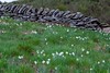
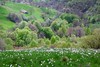
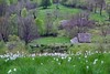
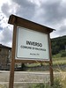
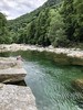
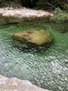
The above images may not be of the site on this page, but were taken nearby. They are loaded from Flickr so please click on them for image credits.
Click here to see more info for this site
Nearby sites
Click here to view sites on an interactive map of the areaKey: Red: member's photo, Blue: 3rd party photo, Yellow: other image, Green: no photo - please go there and take one, Grey: site destroyed
Download sites to:
KML (Google Earth)
GPX (GPS waypoints)
CSV (Garmin/Navman)
CSV (Excel)
To unlock full downloads you need to sign up as a Contributory Member. Otherwise downloads are limited to 50 sites.
Turn off the page maps and other distractions
Nearby sites listing. In the following links * = Image available
7.7km SSE 161° Lugnacco Menhir* Standing Stone (Menhir)
17.5km NE 39° Plan de Sorcières* Rock Art
27.8km SSE 148° Mazzè Menhir* Standing Stone (Menhir)
29.5km ESE 112° Menhirs di Cavaglià* Stone Circle
36.8km NW 315° Vollein Necropolis Barrow Cemetery
37.1km SSW 208° Dreamland* Modern Stone Circle etc
37.2km SSE 163° Chivasso Menhir* Standing Stone (Menhir)
43.0km NW 306° Saint Martin de Corleans Dolmen* Burial Chamber or Dolmen
49.3km S 186° Museo Egizio* Museum
55.6km N 358° Heidenstein Ofenen Rock Art
57.8km ENE 62° Preja Batizà* Rock Art
58.5km ENE 58° Masso coppellato Pella Rock Art
59.0km WSW 252° Les Peintures du Rocher du Château* Rock Art
60.1km SSW 205° Bosco de Celti* Henge
63.8km NE 52° Masso coppellato Bagnella Rock Art
66.2km WSW 249° La Pierre des Saints Rock Art
66.8km ENE 68° Necropoli Golasecchiana di Motto Lagone Long Barrow
67.2km WSW 248° Pierre Gravée (Crosats) Rock Art
68.8km W 264° Col des Ves* Standing Stone (Menhir)
69.0km WSW 252° Pierre à Cupules dite Le Rocher aux Pieds Rock Art
69.0km WSW 252° La Pierre aux Pieds Rock Art
69.1km WSW 249° Pierre Gravée (St Pierre) Rock Art
69.7km WNW 286° Col du Petit Saint-Bernard Cromlech* Stone Circle
69.7km WNW 286° Cromlech del Piccolo San Bernardo* Stone Circle
70.1km NNW 345° Les Pierres aux Fees Rock Art
View more nearby sites and additional images


 We would like to know more about this location. Please feel free to add a brief description and any relevant information in your own language.
 Wir möchten mehr über diese Stätte erfahren. Bitte zögern Sie nicht, eine kurze Beschreibung und relevante Informationen in Deutsch hinzuzufügen.
 Nous aimerions en savoir encore un peu sur les lieux. S'il vous plaît n'hesitez pas à ajouter une courte description et tous les renseignements pertinents dans votre propre langue.
 Quisieramos informarnos un poco más de las lugares. No dude en añadir una breve descripción y otros datos relevantes en su propio idioma.