 with our Megalithic Portal iPhone app")


<< Our Photo Pages >> Rocher Robert Forrer - Ancient Mine, Quarry or other Industry in France in Alsace-Lorraine:Bas-Rhin (67)
Submitted by KaiHofmann on Monday, 10 December 2018 Page Views: 1193
Multi-periodSite Name: Rocher Robert ForrerCountry: France
NOTE: This site is 4.358 km away from the location you searched for.
Département: Alsace-Lorraine:Bas-Rhin (67) Type: Ancient Mine, Quarry or other Industry
Nearest Town: Barr Nearest Village: Ottrott
Latitude: 48.424515N Longitude: 7.404088E
Condition:
| 5 | Perfect |
| 4 | Almost Perfect |
| 3 | Reasonable but with some damage |
| 2 | Ruined but still recognisable as an ancient site |
| 1 | Pretty much destroyed, possibly visible as crop marks |
| 0 | No data. |
| -1 | Completely destroyed |
| 5 | Superb |
| 4 | Good |
| 3 | Ordinary |
| 2 | Not Good |
| 1 | Awful |
| 0 | No data. |
| 5 | Can be driven to, probably with disabled access |
| 4 | Short walk on a footpath |
| 3 | Requiring a bit more of a walk |
| 2 | A long walk |
| 1 | In the middle of nowhere, a nightmare to find |
| 0 | No data. |
| 5 | co-ordinates taken by GPS or official recorded co-ordinates |
| 4 | co-ordinates scaled from a detailed map |
| 3 | co-ordinates scaled from a bad map |
| 2 | co-ordinates of the nearest village |
| 1 | co-ordinates of the nearest town |
| 0 | no data |
Internal Links:
External Links:
")
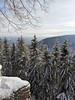
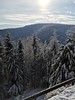
Remains of a prehistoric quarry, where the stones of the Mont St. Odile rampart came from.
You may be viewing yesterday's version of this page. To see the most up to date information please register for a free account.
")
")
Do not use the above information on other web sites or publications without permission of the contributor.
Nearby Images from Flickr
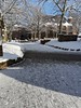
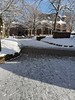
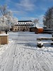
The above images may not be of the site on this page, but were taken nearby. They are loaded from Flickr so please click on them for image credits.
Click here to see more info for this site
Nearby sites
Click here to view sites on an interactive map of the areaKey: Red: member's photo, Blue: 3rd party photo, Yellow: other image, Green: no photo - please go there and take one, Grey: site destroyed
Download sites to:
KML (Google Earth)
GPX (GPS waypoints)
CSV (Garmin/Navman)
CSV (Excel)
To unlock full downloads you need to sign up as a Contributory Member. Otherwise downloads are limited to 50 sites.
Turn off the page maps and other distractions
Nearby sites listing. In the following links * = Image available
226m NW 312° Grotte Des Druides* Cave or Rock Shelter
668m NW 324° Mont St.Odile Tombes Mérovingiennes* Burial Chamber or Dolmen
1.2km N 360° Fountain Sainte-Odile* Holy Well or Sacred Spring
1.5km N 2° Mont St. Odile* Hillfort
10.7km WSW 254° Menhir dit le Rocher des Poupons Standing Stone (Menhir)
11.2km S 177° Dambach-la-Ville Menhir* Modern Stone Circle etc
12.5km SSE 165° Pierre de la Chapelle Saint-Jean* Standing Stone (Menhir)
12.9km S 177° Rochers des Celtes* Barrow Cemetery
14.5km NE 34° Langenstein de Dorlisheim* Standing Stone (Menhir)
15.5km SSW 202° Enceinte de Frankenbourg* Ancient Village or Settlement
15.8km SSW 212° Roches des Fées (Neubois) Natural Stone / Erratic / Other Natural Feature
15.9km SSW 205° Rocher du Coucou Rock Art
16.6km NW 317° Enceinte du Jardin des Fees* Rock Outcrop
16.6km NW 317° Jardin des Fées Menhir II* Standing Stone (Menhir)
16.6km NW 317° Jardin des Fées Menhir I path* Standing Stone (Menhir)
16.8km NW 320° Menhir du Kappelbronn* Standing Stone (Menhir)
16.9km NNW 332° Ringelsberg Fortifications Gallo-romaines Hillfort
17.9km NW 322° Porte de Pierre Mur Paien* Misc. Earthwork
17.9km SSW 208° Cupules du Mont Chaumont Rock Art
17.9km NW 322° Porte de Pierre cup mark stone* Rock Art
17.9km NW 322° Porte de Pierre Monolithe* Natural Stone / Erratic / Other Natural Feature
20.2km WNW 299° Donon Temples* Ancient Temple
20.3km WNW 298° Donon Temple I* Ancient Temple
20.3km WNW 299° Donon Holy Well* Holy Well or Sacred Spring
20.3km WNW 299° Donon Hillfort Rampart* Hillfort
View more nearby sites and additional images


 We would like to know more about this location. Please feel free to add a brief description and any relevant information in your own language.
 Wir möchten mehr über diese Stätte erfahren. Bitte zögern Sie nicht, eine kurze Beschreibung und relevante Informationen in Deutsch hinzuzufügen.
 Nous aimerions en savoir encore un peu sur les lieux. S'il vous plaît n'hesitez pas à ajouter une courte description et tous les renseignements pertinents dans votre propre langue.
 Quisieramos informarnos un poco más de las lugares. No dude en añadir una breve descripción y otros datos relevantes en su propio idioma.