


<< Our Photo Pages >> Dambach-la-Ville Menhir - Modern Stone Circle etc in France in Alsace-Lorraine:Bas-Rhin (67)
Submitted by KaiHofmann on Tuesday, 17 July 2012 Page Views: 2143
Modern SitesSite Name: Dambach-la-Ville MenhirCountry: France
NOTE: This site is 2.912 km away from the location you searched for.
Département: Alsace-Lorraine:Bas-Rhin (67) Type: Modern Stone Circle etc
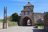
Nearest Town: Dambach-la-Ville
Latitude: 48.323923N Longitude: 7.413089E
Condition:
| 5 | Perfect |
| 4 | Almost Perfect |
| 3 | Reasonable but with some damage |
| 2 | Ruined but still recognisable as an ancient site |
| 1 | Pretty much destroyed, possibly visible as crop marks |
| 0 | No data. |
| -1 | Completely destroyed |
| 5 | Superb |
| 4 | Good |
| 3 | Ordinary |
| 2 | Not Good |
| 1 | Awful |
| 0 | No data. |
| 5 | Can be driven to, probably with disabled access |
| 4 | Short walk on a footpath |
| 3 | Requiring a bit more of a walk |
| 2 | A long walk |
| 1 | In the middle of nowhere, a nightmare to find |
| 0 | No data. |
| 5 | co-ordinates taken by GPS or official recorded co-ordinates |
| 4 | co-ordinates scaled from a detailed map |
| 3 | co-ordinates scaled from a bad map |
| 2 | co-ordinates of the nearest village |
| 1 | co-ordinates of the nearest town |
| 0 | no data |
Internal Links:
External Links:
")
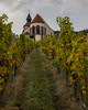
Standing stone in the vineyards south of Dambach-la-Ville.
You may be viewing yesterday's version of this page. To see the most up to date information please register for a free account.
")
")
")
Do not use the above information on other web sites or publications without permission of the contributor.
Nearby Images from Flickr
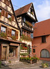
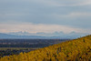
The above images may not be of the site on this page, but were taken nearby. They are loaded from Flickr so please click on them for image credits.
Click here to see more info for this site
Nearby sites
Click here to view sites on an interactive map of the areaKey: Red: member's photo, Blue: 3rd party photo, Yellow: other image, Green: no photo - please go there and take one, Grey: site destroyed
Download sites to:
KML (Google Earth)
GPX (GPS waypoints)
CSV (Garmin/Navman)
CSV (Excel)
To unlock full downloads you need to sign up as a Contributory Member. Otherwise downloads are limited to 50 sites.
Turn off the page maps and other distractions
Nearby sites listing. In the following links * = Image available
1.7km S 177° Rochers des Celtes* Barrow Cemetery
2.7km ESE 108° Pierre de la Chapelle Saint-Jean* Standing Stone (Menhir)
7.3km WSW 244° Enceinte de Frankenbourg* Ancient Village or Settlement
8.1km WSW 247° Rocher du Coucou Rock Art
9.4km WSW 256° Roches des Fées (Neubois) Natural Stone / Erratic / Other Natural Feature
10.3km WSW 244° Cupules du Mont Chaumont Rock Art
11.2km N 357° Rocher Robert Forrer* Ancient Mine, Quarry or other Industry
11.4km N 356° Grotte Des Druides* Cave or Rock Shelter
11.6km SE 145° Nachtweide Tumuli* Artificial Mound
11.6km SE 145° Mussig Tumuli* Artificial Mound
11.8km N 355° Mont St.Odile Tombes Mérovingiennes* Burial Chamber or Dolmen
12.4km N 357° Fountain Sainte-Odile* Holy Well or Sacred Spring
12.7km N 357° Mont St. Odile* Hillfort
13.7km NW 307° Menhir dit le Rocher des Poupons Standing Stone (Menhir)
13.9km SW 226° Cupules du Rocher du Géant* Rock Art
13.9km SW 226° Rocher des Cordonniers* Rock Outcrop
14.2km SW 228° Rocher de la Petite Fée* Rock Outcrop
14.3km SW 228° Rocher des Reptiles* Rock Outcrop
14.4km SW 222° Taenchel Menhirs Couche Standing Stone (Menhir)
14.4km SW 221° Mur Païen* Promontory Fort / Cliff Castle
14.5km SW 222° La Roche Pointue* Rock Outcrop
14.5km SW 219° Roche de la Garde* Rock Outcrop
14.7km SW 218° Rocher de la Paix d'Udine* Rock Outcrop
14.7km SW 228° Roches des Trois Tables* Rock Outcrop
14.8km SW 229° Rocher de l'Anneau* Rock Outcrop
View more nearby sites and additional images


 We would like to know more about this location. Please feel free to add a brief description and any relevant information in your own language.
 Wir möchten mehr über diese Stätte erfahren. Bitte zögern Sie nicht, eine kurze Beschreibung und relevante Informationen in Deutsch hinzuzufügen.
 Nous aimerions en savoir encore un peu sur les lieux. S'il vous plaît n'hesitez pas à ajouter une courte description et tous les renseignements pertinents dans votre propre langue.
 Quisieramos informarnos un poco más de las lugares. No dude en añadir una breve descripción y otros datos relevantes en su propio idioma.