


<< Our Photo Pages >> Gruenbachwald Graeberfeld - Barrow Cemetery in Germany in Saarland
Submitted by KaiHofmann on Thursday, 05 May 2011 Page Views: 2275
Neolithic and Bronze AgeSite Name: Gruenbachwald GraeberfeldCountry: Germany
NOTE: This site is 7.099 km away from the location you searched for.
Land: Saarland Type: Barrow Cemetery
Nearest Town: Blieskastel Nearest Village: Boeckweiler
Latitude: 49.198321N Longitude: 7.304342E
Condition:
| 5 | Perfect |
| 4 | Almost Perfect |
| 3 | Reasonable but with some damage |
| 2 | Ruined but still recognisable as an ancient site |
| 1 | Pretty much destroyed, possibly visible as crop marks |
| 0 | No data. |
| -1 | Completely destroyed |
| 5 | Superb |
| 4 | Good |
| 3 | Ordinary |
| 2 | Not Good |
| 1 | Awful |
| 0 | No data. |
| 5 | Can be driven to, probably with disabled access |
| 4 | Short walk on a footpath |
| 3 | Requiring a bit more of a walk |
| 2 | A long walk |
| 1 | In the middle of nowhere, a nightmare to find |
| 0 | No data. |
| 5 | co-ordinates taken by GPS or official recorded co-ordinates |
| 4 | co-ordinates scaled from a detailed map |
| 3 | co-ordinates scaled from a bad map |
| 2 | co-ordinates of the nearest village |
| 1 | co-ordinates of the nearest town |
| 0 | no data |
Internal Links:
External Links:
")
the Gruenbachwald barrow cemetery exist out of 6 iron age barrows. In one of it a iron helmet of the south alpine region has been found.
You may be viewing yesterday's version of this page. To see the most up to date information please register for a free account.
")
")
Do not use the above information on other web sites or publications without permission of the contributor.
Nearby Images from Flickr
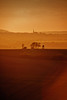
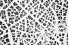
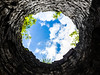
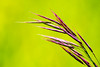
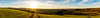
The above images may not be of the site on this page, but were taken nearby. They are loaded from Flickr so please click on them for image credits.
Click here to see more info for this site
Nearby sites
Click here to view sites on an interactive map of the areaKey: Red: member's photo, Blue: 3rd party photo, Yellow: other image, Green: no photo - please go there and take one, Grey: site destroyed
Download sites to:
KML (Google Earth)
GPX (GPS waypoints)
CSV (Garmin/Navman)
CSV (Excel)
To unlock full downloads you need to sign up as a Contributory Member. Otherwise downloads are limited to 50 sites.
Turn off the page maps and other distractions
Nearby sites listing. In the following links * = Image available
2.0km SSW 206° Lindenbrunnen* Holy Well or Sacred Spring
2.9km WSW 239° Kirchheimerhof Grabhuegelfeld * Barrow Cemetery
3.2km SW 216° Böckweiler Hügelgrab* Round Barrow(s)
4.0km WSW 253° Odilienquelle* Holy Well or Sacred Spring
4.9km SSE 165° Altheim Brenschelbach Grabhuegelfeld * Barrow Cemetery
6.0km N 4° Heidenfelshoehle* Rock Art
6.5km NW 322° Gollenstein* Standing Stone (Menhir)
6.9km W 263° Rubenheim Grabhuegelfeld* Barrow Cemetery
7.4km NNW 329° Rother Fels Frauenbrunnenstein Lautzkirchen* Standing Stones
8.1km SSE 165° Tumuli de Ormesviller Barrow Cemetery
8.3km NNW 346° Pirminius Felsen* Early Christian Sculptured Stone
9.4km N 0° Roemerhuegel* Artificial Mound
9.4km N 6° Roemermuseum Schwarzenacker* Museum
9.6km W 280° Wetzstein Assweiler* Carving
10.1km W 272° Huegelgraeber Sauerackerwald* Barrow Cemetery
10.1km SW 230° Horres* Round Barrow(s)
10.2km NNW 335° Frauenbrunnen (Pirmanswald)* Holy Well or Sacred Spring
10.3km W 280° Ommersheim Huegelgraeberfeld 1* Barrow Cemetery
10.5km W 278° Ommersheim Huegelgraeberfeld 2* Barrow Cemetery
10.6km S 183° Tumulus de Rimling Round Barrow(s)
10.6km N 354° Klosterwald Tempelbezirk Ancient Temple
10.6km NNW 341° Felsenkeller Kirkel Ancient Village or Settlement
10.7km NNW 336° Kirkel Fliehburg * Hillfort
10.8km NNW 337° Hoellerloecher* Ancient Mine, Quarry or other Industry
10.9km WSW 245° Bebelsheim Grabhuegel* Barrow Cemetery
View more nearby sites and additional images


 We would like to know more about this location. Please feel free to add a brief description and any relevant information in your own language.
 Wir möchten mehr über diese Stätte erfahren. Bitte zögern Sie nicht, eine kurze Beschreibung und relevante Informationen in Deutsch hinzuzufügen.
 Nous aimerions en savoir encore un peu sur les lieux. S'il vous plaît n'hesitez pas à ajouter une courte description et tous les renseignements pertinents dans votre propre langue.
 Quisieramos informarnos un poco más de las lugares. No dude en añadir una breve descripción y otros datos relevantes en su propio idioma.