


<< Text Pages >> Kretz Römerbergwerk - Ancient Mine, Quarry or other Industry in Germany in Rhineland-Palatinate
Submitted by KaiHofmann on Wednesday, 19 April 2017 Page Views: 630
Multi-periodSite Name: Kretz RömerbergwerkCountry: Germany Land: Rhineland-Palatinate Type: Ancient Mine, Quarry or other Industry
Nearest Town: Koblenz Nearest Village: Kretz
Latitude: 50.396283N Longitude: 7.353734E
Condition:
| 5 | Perfect |
| 4 | Almost Perfect |
| 3 | Reasonable but with some damage |
| 2 | Ruined but still recognisable as an ancient site |
| 1 | Pretty much destroyed, possibly visible as crop marks |
| 0 | No data. |
| -1 | Completely destroyed |
| 5 | Superb |
| 4 | Good |
| 3 | Ordinary |
| 2 | Not Good |
| 1 | Awful |
| 0 | No data. |
| 5 | Can be driven to, probably with disabled access |
| 4 | Short walk on a footpath |
| 3 | Requiring a bit more of a walk |
| 2 | A long walk |
| 1 | In the middle of nowhere, a nightmare to find |
| 0 | No data. |
| 5 | co-ordinates taken by GPS or official recorded co-ordinates |
| 4 | co-ordinates scaled from a detailed map |
| 3 | co-ordinates scaled from a bad map |
| 2 | co-ordinates of the nearest village |
| 1 | co-ordinates of the nearest town |
| 0 | no data |
Internal Links:
External Links:
Ancient Mine, Quarry or other Industry in Rhineland-Palatinate
The Gallo/Roman mine was used in the 1st century CE. Today a large museum was installed around the ancient mine/industry.
You may be viewing yesterday's version of this page. To see the most up to date information please register for a free account.
Do not use the above information on other web sites or publications without permission of the contributor.
Nearby Images from Flickr
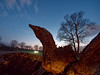
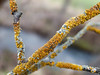
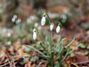
The above images may not be of the site on this page, but were taken nearby. They are loaded from Flickr so please click on them for image credits.
Click here to see more info for this site
Nearby sites
Click here to view sites on an interactive map of the areaKey: Red: member's photo, Blue: 3rd party photo, Yellow: other image, Green: no photo - please go there and take one, Grey: site destroyed
Download sites to:
KML (Google Earth)
GPX (GPS waypoints)
CSV (Garmin/Navman)
CSV (Excel)
To unlock full downloads you need to sign up as a Contributory Member. Otherwise downloads are limited to 50 sites.
Turn off the page maps and other distractions
Nearby sites listing. In the following links * = Image available
3.4km NW 305° Tumulus von Nickenich* Round Barrow(s)
6.3km SSE 151° Grabmal Ochtendung* Round Barrow(s)
8.6km SSE 155° Dreitonnenkuppe Stein* Standing Stone (Menhir)
8.6km SSE 155° Dreitonnenkuppe Grabhügel* Round Barrow(s)
8.8km SE 133° Gollenbusch Graeberfeld Barrow Cemetery
8.9km SE 137° Goloring* Henge
9.4km SE 133° Hügelgräberfeld Chorsang Barrow Cemetery
11.1km NNW 346° Reutersley* Hillfort
16.3km NE 56° Grabhügelfeld Heimbach-Weis* Barrow Cemetery
16.7km W 279° Schleifstein Kempenich* Polissoir
18.2km SSE 156° Keltenburg Alken Hillfort
18.5km ESE 118° Wallanlage Dommelberg* Hillfort
19.5km SE 138° Bruder Tönnes Hügel* Round Barrow(s)
19.5km SE 140° Grabhügelfeld Waldesch* Barrow Cemetery
22.9km S 176° Druidenstein Moselkern* Hillfort
23.4km E 91° Grabhügelfeld Simmern Barrow Cemetery
24.7km SSW 191° Martberg* Ancient Temple
28.9km WNW 297° Teufelsloch bei Altenahr* Natural Stone / Erratic / Other Natural Feature
28.9km SSE 160° Gondershausen paleolithic horse engravings* Rock Art
30.9km NNW 341° Drachenfelsquelle* Holy Well or Sacred Spring
33.9km NNW 342° Ringwall Petersberg* Hillfort
34.5km ESE 112° Alte Burg Singhofen* Hillfort
34.5km SSE 162° Grabhügelgruppe Beltheim Barrow Cemetery
34.7km WSW 244° Teufelsstein von Ueß Natural Stone / Erratic / Other Natural Feature
34.7km NNW 336° Draischbrunnen* Holy Well or Sacred Spring
View more nearby sites and additional images


 We would like to know more about this location. Please feel free to add a brief description and any relevant information in your own language.
 Wir möchten mehr über diese Stätte erfahren. Bitte zögern Sie nicht, eine kurze Beschreibung und relevante Informationen in Deutsch hinzuzufügen.
 Nous aimerions en savoir encore un peu sur les lieux. S'il vous plaît n'hesitez pas à ajouter une courte description et tous les renseignements pertinents dans votre propre langue.
 Quisieramos informarnos un poco más de las lugares. No dude en añadir una breve descripción y otros datos relevantes en su propio idioma.