

<< Text Pages >> Arningquelle - Holy Well or Sacred Spring in Germany in North Rhine-Westphalia
Submitted by Harald_Platta on Wednesday, 27 January 2016 Page Views: 704
Springs and Holy WellsSite Name: Arningquelle Alternative Name: Heiliger BornCountry: Germany
NOTE: This site is 4.945 km away from the location you searched for.
Land: North Rhine-Westphalia Type: Holy Well or Sacred Spring
Nearest Town: Havixbeck
Latitude: 51.965556N Longitude: 7.399722E
Condition:
| 5 | Perfect |
| 4 | Almost Perfect |
| 3 | Reasonable but with some damage |
| 2 | Ruined but still recognisable as an ancient site |
| 1 | Pretty much destroyed, possibly visible as crop marks |
| 0 | No data. |
| -1 | Completely destroyed |
| 5 | Superb |
| 4 | Good |
| 3 | Ordinary |
| 2 | Not Good |
| 1 | Awful |
| 0 | No data. |
| 5 | Can be driven to, probably with disabled access |
| 4 | Short walk on a footpath |
| 3 | Requiring a bit more of a walk |
| 2 | A long walk |
| 1 | In the middle of nowhere, a nightmare to find |
| 0 | No data. |
| 5 | co-ordinates taken by GPS or official recorded co-ordinates |
| 4 | co-ordinates scaled from a detailed map |
| 3 | co-ordinates scaled from a bad map |
| 2 | co-ordinates of the nearest village |
| 1 | co-ordinates of the nearest town |
| 0 | no data |
Internal Links:
External Links:
The Arningquelle is a well in Havixbeck (North Rhine-Westphalia, Germany).
The idea of the holy well might derive from the assumption that this site was most likely used as sanctuary in early history.
Literature:
[01] Longinus: Führer durch die Baumberge (1896).
[02] Haenel, M.: Havixbeck – Arningquelle. In: Wasserquellen-Atlas [Webpage].
You may be viewing yesterday's version of this page. To see the most up to date information please register for a free account.
Do not use the above information on other web sites or publications without permission of the contributor.
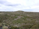
Nearby Images from Flickr

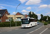
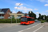
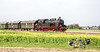
The above images may not be of the site on this page, but were taken nearby. They are loaded from Flickr so please click on them for image credits.
Click here to see more info for this site
Nearby sites
Click here to view sites on an interactive map of the areaKey: Red: member's photo, Blue: 3rd party photo, Yellow: other image, Green: no photo - please go there and take one, Grey: site destroyed
Download sites to:
KML (Google Earth)
GPX (GPS waypoints)
CSV (Garmin/Navman)
CSV (Excel)
To unlock full downloads you need to sign up as a Contributory Member. Otherwise downloads are limited to 50 sites.
Turn off the page maps and other distractions
Nearby sites listing. In the following links * = Image available
7.7km WNW 284° Findlingsgruppe Ludgeristraße* Modern Stone Circle etc
7.7km WNW 285° Ludgerusbrunnen* Holy Well or Sacred Spring
11.2km SSW 192° Großsteingrab Buldern Chambered Tomb
11.3km WSW 254° Wodanstein Gerleve Natural Stone / Erratic / Other Natural Feature
13.1km ESE 105° Mecklenbeck Huegelgrab Round Barrow(s)
14.4km E 91° Summstein Münster* Modern Stone Circle etc
14.5km E 80° Gräberfeld Gittrup Barrow Cemetery
15.0km ENE 75° Heimatmuseum in Kinderhaus* Museum
15.4km E 91° Archäologisches Museum Münster* Museum
17.0km SW 224° Grabhügelfeld Dülmen-Welte* Barrow Cemetery
17.3km WSW 247° Grabhügelgruppe, Mkz. 4009,5 a, b c* Barrow Cemetery
18.6km WSW 251° Grabhügel, Mkz. 4008,39 Round Barrow(s)
18.8km WSW 252° Grabhügel, Mkz. 4008,33* Round Barrow(s)
19.2km W 260° Monenberg, Mkz. 4008,38* Round Barrow(s)
19.3km WNW 285° Holtwicker Ei* Natural Stone / Erratic / Other Natural Feature
19.5km WSW 250° Grabhügel, Mkz. 4008, 3* Round Barrow(s)
19.7km WSW 256° Grabhügel Flamschen* Round Barrow(s)
20.0km WSW 241° Grabhügel, Mkz. 4108,16 und 4108,17 Round Barrow(s)
20.0km WSW 249° Grabhügel, Mkz. 4008,30 und 4008,31 Round Barrow(s)
21.1km WSW 240° Grabhügel, Mkz. 4108,39* Round Barrow(s)
21.9km ENE 78° Gräberfeld Münster-Handorf Barrow Cemetery
23.3km NE 39° Sachsenhof Greven-Pentrup* Museum
24.5km SSW 205° Opferstein Borkenberge* Rock Outcrop
24.7km S 176° Lüdinghausen Iron Age Glue Factory Ancient Mine, Quarry or other Industry
25.1km NW 308° Funnelbeaker Culture Cemetery Heek Barrow Cemetery
View more nearby sites and additional images


 We would like to know more about this location. Please feel free to add a brief description and any relevant information in your own language.
 Wir möchten mehr über diese Stätte erfahren. Bitte zögern Sie nicht, eine kurze Beschreibung und relevante Informationen in Deutsch hinzuzufügen.
 Nous aimerions en savoir encore un peu sur les lieux. S'il vous plaît n'hesitez pas à ajouter une courte description et tous les renseignements pertinents dans votre propre langue.
 Quisieramos informarnos un poco más de las lugares. No dude en añadir una breve descripción y otros datos relevantes en su propio idioma.