


<< Our Photo Pages >> Kaffihaugen-Ospehaugen - Round Barrow(s) in Norway in Sogn og Fjordane
Submitted by kenntha88 on Wednesday, 03 November 2021 Page Views: 334
Neolithic and Bronze AgeSite Name: Kaffihaugen-OspehaugenCountry: Norway
NOTE: This site is 8.176 km away from the location you searched for.
Fylke: Sogn og Fjordane Type: Round Barrow(s)
Nearest Village: Aurlandsvangen
Latitude: 60.902157N Longitude: 7.204874E
Condition:
| 5 | Perfect |
| 4 | Almost Perfect |
| 3 | Reasonable but with some damage |
| 2 | Ruined but still recognisable as an ancient site |
| 1 | Pretty much destroyed, possibly visible as crop marks |
| 0 | No data. |
| -1 | Completely destroyed |
| 5 | Superb |
| 4 | Good |
| 3 | Ordinary |
| 2 | Not Good |
| 1 | Awful |
| 0 | No data. |
| 5 | Can be driven to, probably with disabled access |
| 4 | Short walk on a footpath |
| 3 | Requiring a bit more of a walk |
| 2 | A long walk |
| 1 | In the middle of nowhere, a nightmare to find |
| 0 | No data. |
| 5 | co-ordinates taken by GPS or official recorded co-ordinates |
| 4 | co-ordinates scaled from a detailed map |
| 3 | co-ordinates scaled from a bad map |
| 2 | co-ordinates of the nearest village |
| 1 | co-ordinates of the nearest town |
| 0 | no data |
Internal Links:
External Links:
")
In the beautiful small village of Aurlandsvangen have several round barrows, these two are the ones most to the east. They consists of two beautiful and monumental round barrows. They are both in a grassy field just close to some modern houses.
The largest barrow is called "Kaffihaugen" or "The coffe barrow" for some reason. It is 30 metres in diameter and 4 metres in height. It is overgrown only with short grass and some few larger trees. It is easily visible in the terrain. A footpath passes just next to the barrow. The barrow was excavated in 1830 and a stone coffin consisting of large slabs of rocks were found but it was no findings inside the coffin and the barrow was restored afterwards. Both barrows are just next to the small road passing trough the field.
The slightly smaller barrow is called "Ospehaugen". It is 20 metres in diameter and 2,5 metres in height. It is also overgrown only with short vegetation and some larger trees and is easily visible. Kulturminnesøk mention it was a third barrow around 17 metres in diameter and 2 metres in height that was excavated and never restored but no findings are known.
You may be viewing yesterday's version of this page. To see the most up to date information please register for a free account.
")
")
Do not use the above information on other web sites or publications without permission of the contributor.
Nearby Images from Flickr
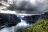
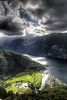


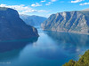
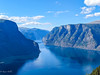
The above images may not be of the site on this page, but were taken nearby. They are loaded from Flickr so please click on them for image credits.
Click here to see more info for this site
Nearby sites
Click here to view sites on an interactive map of the areaKey: Red: member's photo, Blue: 3rd party photo, Yellow: other image, Green: no photo - please go there and take one, Grey: site destroyed
Download sites to:
KML (Google Earth)
GPX (GPS waypoints)
CSV (Garmin/Navman)
CSV (Excel)
To unlock full downloads you need to sign up as a Contributory Member. Otherwise downloads are limited to 50 sites.
Turn off the page maps and other distractions
Nearby sites listing. In the following links * = Image available
242m NW 317° Skuleveien* Round Barrow(s)
316m WNW 296° Sogn Hagebruksskule* Round Barrow(s)
869m WNW 281° Leikarvollen* Round Barrow(s)
7.4km SW 223° Flåmdalsvegen* Cist
7.5km SW 222° Lunden i Flåm* Standing Stone (Menhir)
7.7km SW 217° Flåmselvi* Standing Stones
24.1km NE 46° Mosvegen* Cairn
27.4km NE 54° Øvre Ljøsne* Barrow Cemetery
27.7km NE 54° Ljøsne-Øst Cairn* Cairn
30.5km NE 56° Bjørkum* Ancient Village or Settlement
31.0km WSW 251° Lundahovden* Round Barrow(s)
31.2km N 6° Amla Runestone* Carving
32.0km WSW 251° Tinghaugane* Round Barrow(s)
33.9km N 359° Nordnes standing stone* Standing Stone (Menhir)
34.5km ENE 62° Nedre Kvame Gravfelt* Barrow Cemetery
36.5km N 351° Stedje Runestone* Carving
37.2km NNW 329° Henjavegen-Krosshaug* Round Barrow(s)
37.4km NNW 328° Nybø* Standing Stone (Menhir)
37.4km NNW 329° Henjahaugane* Barrow Cemetery
38.1km NW 326° Baldershagen* Barrow Cemetery
38.2km NW 326° Balder's Rock* Standing Stone (Menhir)
38.3km NW 325° Hamre* Standing Stone (Menhir)
38.3km NNW 348° Eggja Runestone* Carving
38.9km WNW 300° Moahaugane* Barrow Cemetery
39.2km NE 35° Hovland* Barrow Cemetery
View more nearby sites and additional images


 We would like to know more about this location. Please feel free to add a brief description and any relevant information in your own language.
 Wir möchten mehr über diese Stätte erfahren. Bitte zögern Sie nicht, eine kurze Beschreibung und relevante Informationen in Deutsch hinzuzufügen.
 Nous aimerions en savoir encore un peu sur les lieux. S'il vous plaît n'hesitez pas à ajouter une courte description et tous les renseignements pertinents dans votre propre langue.
 Quisieramos informarnos un poco más de las lugares. No dude en añadir una breve descripción y otros datos relevantes en su propio idioma.