


<< Our Photo Pages >> Altburg Weiersbach - Hillfort in Germany in Rhineland-Palatinate
Submitted by KaiHofmann on Sunday, 30 June 2019 Page Views: 3181
Iron Age and Later PrehistorySite Name: Altburg WeiersbachCountry: Germany Land: Rhineland-Palatinate Type: Hillfort
Nearest Town: Birkenfeld Nearest Village: Heimbach
Latitude: 49.611155N Longitude: 7.218079E
Condition:
| 5 | Perfect |
| 4 | Almost Perfect |
| 3 | Reasonable but with some damage |
| 2 | Ruined but still recognisable as an ancient site |
| 1 | Pretty much destroyed, possibly visible as crop marks |
| 0 | No data. |
| -1 | Completely destroyed |
| 5 | Superb |
| 4 | Good |
| 3 | Ordinary |
| 2 | Not Good |
| 1 | Awful |
| 0 | No data. |
| 5 | Can be driven to, probably with disabled access |
| 4 | Short walk on a footpath |
| 3 | Requiring a bit more of a walk |
| 2 | A long walk |
| 1 | In the middle of nowhere, a nightmare to find |
| 0 | No data. |
| 5 | co-ordinates taken by GPS or official recorded co-ordinates |
| 4 | co-ordinates scaled from a detailed map |
| 3 | co-ordinates scaled from a bad map |
| 2 | co-ordinates of the nearest village |
| 1 | co-ordinates of the nearest town |
| 0 | no data |
Internal Links:
External Links:
I have visited· I would like to visit
ELindey visited on 18th Jun 2019 - their rating: Cond: 2 Amb: 4 Access: 3 A great little hilltop fort with noticeable stone fortifications. A modern built Celtic Zodiac circle
")
You may be viewing yesterday's version of this page. To see the most up to date information please register for a free account.
")
")
Do not use the above information on other web sites or publications without permission of the contributor.
Nearby Images from Flickr
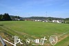
The above images may not be of the site on this page, but were taken nearby. They are loaded from Flickr so please click on them for image credits.
Click here to see more info for this site
Nearby sites
Click here to view sites on an interactive map of the areaKey: Red: member's photo, Blue: 3rd party photo, Yellow: other image, Green: no photo - please go there and take one, Grey: site destroyed
Download sites to:
KML (Google Earth)
GPX (GPS waypoints)
CSV (Garmin/Navman)
CSV (Excel)
To unlock full downloads you need to sign up as a Contributory Member. Otherwise downloads are limited to 50 sites.
Turn off the page maps and other distractions
Nearby sites listing. In the following links * = Image available
3.5km W 267° Hasselt Graeberfeld* Barrow Cemetery
4.4km SW 227° Messerbrunnen* Holy Well or Sacred Spring
9.5km SSE 151° Schwarzerden Mithrasrelief* Ancient Temple
9.6km SW 233° Hinkelstein Walhausen* Standing Stone (Menhir)
11.3km E 97° Wildfrauenhoehle Baumholder Cave or Rock Shelter
12.5km SW 222° Der Gutenbrunnen* Holy Well or Sacred Spring
13.0km SW 224° Guedesweiler Wildfrauenhoehle* Cave or Rock Shelter
13.2km WSW 258° Huegelgraeberfeld Priesberg Barrow Cemetery
13.5km SSW 202° Wendalinushöhle* Cave or Rock Shelter
14.4km SSW 196° Strasse der Skulpturen* Modern Stone Circle etc
15.2km W 275° Otzenhausen Quelle* Holy Well or Sacred Spring
15.3km SW 228° Mommerich Huenenwall* Hillfort
15.4km W 275° Hunnenring* Hillfort
15.6km NW 316° Sigfrieds Quelle Erbeskopf Holy Well or Sacred Spring
15.6km N 356° Allenbach Ringkopf Hillfort
15.7km WSW 254° Grindborn* Holy Well or Sacred Spring
16.2km SW 214° Augenborn* Holy Well or Sacred Spring
16.5km N 2° Kirschweiler Festung Hillfort
16.6km SW 231° Tholey Fuchshuebel* Round Barrow(s)
17.1km NW 326° Summstein Erbeskopf Modern Stone Circle etc
17.4km SW 222° Wareswald* Ancient Village or Settlement
18.5km N 9° Wildenburg Hillfort
19.1km SSW 195° Spiemont Hillfort
19.4km SW 224° Storchenstein* Standing Stone (Menhir)
19.8km NE 38° Keltenburg Fischbach Hillfort
View more nearby sites and additional images


 We would like to know more about this location. Please feel free to add a brief description and any relevant information in your own language.
 Wir möchten mehr über diese Stätte erfahren. Bitte zögern Sie nicht, eine kurze Beschreibung und relevante Informationen in Deutsch hinzuzufügen.
 Nous aimerions en savoir encore un peu sur les lieux. S'il vous plaît n'hesitez pas à ajouter une courte description et tous les renseignements pertinents dans votre propre langue.
 Quisieramos informarnos un poco más de las lugares. No dude en añadir una breve descripción y otros datos relevantes en su propio idioma.