


<< Our Photo Pages >> Nordnes standing stone - Standing Stone (Menhir) in Norway in Sogn og Fjordane
Submitted by kenntha88 on Thursday, 14 September 2017 Page Views: 1073
Neolithic and Bronze AgeSite Name: Nordnes standing stoneCountry: Norway
NOTE: This site is 6.084 km away from the location you searched for.
Fylke: Sogn og Fjordane Type: Standing Stone (Menhir)
Nearest Town: Sogndal
Latitude: 61.206810N Longitude: 7.190734E
Condition:
| 5 | Perfect |
| 4 | Almost Perfect |
| 3 | Reasonable but with some damage |
| 2 | Ruined but still recognisable as an ancient site |
| 1 | Pretty much destroyed, possibly visible as crop marks |
| 0 | No data. |
| -1 | Completely destroyed |
| 5 | Superb |
| 4 | Good |
| 3 | Ordinary |
| 2 | Not Good |
| 1 | Awful |
| 0 | No data. |
| 5 | Can be driven to, probably with disabled access |
| 4 | Short walk on a footpath |
| 3 | Requiring a bit more of a walk |
| 2 | A long walk |
| 1 | In the middle of nowhere, a nightmare to find |
| 0 | No data. |
| 5 | co-ordinates taken by GPS or official recorded co-ordinates |
| 4 | co-ordinates scaled from a detailed map |
| 3 | co-ordinates scaled from a bad map |
| 2 | co-ordinates of the nearest village |
| 1 | co-ordinates of the nearest town |
| 0 | no data |
Internal Links:
External Links:
")
This is what remains of a standing stone that once was located on Nordnes Sogndal. Several paintings and drawings of the original stone is well known, though it was taken down and used in a wall and cut in three parts. The top part was moved and placed outside the Sogn folk museum.
The sad remains of the once very tall stone are around 50cm in height and have a rounded top, it is fixed to the ground with concrete.
You may be viewing yesterday's version of this page. To see the most up to date information please register for a free account.
")
")
Do not use the above information on other web sites or publications without permission of the contributor.
Nearby Images from Flickr
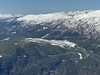
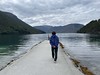
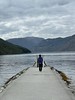
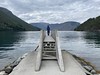
The above images may not be of the site on this page, but were taken nearby. They are loaded from Flickr so please click on them for image credits.
Click here to see more info for this site
Nearby sites
Click here to view sites on an interactive map of the areaKey: Red: member's photo, Blue: 3rd party photo, Yellow: other image, Green: no photo - please go there and take one, Grey: site destroyed
Download sites to:
KML (Google Earth)
GPX (GPS waypoints)
CSV (Garmin/Navman)
CSV (Excel)
To unlock full downloads you need to sign up as a Contributory Member. Otherwise downloads are limited to 50 sites.
Turn off the page maps and other distractions
Nearby sites listing. In the following links * = Image available
5.0km SE 125° Amla Runestone* Carving
5.4km WNW 294° Stedje Runestone* Carving
8.2km WNW 296° Eggja Runestone* Carving
10.7km NNE 11° Borhaug* Standing Stone (Menhir)
12.0km NNE 33° Ragnvaldshaug* Round Barrow(s)
12.3km NNE 33° Urnes Standing Stone* Standing Stone (Menhir)
18.5km W 264° Henjavegen-Krosshaug* Round Barrow(s)
18.6km W 264° Henjahaugane* Barrow Cemetery
19.2km W 263° Nybø* Standing Stone (Menhir)
20.8km W 263° Baldershagen* Barrow Cemetery
20.8km W 264° Balder's Rock* Standing Stone (Menhir)
21.4km W 263° Hamre* Standing Stone (Menhir)
23.2km E 93° Skjorahaugen* Barrow Cemetery
23.4km E 94° Homannhaugen* Cairn
23.5km E 95° Hovland* Barrow Cemetery
25.0km SE 134° Mosvegen* Cairn
28.9km SE 128° Øvre Ljøsne* Barrow Cemetery
29.1km SE 127° Ljøsne-Øst Cairn* Cairn
30.9km ESE 123° Bjørkum* Ancient Village or Settlement
33.6km W 272° Veganeset* Cairn
33.7km S 180° Leikarvollen* Round Barrow(s)
33.7km S 179° Skuleveien* Round Barrow(s)
33.7km S 179° Sogn Hagebruksskule* Round Barrow(s)
33.9km S 179° Kaffihaugen-Ospehaugen* Round Barrow(s)
35.2km W 270° Balestrand barrows* Round Barrow(s)
View more nearby sites and additional images


 We would like to know more about this location. Please feel free to add a brief description and any relevant information in your own language.
 Wir möchten mehr über diese Stätte erfahren. Bitte zögern Sie nicht, eine kurze Beschreibung und relevante Informationen in Deutsch hinzuzufügen.
 Nous aimerions en savoir encore un peu sur les lieux. S'il vous plaît n'hesitez pas à ajouter une courte description et tous les renseignements pertinents dans votre propre langue.
 Quisieramos informarnos un poco más de las lugares. No dude en añadir una breve descripción y otros datos relevantes en su propio idioma.