


<< Text Pages >> Grotte du Clos - Cave or Rock Shelter in France in Provence:Alpes-Maritimes (06)
Submitted by AlexHunger on Tuesday, 07 June 2005 Page Views: 2319
Natural PlacesSite Name: Grotte du ClosCountry: France
NOTE: This site is 3.65 km away from the location you searched for.
Département: Provence:Alpes-Maritimes (06) Type: Cave or Rock Shelter
Nearest Town: Nice Nearest Village: Roquefort-le-Pins
Latitude: 43.653820N Longitude: 7.065730E
Condition:
| 5 | Perfect |
| 4 | Almost Perfect |
| 3 | Reasonable but with some damage |
| 2 | Ruined but still recognisable as an ancient site |
| 1 | Pretty much destroyed, possibly visible as crop marks |
| 0 | No data. |
| -1 | Completely destroyed |
| 5 | Superb |
| 4 | Good |
| 3 | Ordinary |
| 2 | Not Good |
| 1 | Awful |
| 0 | No data. |
| 5 | Can be driven to, probably with disabled access |
| 4 | Short walk on a footpath |
| 3 | Requiring a bit more of a walk |
| 2 | A long walk |
| 1 | In the middle of nowhere, a nightmare to find |
| 0 | No data. |
| 5 | co-ordinates taken by GPS or official recorded co-ordinates |
| 4 | co-ordinates scaled from a detailed map |
| 3 | co-ordinates scaled from a bad map |
| 2 | co-ordinates of the nearest village |
| 1 | co-ordinates of the nearest town |
| 0 | no data |
Be the first person to rate this site - see the 'Contribute!' box in the right hand menu.
Internal Links:
External Links:
Cave in Alpes Maritime
IMPORTANT NOTE: Site believed to be near this position. Bronze Age Cave in South of town
You may be viewing yesterday's version of this page. To see the most up to date information please register for a free account.
Do not use the above information on other web sites or publications without permission of the contributor.
Nearby Images from Flickr
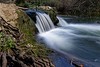
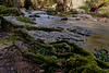
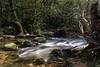
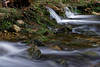
The above images may not be of the site on this page, but were taken nearby. They are loaded from Flickr so please click on them for image credits.
Click here to see more info for this site
Nearby sites
Click here to view sites on an interactive map of the areaKey: Red: member's photo, Blue: 3rd party photo, Yellow: other image, Green: no photo - please go there and take one, Grey: site destroyed
Download sites to:
KML (Google Earth)
GPX (GPS waypoints)
CSV (Garmin/Navman)
CSV (Excel)
To unlock full downloads you need to sign up as a Contributory Member. Otherwise downloads are limited to 50 sites.
Turn off the page maps and other distractions
Nearby sites listing. In the following links * = Image available
3.5km NNE 31° Grotte Bianchi Cave or Rock Shelter
4.0km WNW 295° Dolmen de Clamarquier Burial Chamber or Dolmen
4.1km W 262° Aven de la Mort Lambert Court Tomb
4.5km SSW 195° Solstice Sundial* Modern Stone Circle etc
4.8km NW 319° Dolmen des Peyraoutes* Burial Chamber or Dolmen
6.0km WNW 298° Le Castellaras Burial Chamber or Dolmen
6.2km N 351° Baume Obscure Grotte Sepulcrale Cave or Rock Shelter
6.4km ENE 60° Saint-Veran Grotte Cave or Rock Shelter
6.7km N 7° Grotte Sepulcrale de L'Aigle Cave or Rock Shelter
7.3km S 183° Font de Cine Court Tomb
7.6km WNW 286° La pierre Haute Dolmen Burial Chamber or Dolmen
8.1km SW 224° Aven des Breguieres Cave or Rock Shelter
8.8km W 268° Tumulus de Saint-Christophe Artificial Mound
8.8km N 355° Le Caire Tumulus Artificial Mound
9.0km NW 308° Grotte de la Saree Cave or Rock Shelter
9.2km NNW 327° Dolmen de Cantracier Burial Chamber or Dolmen
9.4km NNE 14° Grotte Sepulcrale Chabert Cave or Rock Shelter
9.5km NW 310° Grotte du Revest Cave or Rock Shelter
9.6km NNE 21° Grotte Sepulcrale Des Perles Cave or Rock Shelter
9.6km NNE 23° Tumuli du Plan des Noves Artificial Mound
10.0km NW 304° Tumulus de la Saree Artificial Mound
10.2km NNE 24° Grotte Sepulcrale de L'Ibis Cave or Rock Shelter
10.6km NNE 17° Grotte Sepulcrale du Fenestron Cave or Rock Shelter
10.8km NNE 20° Dolmen des Blaquières Burial Chamber or Dolmen
11.6km W 272° The Museum of Provençal Art and History Museum
View more nearby sites and additional images


 We would like to know more about this location. Please feel free to add a brief description and any relevant information in your own language.
 Wir möchten mehr über diese Stätte erfahren. Bitte zögern Sie nicht, eine kurze Beschreibung und relevante Informationen in Deutsch hinzuzufügen.
 Nous aimerions en savoir encore un peu sur les lieux. S'il vous plaît n'hesitez pas à ajouter une courte description et tous les renseignements pertinents dans votre propre langue.
 Quisieramos informarnos un poco más de las lugares. No dude en añadir una breve descripción y otros datos relevantes en su propio idioma.