


<< Our Photo Pages >> Uhrenstein Monzelfeld - Standing Stone (Menhir) in Germany in Rhineland-Palatinate
Submitted by Klingon on Wednesday, 27 April 2005 Page Views: 4953
Neolithic and Bronze AgeSite Name: Uhrenstein MonzelfeldCountry: Germany
NOTE: This site is 2.265 km away from the location you searched for.
Land: Rhineland-Palatinate Type: Standing Stone (Menhir)
Nearest Town: Monzelfeld
Latitude: 49.896903N Longitude: 7.079970E
Condition:
| 5 | Perfect |
| 4 | Almost Perfect |
| 3 | Reasonable but with some damage |
| 2 | Ruined but still recognisable as an ancient site |
| 1 | Pretty much destroyed, possibly visible as crop marks |
| 0 | No data. |
| -1 | Completely destroyed |
| 5 | Superb |
| 4 | Good |
| 3 | Ordinary |
| 2 | Not Good |
| 1 | Awful |
| 0 | No data. |
| 5 | Can be driven to, probably with disabled access |
| 4 | Short walk on a footpath |
| 3 | Requiring a bit more of a walk |
| 2 | A long walk |
| 1 | In the middle of nowhere, a nightmare to find |
| 0 | No data. |
| 5 | co-ordinates taken by GPS or official recorded co-ordinates |
| 4 | co-ordinates scaled from a detailed map |
| 3 | co-ordinates scaled from a bad map |
| 2 | co-ordinates of the nearest village |
| 1 | co-ordinates of the nearest town |
| 0 | no data |
Internal Links:
External Links:
I have visited· I would like to visit
SolarMegalith would like to visit
")
You may be viewing yesterday's version of this page. To see the most up to date information please register for a free account.
")
")
Do not use the above information on other web sites or publications without permission of the contributor.
Nearby Images from Flickr

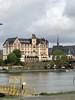
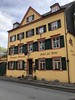
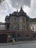
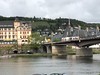
The above images may not be of the site on this page, but were taken nearby. They are loaded from Flickr so please click on them for image credits.
Click here to see more info for this site
Nearby sites
Click here to view sites on an interactive map of the areaKey: Red: member's photo, Blue: 3rd party photo, Yellow: other image, Green: no photo - please go there and take one, Grey: site destroyed
Download sites to:
KML (Google Earth)
GPX (GPS waypoints)
CSV (Garmin/Navman)
CSV (Excel)
To unlock full downloads you need to sign up as a Contributory Member. Otherwise downloads are limited to 50 sites.
Turn off the page maps and other distractions
Nearby sites listing. In the following links * = Image available
2.7km NE 39° Longkamp Steine* Standing Stone (Menhir)
3.9km NE 39° Wildstein Natural Stone / Erratic / Other Natural Feature
4.1km ENE 59° Pferdekopf* Natural Stone / Erratic / Other Natural Feature
4.6km E 97° Bildstein Pilmeroth/Wederath Natural Stone / Erratic / Other Natural Feature
4.8km SE 129° Hügelgraber Kommen Round Barrow(s)
5.2km S 177° Heidenpuetz Holy Well or Sacred Spring
5.9km S 184° Judenkirchhof Elzerath* Multiple Stone Rows / Avenue
6.0km SSE 168° Graue Ley* Natural Stone / Erratic / Other Natural Feature
6.0km WSW 245° Wendelstein Natural Stone / Erratic / Other Natural Feature
6.2km SE 132° Wederath Grabhügel II Round Barrow(s)
6.4km SE 132° Wederath Grabhügel I Round Barrow(s)
6.6km NNE 26° Rote Göttin vom Mont Royal* Standing Stone (Menhir)
6.8km SW 226° Hahnenkopf Kieselfindlinge* Stone Circle
6.9km SE 133° Römergrab Wederath Round Barrow(s)
6.9km NE 42° Campsteine* Standing Stones
6.9km NE 42° Roemerstrasse Campsteine Ancient Trackway
7.0km SE 146° Gonzerath Hügelgräber Round Barrow(s)
7.1km SW 231° Hahnenkopf Grabhuegelgruppe Barrow Cemetery
8.0km ESE 119° Menhir am Archäologiepark Belginum* Standing Stone (Menhir)
8.0km ESE 119° Menhirgruppe am Archäologiepark Belginum* Standing Stones
8.1km ESE 117° Wederath Hügelgräber III Round Barrow(s)
8.8km ESE 107° Grabhügelgruppe Hochscheid Barrow Cemetery
9.2km W 260° Menhir von Wintrich* Standing Stone (Menhir)
9.5km S 191° Merscheid Römergrab Artificial Mound
9.5km SW 216° Horath Hügelgräber II Barrow Cemetery
View more nearby sites and additional images


 We would like to know more about this location. Please feel free to add a brief description and any relevant information in your own language.
 Wir möchten mehr über diese Stätte erfahren. Bitte zögern Sie nicht, eine kurze Beschreibung und relevante Informationen in Deutsch hinzuzufügen.
 Nous aimerions en savoir encore un peu sur les lieux. S'il vous plaît n'hesitez pas à ajouter une courte description et tous les renseignements pertinents dans votre propre langue.
 Quisieramos informarnos un poco más de las lugares. No dude en añadir una breve descripción y otros datos relevantes en su propio idioma.