


<< Our Photo Pages >> Summstein Herminghauspark - Modern Stone Circle etc in Germany in North Rhine-Westphalia
Submitted by Harald_Platta on Sunday, 13 August 2017 Page Views: 950
Modern SitesSite Name: Summstein HerminghausparkCountry: Germany Land: North Rhine-Westphalia Type: Modern Stone Circle etc
Nearest Town: Velbert
Latitude: 51.338910N Longitude: 7.034287E
Condition:
| 5 | Perfect |
| 4 | Almost Perfect |
| 3 | Reasonable but with some damage |
| 2 | Ruined but still recognisable as an ancient site |
| 1 | Pretty much destroyed, possibly visible as crop marks |
| 0 | No data. |
| -1 | Completely destroyed |
| 5 | Superb |
| 4 | Good |
| 3 | Ordinary |
| 2 | Not Good |
| 1 | Awful |
| 0 | No data. |
| 5 | Can be driven to, probably with disabled access |
| 4 | Short walk on a footpath |
| 3 | Requiring a bit more of a walk |
| 2 | A long walk |
| 1 | In the middle of nowhere, a nightmare to find |
| 0 | No data. |
| 5 | co-ordinates taken by GPS or official recorded co-ordinates |
| 4 | co-ordinates scaled from a detailed map |
| 3 | co-ordinates scaled from a bad map |
| 2 | co-ordinates of the nearest village |
| 1 | co-ordinates of the nearest town |
| 0 | no data |
Internal Links:
External Links:
I have visited· I would like to visit
Harald_Platta visited on 7th Feb 2018 - their rating: Cond: 5 Amb: 3 Access: 4
")
Further information and literature on Summsteine in general: MP page Großer Summstein.
Link:
Homepage Herminghauspark
You may be viewing yesterday's version of this page. To see the most up to date information please register for a free account.
")
Do not use the above information on other web sites or publications without permission of the contributor.
Nearby Images from Flickr
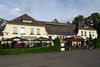


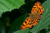
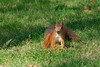
The above images may not be of the site on this page, but were taken nearby. They are loaded from Flickr so please click on them for image credits.
Click here to see more info for this site
Nearby sites
Click here to view sites on an interactive map of the areaKey: Red: member's photo, Blue: 3rd party photo, Yellow: other image, Green: no photo - please go there and take one, Grey: site destroyed
Download sites to:
KML (Google Earth)
GPX (GPS waypoints)
CSV (Garmin/Navman)
CSV (Excel)
To unlock full downloads you need to sign up as a Contributory Member. Otherwise downloads are limited to 50 sites.
Turn off the page maps and other distractions
Nearby sites listing. In the following links * = Image available
4.8km NNW 328° Alteburg (Essen)* Hillfort
5.3km NNW 337° Herrenburg (Essen)* Hillfort
5.3km NNW 338° Quellheiligtum Klemensborn* Holy Well or Sacred Spring
5.6km NNE 31° Kupferdreh Steinkiste* Cist
6.3km WNW 299° Bilstein* Rock Outcrop
6.8km NNE 29° Mineralien-Museum Essen-Kupferdreh* Museum
8.5km N 2° Summstein Schellenberg* Modern Stone Circle etc
8.8km NW 326° Galgenhügel Schuir* Artificial Mound
9.2km NW 321° Gräberfeld Lilienthalstraße* Barrow Cemetery
9.3km NE 51° Heiliger Spring (Hattingen)* Holy Well or Sacred Spring
9.8km ENE 56° Isenberg Höhlung* Cave or Rock Shelter
9.9km NE 50° Heidenstein (Hattingen)* Natural Stone / Erratic / Other Natural Feature
10.1km NW 323° Dellberg* Artificial Mound
11.3km ENE 74° Wodantalquelle* Holy Well or Sacred Spring
11.6km NW 311° Summstein Holthausen* Modern Stone Circle etc
11.8km SE 138° Rommelspütt Holy Well or Sacred Spring
11.8km SE 142° Fuhlrott-Museum* Museum
11.8km NNE 29° Ruhrkämpfer-Denkmal* Modern Stone Circle etc
11.9km NE 45° Grotenberg* Rock Outcrop
11.9km NNE 29° Vryburg* Hillfort
12.1km ENE 57° Horkenstein* Rock Art
12.7km SE 132° Steinsetzung Hünefeld* Modern Stone Circle etc
12.8km ENE 61° Augenquelle* Holy Well or Sacred Spring
13.0km NE 39° Krampenstein* Natural Stone / Erratic / Other Natural Feature
13.2km SE 126° Hohenstein (Wuppertal)* Rock Outcrop
View more nearby sites and additional images


 We would like to know more about this location. Please feel free to add a brief description and any relevant information in your own language.
 Wir möchten mehr über diese Stätte erfahren. Bitte zögern Sie nicht, eine kurze Beschreibung und relevante Informationen in Deutsch hinzuzufügen.
 Nous aimerions en savoir encore un peu sur les lieux. S'il vous plaît n'hesitez pas à ajouter une courte description et tous les renseignements pertinents dans votre propre langue.
 Quisieramos informarnos un poco más de las lugares. No dude en añadir una breve descripción y otros datos relevantes en su propio idioma.