 with our Megalithic Portal iPhone app")


<< Our Photo Pages >> Holtwicker Ei - Natural Stone / Erratic / Other Natural Feature in Germany in North Rhine-Westphalia
Submitted by Andreas on Thursday, 25 February 2010 Page Views: 2625
Natural PlacesSite Name: Holtwicker EiCountry: Germany
NOTE: This site is 8.852 km away from the location you searched for.
Land: North Rhine-Westphalia Type: Natural Stone / Erratic / Other Natural Feature
Nearest Town: Coesfeld Nearest Village: Holtwick
Latitude: 52.011100N Longitude: 7.128060E
Condition:
| 5 | Perfect |
| 4 | Almost Perfect |
| 3 | Reasonable but with some damage |
| 2 | Ruined but still recognisable as an ancient site |
| 1 | Pretty much destroyed, possibly visible as crop marks |
| 0 | No data. |
| -1 | Completely destroyed |
| 5 | Superb |
| 4 | Good |
| 3 | Ordinary |
| 2 | Not Good |
| 1 | Awful |
| 0 | No data. |
| 5 | Can be driven to, probably with disabled access |
| 4 | Short walk on a footpath |
| 3 | Requiring a bit more of a walk |
| 2 | A long walk |
| 1 | In the middle of nowhere, a nightmare to find |
| 0 | No data. |
| 5 | co-ordinates taken by GPS or official recorded co-ordinates |
| 4 | co-ordinates scaled from a detailed map |
| 3 | co-ordinates scaled from a bad map |
| 2 | co-ordinates of the nearest village |
| 1 | co-ordinates of the nearest town |
| 0 | no data |
Internal Links:
External Links:
I have visited· I would like to visit
Andreas has visited here
")
The erratic's name ("Ei" translates as "egg") seems to refer to its irregular shape. But actually I couldn't see any resemblance to an egg.
The visible size is about 3 x 3 x 2,4 metres, and the circumference is about 10 metres.
According to older reports large parts of the stone are still hidden in the ground. So its weight just can be roughly estimated as possibly about 35 t.
As lots of erratics also the Holtwick specimen consists of granite, in this case a slightly red granite. Its geological age is about 1,4-1,5 Billion (= Milliarden) years.
Originally the stone most probably was located at southern Sweden, about 700 kilometres north of its recent localisation. But with the extending ice during the glacial Saale period (about 240000-125000 BP) the stone was progressively moved to the western Münsterland, probably about 200000 years ago.
A local legend, containing a very familar tale theme, reports that the devil tried to destroy an early medieval church at Holtwick. But there was a barrier in form of an oak forest. And due to his long journey and the stone's weight the devil was too weak and too tired to throw far enough. So the stone found its new home in a small park at Holtwick.
In the late 19th century the erratic was also known as "Bonenjägerstein". This possibly means something as "Odin the hunter's stone" (or the like). Such a name seems to indicate a cultic using. But in this case that's actually rather improbable. I suppose the locals just have derived the name from another stone (Bonenjägerstein respectively Wodanstein nearby Dülmen).
References:
K.H.Otto: Wie die Findlinge nach Westfalen kamen, in: Siedlung und Landschaft in Westfalen, vol. 35, 2007, p. 38-39
E.Speetzen: Findlinge in Nordrhein-Westfalen, in: H.G.Horn (Ed.): Neandertaler + Co., Eiszeitjägern auf der Spur- Streifzüge durch die Urgeschichte Nordrhein-Westfalens, Mainz 2006, p. 53-68
You may be viewing yesterday's version of this page. To see the most up to date information please register for a free account.
")
")
")
Do not use the above information on other web sites or publications without permission of the contributor.
Nearby Images from Flickr
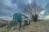
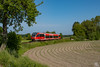
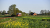

The above images may not be of the site on this page, but were taken nearby. They are loaded from Flickr so please click on them for image credits.
Click here to see more info for this site
Nearby sites
Click here to view sites on an interactive map of the areaKey: Red: member's photo, Blue: 3rd party photo, Yellow: other image, Green: no photo - please go there and take one, Grey: site destroyed
Download sites to:
KML (Google Earth)
GPX (GPS waypoints)
CSV (Garmin/Navman)
CSV (Excel)
To unlock full downloads you need to sign up as a Contributory Member. Otherwise downloads are limited to 50 sites.
Turn off the page maps and other distractions
Nearby sites listing. In the following links * = Image available
8.6km S 182° Monenberg, Mkz. 4008,38* Round Barrow(s)
10.0km S 183° Grabhügel Flamschen* Round Barrow(s)
10.5km N 353° Funnelbeaker Culture Cemetery Heek Barrow Cemetery
11.1km S 176° Grabhügel, Mkz. 4008,33* Round Barrow(s)
11.2km S 175° Grabhügel, Mkz. 4008,39 Round Barrow(s)
11.2km SE 136° Wodanstein Gerleve Natural Stone / Erratic / Other Natural Feature
11.6km ESE 105° Ludgerusbrunnen* Holy Well or Sacred Spring
11.6km ESE 106° Findlingsgruppe Ludgeristraße* Modern Stone Circle etc
11.7km S 178° Grabhügel, Mkz. 4008, 3* Round Barrow(s)
12.2km S 180° Grabhügel, Mkz. 4008,30 und 4008,31 Round Barrow(s)
12.3km SSE 167° Grabhügelgruppe, Mkz. 4009,5 a, b c* Barrow Cemetery
14.7km S 176° Grabhügel, Mkz. 4108,16 und 4108,17 Round Barrow(s)
15.8km S 179° Grabhügel, Mkz. 4108,39* Round Barrow(s)
16.6km N 351° Hunenkerckhoff Barrow Cemetery
18.6km SSE 158° Grabhügelfeld Dülmen-Welte* Barrow Cemetery
19.1km SSW 192° Reken Grabhügel 4108/10* Round Barrow(s)
19.1km SSW 193° Reken Grabhügel 4108/31* Round Barrow(s)
19.2km SSW 192° Reken Grabhügel 4108/30* Round Barrow(s)
19.2km SSW 193° Reken Grabhügel 4108/35* Round Barrow(s)
19.3km ESE 105° Arningquelle Holy Well or Sacred Spring
19.6km S 187° Großsteingrab im Sandheck* Chambered Tomb
19.8km S 189° Reken Grabhügel 4108/32* Round Barrow(s)
19.9km SW 226° Museum Burg Ramsdorf* Museum
20.1km SSW 202° Reken Grabhügelgruppe 4108/36a-j Barrow Cemetery
20.1km SSW 200° Reken Grabhügelgruppe 4108/21a-d* Barrow Cemetery
View more nearby sites and additional images


 We would like to know more about this location. Please feel free to add a brief description and any relevant information in your own language.
 Wir möchten mehr über diese Stätte erfahren. Bitte zögern Sie nicht, eine kurze Beschreibung und relevante Informationen in Deutsch hinzuzufügen.
 Nous aimerions en savoir encore un peu sur les lieux. S'il vous plaît n'hesitez pas à ajouter une courte description et tous les renseignements pertinents dans votre propre langue.
 Quisieramos informarnos un poco más de las lugares. No dude en añadir una breve descripción y otros datos relevantes en su propio idioma.