


<< Text Pages >> Menhir de Tiecs - Standing Stone (Menhir) in France in Provence:Alpes-Maritimes (06)
Submitted by KaiHofmann on Friday, 26 July 2013 Page Views: 3054
Neolithic and Bronze AgeSite Name: Menhir de TiecsCountry: France
NOTE: This site is 12.398 km away from the location you searched for.
Département: Provence:Alpes-Maritimes (06) Type: Standing Stone (Menhir)
Nearest Village: Rubion
Latitude: 44.117583N Longitude: 7.083167E
Condition:
| 5 | Perfect |
| 4 | Almost Perfect |
| 3 | Reasonable but with some damage |
| 2 | Ruined but still recognisable as an ancient site |
| 1 | Pretty much destroyed, possibly visible as crop marks |
| 0 | No data. |
| -1 | Completely destroyed |
| 5 | Superb |
| 4 | Good |
| 3 | Ordinary |
| 2 | Not Good |
| 1 | Awful |
| 0 | No data. |
| 5 | Can be driven to, probably with disabled access |
| 4 | Short walk on a footpath |
| 3 | Requiring a bit more of a walk |
| 2 | A long walk |
| 1 | In the middle of nowhere, a nightmare to find |
| 0 | No data. |
| 5 | co-ordinates taken by GPS or official recorded co-ordinates |
| 4 | co-ordinates scaled from a detailed map |
| 3 | co-ordinates scaled from a bad map |
| 2 | co-ordinates of the nearest village |
| 1 | co-ordinates of the nearest town |
| 0 | no data |
Be the first person to rate this site - see the 'Contribute!' box in the right hand menu.
Internal Links:
External Links:
Standing Stone (Menhir) in Provence:Alpes-Maritimes (06)
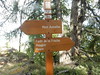
Standing stone close to the Chapelle Sainte-Anne.
You may be viewing yesterday's version of this page. To see the most up to date information please register for a free account.
Do not use the above information on other web sites or publications without permission of the contributor.
Nearby Images from Flickr
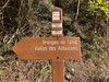
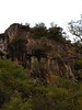
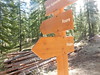

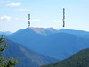
The above images may not be of the site on this page, but were taken nearby. They are loaded from Flickr so please click on them for image credits.
Click here to see more info for this site
Nearby sites
Click here to view sites on an interactive map of the areaKey: Red: member's photo, Blue: 3rd party photo, Yellow: other image, Green: no photo - please go there and take one, Grey: site destroyed
Download sites to:
KML (Google Earth)
GPX (GPS waypoints)
CSV (Garmin/Navman)
CSV (Excel)
To unlock full downloads you need to sign up as a Contributory Member. Otherwise downloads are limited to 50 sites.
Turn off the page maps and other distractions
Nearby sites listing. In the following links * = Image available
25.6km WSW 248° Grotte du Chat* Cave or Rock Shelter
28.7km E 99° Gravures Rupestres de Vallée des Merveilles* Rock Art
30.5km SE 133° Peire Cava Tumulus Artificial Mound
31.1km E 95° Gravures Rupestres de Fontanalba* Rock Art
32.6km WSW 239° Saint-Benoit Grotte Cave or Rock Shelter
36.6km WSW 242° Le Chambre du Roi* Carving
36.9km SSW 196° Grotte du Bord de la Route Cave or Rock Shelter
37.5km SE 131° Albarea Grotte Sepulcrale Cave or Rock Shelter
37.5km WSW 248° Menhir d'Argenton Standing Stone (Menhir)
37.6km SSW 198° L'Avaou Cave or Rock Shelter
38.6km SSW 194° Grotte du Pourtegal Cave or Rock Shelter
40.3km S 169° Grotte de Perseguier Cave or Rock Shelter
40.8km E 94° Musée des Merveilles* Museum
41.5km S 177° Dolmen des Blaquières Burial Chamber or Dolmen
41.5km S 178° Grotte Sepulcrale du Fenestron Cave or Rock Shelter
42.3km S 176° Grotte Sepulcrale de L'Ibis Cave or Rock Shelter
42.4km S 179° Grotte Sepulcrale Chabert Cave or Rock Shelter
42.6km S 177° Grotte Sepulcrale Des Perles Cave or Rock Shelter
42.7km S 177° Tumuli du Plan des Noves Artificial Mound
42.8km S 183° Le Caire Tumulus Artificial Mound
43.7km SSW 199° Grotte de Treppasses Cave or Rock Shelter
44.0km NNE 28° Rocce Re Rock Art
44.1km SSW 201° Grotte des Morts Cave or Rock Shelter
44.3km S 188° Dolmen de Cantracier Burial Chamber or Dolmen
44.3km SSW 200° Aven Cresp Cave or Rock Shelter
View more nearby sites and additional images


 We would like to know more about this location. Please feel free to add a brief description and any relevant information in your own language.
 Wir möchten mehr über diese Stätte erfahren. Bitte zögern Sie nicht, eine kurze Beschreibung und relevante Informationen in Deutsch hinzuzufügen.
 Nous aimerions en savoir encore un peu sur les lieux. S'il vous plaît n'hesitez pas à ajouter une courte description et tous les renseignements pertinents dans votre propre langue.
 Quisieramos informarnos un poco más de las lugares. No dude en añadir una breve descripción y otros datos relevantes en su propio idioma.