


<< Our Photo Pages >> Gule - Standing Stone (Menhir) in Norway in Møre og Romsdal
Submitted by kenntha88 on Thursday, 28 August 2014 Page Views: 1260
Neolithic and Bronze AgeSite Name: GuleCountry: Norway
NOTE: This site is 7.173 km away from the location you searched for.
Fylke: Møre og Romsdal Type: Standing Stone (Menhir)
Nearest Town: Molde
Latitude: 62.899665N Longitude: 6.957983E
Condition:
| 5 | Perfect |
| 4 | Almost Perfect |
| 3 | Reasonable but with some damage |
| 2 | Ruined but still recognisable as an ancient site |
| 1 | Pretty much destroyed, possibly visible as crop marks |
| 0 | No data. |
| -1 | Completely destroyed |
| 5 | Superb |
| 4 | Good |
| 3 | Ordinary |
| 2 | Not Good |
| 1 | Awful |
| 0 | No data. |
| 5 | Can be driven to, probably with disabled access |
| 4 | Short walk on a footpath |
| 3 | Requiring a bit more of a walk |
| 2 | A long walk |
| 1 | In the middle of nowhere, a nightmare to find |
| 0 | No data. |
| 5 | co-ordinates taken by GPS or official recorded co-ordinates |
| 4 | co-ordinates scaled from a detailed map |
| 3 | co-ordinates scaled from a bad map |
| 2 | co-ordinates of the nearest village |
| 1 | co-ordinates of the nearest town |
| 0 | no data |
Internal Links:
External Links:
")
This single standing stone is the only survivor of a total of 4 standing stones. They were removed between 1880 and 1890, and the previously standing stones are only known from some written record. Probably they have been used in the construction of some of the nearby farm buildings.
The stone is about 2 metres in height and around 35cm wide and around 20cm thick. The top is straight cut-off and the stone is tilting slightly. It is located in a large grassy field and is easily visible from the road to the north, even when the stone is surrounded by taller grass.
You may be viewing yesterday's version of this page. To see the most up to date information please register for a free account.
")
")
")
Do not use the above information on other web sites or publications without permission of the contributor.
Nearby Images from Flickr
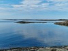
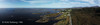
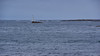
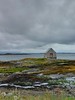
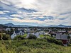
The above images may not be of the site on this page, but were taken nearby. They are loaded from Flickr so please click on them for image credits.
Click here to see more info for this site
Nearby sites
Click here to view sites on an interactive map of the areaKey: Red: member's photo, Blue: 3rd party photo, Yellow: other image, Green: no photo - please go there and take one, Grey: site destroyed
Download sites to:
KML (Google Earth)
GPX (GPS waypoints)
CSV (Garmin/Navman)
CSV (Excel)
To unlock full downloads you need to sign up as a Contributory Member. Otherwise downloads are limited to 50 sites.
Turn off the page maps and other distractions
Nearby sites listing. In the following links * = Image available
8.4km S 182° Hoksnes* Standing Stone (Menhir)
9.5km NE 40° Malefeten* Barrow Cemetery
9.6km SSE 160° Reithaugen Round Barrow(s)
12.9km SW 218° Korsbø-Smøla* Standing Stones
13.2km S 190° Prestegardsskogen* Round Barrow(s)
14.2km S 191° Tangen (Aukra)* Round Barrow(s)
14.5km NE 48° Sandvikshagen* Barrow Cemetery
21.2km NE 55° Rullesteinshaugen* Cairn
26.6km SE 135° The Troll's Arrow* Standing Stone (Menhir)
26.7km SE 134° Jutahaugen* Stone Circle
27.9km E 82° Håkonrøysa* Cairn
29.7km SSW 194° Naustvollen* Standing Stone (Menhir)
31.3km SE 137° Nesje Standing Stones* Standing Stones
33.8km ENE 63° Søfstadklubben* Rock Art
33.8km SSE 165° Kråkneset Cairns* Cairn
35.1km SE 125° Horga Pagan Altar* Sculptured Stone
37.2km SSE 152° Reiestad Standing Stone* Standing Stone (Menhir)
37.9km SSE 150° Grandan Mounds* Round Barrow(s)
40.0km SSE 150° Våge standing stone* Standing Stone (Menhir)
40.4km ENE 73° Kvernes Tingsted* Stone Circle
40.4km ENE 78° Ikornneset* Barrow Cemetery
44.9km ENE 72° Frei Standing Stones* Standing Stones
49.3km ENE 75° Aspa Standing Stones* Standing Stones
58.8km ENE 58° Linvågen* Standing Stone (Menhir)
59.0km SW 231° Blimshaugen mound* Round Barrow(s)
View more nearby sites and additional images


 We would like to know more about this location. Please feel free to add a brief description and any relevant information in your own language.
 Wir möchten mehr über diese Stätte erfahren. Bitte zögern Sie nicht, eine kurze Beschreibung und relevante Informationen in Deutsch hinzuzufügen.
 Nous aimerions en savoir encore un peu sur les lieux. S'il vous plaît n'hesitez pas à ajouter une courte description et tous les renseignements pertinents dans votre propre langue.
 Quisieramos informarnos un poco más de las lugares. No dude en añadir una breve descripción y otros datos relevantes en su propio idioma.