 with our Megalithic Portal iPhone app")

<< Our Photo Pages >> Lundahovden - Round Barrow(s) in Norway in Hordaland
Submitted by kenntha88 on Wednesday, 21 September 2022 Page Views: 253
Neolithic and Bronze AgeSite Name: LundahovdenCountry: Norway
NOTE: This site is 12.408 km away from the location you searched for.
Fylke: Hordaland Type: Round Barrow(s)
Nearest Town: Voss Nearest Village: Haugsvik
Latitude: 60.808586N Longitude: 6.665099E
Condition:
| 5 | Perfect |
| 4 | Almost Perfect |
| 3 | Reasonable but with some damage |
| 2 | Ruined but still recognisable as an ancient site |
| 1 | Pretty much destroyed, possibly visible as crop marks |
| 0 | No data. |
| -1 | Completely destroyed |
| 5 | Superb |
| 4 | Good |
| 3 | Ordinary |
| 2 | Not Good |
| 1 | Awful |
| 0 | No data. |
| 5 | Can be driven to, probably with disabled access |
| 4 | Short walk on a footpath |
| 3 | Requiring a bit more of a walk |
| 2 | A long walk |
| 1 | In the middle of nowhere, a nightmare to find |
| 0 | No data. |
| 5 | co-ordinates taken by GPS or official recorded co-ordinates |
| 4 | co-ordinates scaled from a detailed map |
| 3 | co-ordinates scaled from a bad map |
| 2 | co-ordinates of the nearest village |
| 1 | co-ordinates of the nearest town |
| 0 | no data |
Internal Links:
External Links:
")
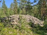
In a grazing grounds for cows just north of a small farm is a very pretty round barrow. The barrow is cleared for any vegetation except from short grass so it is easy to see from a far distance. It is located in a hill sloping down to the south.
The barrow is 25 metres in diameter and 2,5 to 3 metres in height. The barrow used to have a ditch borrowed straight trough it but this damage have later been filled in. This barrow and several others in the ara are described on a information poster at Haugsvik a little further to the west.
You may be viewing yesterday's version of this page. To see the most up to date information please register for a free account.
")
Do not use the above information on other web sites or publications without permission of the contributor.
Nearby Images from Flickr
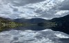
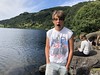
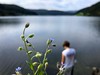
The above images may not be of the site on this page, but were taken nearby. They are loaded from Flickr so please click on them for image credits.
Click here to see more info for this site
Nearby sites
Click here to view sites on an interactive map of the areaKey: Red: member's photo, Blue: 3rd party photo, Yellow: other image, Green: no photo - please go there and take one, Grey: site destroyed
Download sites to:
KML (Google Earth)
GPX (GPS waypoints)
CSV (Garmin/Navman)
CSV (Excel)
To unlock full downloads you need to sign up as a Contributory Member. Otherwise downloads are limited to 50 sites.
Turn off the page maps and other distractions
Nearby sites listing. In the following links * = Image available
1.0km W 265° Tinghaugane* Round Barrow(s)
8.5km WSW 256° Draugsvoll* Round Barrow(s)
10.7km WSW 253° Runakollane* Cairn
15.0km SW 221° Grjotland* Barrow Cemetery
17.8km SSW 210° Reppavegen* Round Barrow(s)
19.0km SSW 201° Sledasteinen* Rock Art
20.6km SSW 207° Vetlehaugen* Round Barrow(s)
23.3km SW 214° Rogne* Round Barrow(s)
24.7km ENE 78° Flåmdalsvegen* Cist
24.7km ENE 79° Lunden i Flåm* Standing Stone (Menhir)
25.0km E 80° Flåmselvi* Standing Stones
26.5km SW 217° Ormshaugen* Round Barrow(s)
26.5km SW 217° Kvåle* Cist
27.7km SW 222° Byrkjehaugen* Round Barrow(s)
27.8km S 173° Endrehaugen* Round Barrow(s)
27.9km S 173° Bårstesteinen* Standing Stone (Menhir)
29.9km N 351° Moahaugane* Barrow Cemetery
30.3km ENE 69° Leikarvollen* Round Barrow(s)
30.6km N 351° Vik Barrows* Round Barrow(s)
30.8km ENE 70° Sogn Hagebruksskule* Round Barrow(s)
30.9km ENE 70° Skuleveien* Round Barrow(s)
31.0km ENE 70° Kaffihaugen-Ospehaugen* Round Barrow(s)
31.1km S 173° Kjerland* Round Barrow(s)
37.3km N 350° Målhaugen* Barrow Cemetery
42.2km N 9° Hamre* Standing Stone (Menhir)
View more nearby sites and additional images


 We would like to know more about this location. Please feel free to add a brief description and any relevant information in your own language.
 Wir möchten mehr über diese Stätte erfahren. Bitte zögern Sie nicht, eine kurze Beschreibung und relevante Informationen in Deutsch hinzuzufügen.
 Nous aimerions en savoir encore un peu sur les lieux. S'il vous plaît n'hesitez pas à ajouter une courte description et tous les renseignements pertinents dans votre propre langue.
 Quisieramos informarnos un poco más de las lugares. No dude en añadir una breve descripción y otros datos relevantes en su propio idioma.