


<< Text Pages >> Dolmen de Saint-Pons - Burial Chamber or Dolmen in France in Provence:Alpes-Maritimes (06)
Submitted by AlexHunger on Tuesday, 07 June 2005 Page Views: 2382
Neolithic and Bronze AgeSite Name: Dolmen de Saint-Pons Alternative Name: Tumulus de la ColletteCountry: France Département: Provence:Alpes-Maritimes (06) Type: Burial Chamber or Dolmen
Nearest Town: Nice Nearest Village: Escragnolles
Latitude: 43.731900N Longitude: 6.783330E
Condition:
| 5 | Perfect |
| 4 | Almost Perfect |
| 3 | Reasonable but with some damage |
| 2 | Ruined but still recognisable as an ancient site |
| 1 | Pretty much destroyed, possibly visible as crop marks |
| 0 | No data. |
| -1 | Completely destroyed |
| 5 | Superb |
| 4 | Good |
| 3 | Ordinary |
| 2 | Not Good |
| 1 | Awful |
| 0 | No data. |
| 5 | Can be driven to, probably with disabled access |
| 4 | Short walk on a footpath |
| 3 | Requiring a bit more of a walk |
| 2 | A long walk |
| 1 | In the middle of nowhere, a nightmare to find |
| 0 | No data. |
| 5 | co-ordinates taken by GPS or official recorded co-ordinates |
| 4 | co-ordinates scaled from a detailed map |
| 3 | co-ordinates scaled from a bad map |
| 2 | co-ordinates of the nearest village |
| 1 | co-ordinates of the nearest town |
| 0 | no data |
Be the first person to rate this site - see the 'Contribute!' box in the right hand menu.
Internal Links:
External Links:
Dolmen with Tumulus in Alpes-Maritimes
You may be viewing yesterday's version of this page. To see the most up to date information please register for a free account.
Do not use the above information on other web sites or publications without permission of the contributor.
Nearby Images from Flickr
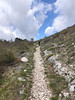
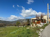
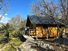

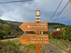
The above images may not be of the site on this page, but were taken nearby. They are loaded from Flickr so please click on them for image credits.
Click here to see more info for this site
Nearby sites
Click here to view sites on an interactive map of the areaKey: Red: member's photo, Blue: 3rd party photo, Yellow: other image, Green: no photo - please go there and take one, Grey: site destroyed
Download sites to:
KML (Google Earth)
GPX (GPS waypoints)
CSV (Garmin/Navman)
CSV (Excel)
To unlock full downloads you need to sign up as a Contributory Member. Otherwise downloads are limited to 50 sites.
Turn off the page maps and other distractions
Nearby sites listing. In the following links * = Image available
505m SE 138° Escragnolles Tumulus Round Cairn
652m SE 130° Tombe à incinération de la Collette Multiple Stone Rows / Avenue
722m SSE 163° Dolmen des Claps Burial Chamber or Dolmen
2.4km WSW 242° Dolmen de la Brainée* Burial Chamber or Dolmen
3.3km WSW 237° Dolmen de la Colle* Burial Chamber or Dolmen
4.7km N 3° Aven-des-Cranes Cave or Rock Shelter
4.8km N 6° Andon Ciste Court Tomb
4.8km N 4° Andon Tumulus No.5 Artificial Mound
4.8km N 2° Andon Tumulus No.4 Artificial Mound
4.9km N 1° Andon Tumulus No.3 Artificial Mound
4.9km N 0° Andon Tumulus No.2 Artificial Mound
5.0km N 359° Andon Tumulus No.1 Artificial Mound
5.0km SE 134° Tumulus du Caillassou Round Barrow(s)
5.2km SE 127° Tombe en Bloc du Mauvans Sud Artificial Mound
5.2km SE 134° Pseudo-Dolmen du Deffends 1 Burial Chamber or Dolmen
5.5km SE 139° Tumulus de la Croix de Cabris No.2 Artificial Mound
5.9km SE 146° Tumulus des Passages Artificial Mound
5.9km SW 231° Dolmen des Riens* Burial Chamber or Dolmen
5.9km SE 140° Tumuli de Mauvauns Artificial Mound
6.1km SSE 153° Degoutay Dolmen* Burial Chamber or Dolmen
6.1km SE 133° Tumulus de Peirachier Artificial Mound
6.2km SSE 167° Ciste des Puades Cist
6.2km SSE 166° Puades Dolmen* Burial Chamber or Dolmen
6.2km SSE 157° Mauvans Nord Dolmen Burial Chamber or Dolmen
6.4km SE 138° Tumulus de la Leque No. 2 Artificial Mound
View more nearby sites and additional images


 We would like to know more about this location. Please feel free to add a brief description and any relevant information in your own language.
 Wir möchten mehr über diese Stätte erfahren. Bitte zögern Sie nicht, eine kurze Beschreibung und relevante Informationen in Deutsch hinzuzufügen.
 Nous aimerions en savoir encore un peu sur les lieux. S'il vous plaît n'hesitez pas à ajouter une courte description et tous les renseignements pertinents dans votre propre langue.
 Quisieramos informarnos un poco más de las lugares. No dude en añadir una breve descripción y otros datos relevantes en su propio idioma.