<< Our Photo Pages >> Nöthen Heidentempel - Ancient Temple in Germany in North Rhine-Westphalia
Submitted by Andreas on Thursday, 25 April 2013 Page Views: 5856
Iron Age and Later PrehistorySite Name: Nöthen Heidentempel Alternative Name: Pesch Römischer TempelCountry: Germany
NOTE: This site is 4.858 km away from the location you searched for.
Land: North Rhine-Westphalia Type: Ancient Temple
Nearest Town: Köln Nearest Village: Pesch
Latitude: 50.533513N Longitude: 6.703003E
Condition:
| 5 | Perfect |
| 4 | Almost Perfect |
| 3 | Reasonable but with some damage |
| 2 | Ruined but still recognisable as an ancient site |
| 1 | Pretty much destroyed, possibly visible as crop marks |
| 0 | No data. |
| -1 | Completely destroyed |
| 5 | Superb |
| 4 | Good |
| 3 | Ordinary |
| 2 | Not Good |
| 1 | Awful |
| 0 | No data. |
| 5 | Can be driven to, probably with disabled access |
| 4 | Short walk on a footpath |
| 3 | Requiring a bit more of a walk |
| 2 | A long walk |
| 1 | In the middle of nowhere, a nightmare to find |
| 0 | No data. |
| 5 | co-ordinates taken by GPS or official recorded co-ordinates |
| 4 | co-ordinates scaled from a detailed map |
| 3 | co-ordinates scaled from a bad map |
| 2 | co-ordinates of the nearest village |
| 1 | co-ordinates of the nearest town |
| 0 | no data |
Internal Links:
External Links:
I have visited· I would like to visit
Janek visited on 7th May 2011 - their rating: Cond: 4 Amb: 4 Access: 4
Some early provisional excavations were made already in the late 19th century, followed by a first really scientific examination between 1913 and 1918.
During the 1st century AD, after the area became a part of roman province Germania Inferior (= "Lower G."), as a result of the integration of the Matrons and other local religious elements into the Roman realm of the gods, a cult complex of stone, containing various buildings, was built.
During the 1st century AD, after the area became a part of roman province Germania Inferior (= "Lower G."), as a result of the integration of the Matrons and other local religious elements into the Roman realm of the gods, a cult complex of stone, containing various buildings, was built.
A second phase of building activities took place (most probably) in the 2nd half of the 2nd century.
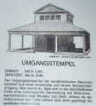
In spite of the meanwhile growing concurrence with Christianity the whole cult ensemble was considerably rebuilt about 330 AD. Its recently recognisable appearance, especially the partly reconstructed Matrons' Sanctuary, represents this last phase of the cult complex until its destruction about 120 years later.
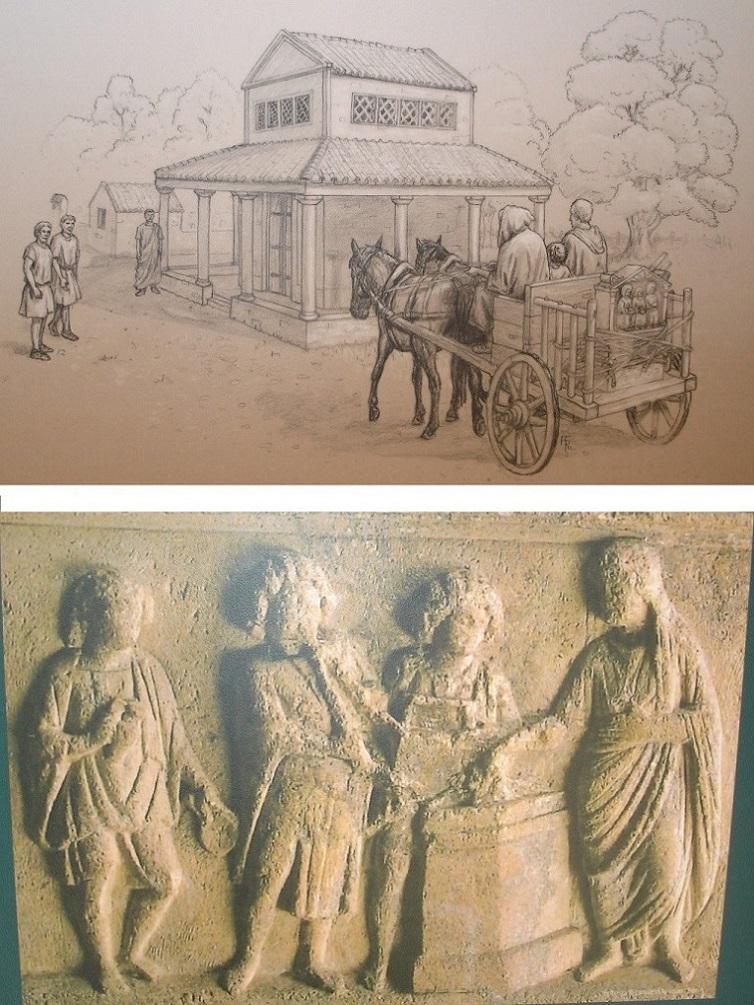
The actual Matrons' Sanctuary was built in form of a typical Gallo-Roman temple.
Its core, the "cella", contained probably a life-sized statue of the Matrons.
The name of the local Matrons ("Matronae Vacallinehae") seems to relate to a Celtic tribe named Vacalli, maybe remains of the local Eburones who could have successfully endured Caesar's attempt of a genocide during his "Gallic Wars".
However, the appearance of the depicted Matrons seems to be based on the typical female attire and style of the Germanic Ubii. This cultural combination of Celtic and Germanic elements fits the impression that the cult of the Matrons usually appears in areas with a mixed celtic-germanic population and/or culture.
Directly neighbouring, south-east of the Matrons' Sanctuary, was a large cult court, situated around the highest point of the ridge with the (probable) holy tree.
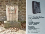
Here lots of votive stones were found. Some of these stones survived at the strangest locations, for instance in the altar of the parish church at nearby Weyer village, where the stone was discovered in 1991.
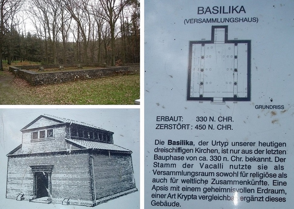
The next south-eastern neighbouring building is thought to have been a meeting house or the like, with a size of about 13,7 x 13,7 m.
Furthermore there were two other buildings, both only with weak foundations. In both cases their remains are not visible any more. The exact purpose of these buildings is unknown.
A recent hague symbolizes the position of a former covered walk (with a length of about 120 m) at the south-eastern outer wall of the cult complex.
The destruction of the whole cult complex, including the Matrons' Sanctuary, about 450 AD seems to have happened with such an aggressive consequence that a religious motivation is rather probable. At that time this kind of conflicts between followers of the older pagan religions and the Christians (since emperor Theodosius' time representing the only official state religion) was not uncommon. But that's only one possible explanation. Alternatively plundering Franks (or maybe Alemanni) could have caused the destruction of the site.
Coordinates submitted by AlexHunger in 2005.
You may be viewing yesterday's version of this page. To see the most up to date information please register for a free account.



Do not use the above information on other web sites or publications without permission of the contributor.
Click here to see more info for this site
Nearby sites
Click here to view sites on an interactive map of the areaKey: Red: member's photo, Blue: 3rd party photo, Yellow: other image, Green: no photo - please go there and take one, Grey: site destroyed
Download sites to:
KML (Google Earth)
GPX (GPS waypoints)
CSV (Garmin/Navman)
CSV (Excel)
To unlock full downloads you need to sign up as a Contributory Member. Otherwise downloads are limited to 50 sites.
Turn off the page maps and other distractions
Nearby sites listing. In the following links * = Image available
3.3km WNW 293° Kakushöhle* Cave or Rock Shelter
3.3km WNW 292° Abschnittswall am Kartstein* Hillfort
5.0km SW 226° Matronenheiligtum Zingsheim* Ancient Temple
5.7km WSW 249° Rummerschlegel* Rock Outcrop
6.2km W 262° Weyerer Wald Huegelgraeberfeld* Barrow Cemetery
7.8km N 352° Katzensteine* Cave or Rock Shelter
8.3km SW 227° Matronenheiligtum Nettersheim* Ancient Temple
8.5km SW 223° Steinrütsch bei Nettersheim* Ancient Mine, Quarry or other Industry
9.9km NW 319° Menhir aus Dottel Standing Stone (Menhir)
10.9km NE 38° Ringwall Kreuzweingarten* Hillfort
13.0km SSW 207° Grabhügel Hängebuche* Round Barrow(s)
15.7km SSW 203° Düwelskall* Cave or Rock Shelter
15.8km SSW 203° Düwelsteen Ripsdorfer Wald* Rock Outcrop
17.1km NNW 337° Chlodwig-Stele* Modern Stone Circle etc
20.4km E 96° Teufelsloch bei Altenahr* Natural Stone / Erratic / Other Natural Feature
22.1km NW 316° Steinplatte Mittelberg Rock Art
23.4km WNW 284° Heilsteinquelle* Holy Well or Sacred Spring
24.5km NNW 329° Heiliger Pütz* Holy Well or Sacred Spring
27.7km WSW 242° Weißer Stein* Natural Stone / Erratic / Other Natural Feature
30.8km S 173° Hünenstein Betteldorf* Standing Stone (Menhir)
31.5km NNE 14° Summstein Lechenich Modern Stone Circle etc
32.2km ESE 113° Schleifstein Kempenich* Polissoir
32.8km S 172° Der Spitze Stein von Hinterweiler* Standing Stone (Menhir)
33.4km SSE 168° Huegelgraeberfeld Dockweiler Wald* Barrow Cemetery
33.7km S 185° Buchenloch Hoehle* Cave or Rock Shelter
View more nearby sites and additional images




 We would like to know more about this location. Please feel free to add a brief description and any relevant information in your own language.
 Wir möchten mehr über diese Stätte erfahren. Bitte zögern Sie nicht, eine kurze Beschreibung und relevante Informationen in Deutsch hinzuzufügen.
 Nous aimerions en savoir encore un peu sur les lieux. S'il vous plaît n'hesitez pas à ajouter une courte description et tous les renseignements pertinents dans votre propre langue.
 Quisieramos informarnos un poco más de las lugares. No dude en añadir una breve descripción y otros datos relevantes en su propio idioma.