

<< Our Photo Pages >> Pierre du Chaud Costet - Natural Stone / Erratic / Other Natural Feature in France in Alsace-Lorraine:Vosges (88)
Submitted by Laumesfeld on Friday, 21 January 2022 Page Views: 433
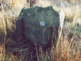
Natural PlacesSite Name: Pierre du Chaud Costet Alternative Name: Pierre CharlemagneCountry: France Département: Alsace-Lorraine:Vosges (88) Type: Natural Stone / Erratic / Other Natural Feature
Nearest Town: Le Tholy Nearest Village: Gerardmer
Latitude: 48.084362N Longitude: 6.742748E
Condition:
| 5 | Perfect |
| 4 | Almost Perfect |
| 3 | Reasonable but with some damage |
| 2 | Ruined but still recognisable as an ancient site |
| 1 | Pretty much destroyed, possibly visible as crop marks |
| 0 | No data. |
| -1 | Completely destroyed |
| 5 | Superb |
| 4 | Good |
| 3 | Ordinary |
| 2 | Not Good |
| 1 | Awful |
| 0 | No data. |
| 5 | Can be driven to, probably with disabled access |
| 4 | Short walk on a footpath |
| 3 | Requiring a bit more of a walk |
| 2 | A long walk |
| 1 | In the middle of nowhere, a nightmare to find |
| 0 | No data. |
| 5 | co-ordinates taken by GPS or official recorded co-ordinates |
| 4 | co-ordinates scaled from a detailed map |
| 3 | co-ordinates scaled from a bad map |
| 2 | co-ordinates of the nearest village |
| 1 | co-ordinates of the nearest town |
| 0 | no data |
Internal Links:
External Links:
")
Stone related to a fertility cult. Like many similar stones in Alsace- Lorraine.
You may be viewing yesterday's version of this page. To see the most up to date information please register for a free account.
Do not use the above information on other web sites or publications without permission of the contributor.
Nearby Images from Flickr

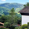
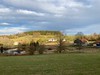
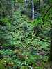
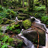
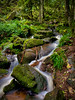
The above images may not be of the site on this page, but were taken nearby. They are loaded from Flickr so please click on them for image credits.
Click here to see more info for this site
Nearby sites
Click here to view sites on an interactive map of the areaKey: Red: member's photo, Blue: 3rd party photo, Yellow: other image, Green: no photo - please go there and take one, Grey: site destroyed
Download sites to:
KML (Google Earth)
GPX (GPS waypoints)
CSV (Garmin/Navman)
CSV (Excel)
To unlock full downloads you need to sign up as a Contributory Member. Otherwise downloads are limited to 50 sites.
Turn off the page maps and other distractions
Nearby sites listing. In the following links * = Image available
5.3km WSW 240° Fontaine Saint Augustin* Holy Well or Sacred Spring
5.9km W 265° Dolmen de Purifaing* Burial Chamber or Dolmen
7.9km W 278° Bassins de la tête des Cuveaux* Natural Stone / Erratic / Other Natural Feature
8.4km WSW 249° Le cercle de pierres du Fossard* Stone Circle
8.8km WSW 237° Pierres-Fittes Deux menhirs Standing Stone (Menhir)
9.2km SW 236° La Pierre de Kerlinkin* Natural Stone / Erratic / Other Natural Feature
24.4km N 359° Site de hauteur de la Corre Ancient Village or Settlement
30.7km NNE 28° Camp Celtique de la Bure* Ancient Village or Settlement
33.1km NNE 13° Dolmen dit le Chaudron des Fées Burial Chamber or Dolmen
33.7km NNE 15° Enceinte dite la Pierre d'Appel* Ancient Village or Settlement
34.0km NNE 11° Menhir des Lèches* Standing Stone (Menhir)
35.7km NNE 20° Menhir dit la Haute Pierre (Moyenmoutier) Standing Stone (Menhir)
36.3km SSW 210° Pierre Mourey Natural Stone / Erratic / Other Natural Feature
37.6km N 10° Pierre Borne (Bertrichamps)* Standing Stone (Menhir)
37.8km ESE 122° Puppelestein de Rimbach* Rock Outcrop
38.0km N 8° Pierre-Borne à la Maladrerie Menhirs Standing Stone (Menhir)
38.3km ESE 111° Longue Pierre De Soultzmatt* Standing Stone (Menhir)
38.8km E 95° Rocher Turenne* Natural Stone / Erratic / Other Natural Feature
38.8km ESE 117° Appenthal Menhirs* Stone Row / Alignment
38.9km E 95° La Fontaine de la Dame* Holy Well or Sacred Spring
40.0km ESE 121° Dietrichstein* Rock Outcrop
40.3km ESE 104° Table des Druides Schauenberg* Rock Outcrop
40.5km ESE 122° Heidenbuckel Menhir Standing Stone (Menhir)
40.6km ESE 105° Pierre du Diable du Teufelstein Rock Outcrop
40.6km W 273° Grotte Saint-Martin* Cave or Rock Shelter
View more nearby sites and additional images


 We would like to know more about this location. Please feel free to add a brief description and any relevant information in your own language.
 Wir möchten mehr über diese Stätte erfahren. Bitte zögern Sie nicht, eine kurze Beschreibung und relevante Informationen in Deutsch hinzuzufügen.
 Nous aimerions en savoir encore un peu sur les lieux. S'il vous plaît n'hesitez pas à ajouter une courte description et tous les renseignements pertinents dans votre propre langue.
 Quisieramos informarnos un poco más de las lugares. No dude en añadir una breve descripción y otros datos relevantes en su propio idioma.