


<< Our Photo Pages >> Sira Gård - Round Barrow(s) in Norway in Vest-Agder
Submitted by kenntha88 on Thursday, 12 November 2020 Page Views: 342
Neolithic and Bronze AgeSite Name: Sira Gård Alternative Name: DronninghaugenCountry: Norway
NOTE: This site is 1.162 km away from the location you searched for.
Fylke: Vest-Agder Type: Round Barrow(s)
Nearest Town: Flekkefjord
Latitude: 58.410947N Longitude: 6.635458E
Condition:
| 5 | Perfect |
| 4 | Almost Perfect |
| 3 | Reasonable but with some damage |
| 2 | Ruined but still recognisable as an ancient site |
| 1 | Pretty much destroyed, possibly visible as crop marks |
| 0 | No data. |
| -1 | Completely destroyed |
| 5 | Superb |
| 4 | Good |
| 3 | Ordinary |
| 2 | Not Good |
| 1 | Awful |
| 0 | No data. |
| 5 | Can be driven to, probably with disabled access |
| 4 | Short walk on a footpath |
| 3 | Requiring a bit more of a walk |
| 2 | A long walk |
| 1 | In the middle of nowhere, a nightmare to find |
| 0 | No data. |
| 5 | co-ordinates taken by GPS or official recorded co-ordinates |
| 4 | co-ordinates scaled from a detailed map |
| 3 | co-ordinates scaled from a bad map |
| 2 | co-ordinates of the nearest village |
| 1 | co-ordinates of the nearest town |
| 0 | no data |
Internal Links:
External Links:
")
At the edge of a grassy huge natural river terrace and next to a small local road crossing is a small round barrow. The barrow is around 17 metres in diameter and 2 metres in height. It is covered only in grass and can easily be seen. The barrow is just next to the road crossing almost tuching the two roads. The barrow is locally called Dronninghaugen or the queens barrow.
Next to the barrow, on the south side of the road is a huge ancient oak, this is said to be a old spirit tree and local people used to sacrifice beer at the trunk all up until the 1800s.
You may be viewing yesterday's version of this page. To see the most up to date information please register for a free account.
")
")
Do not use the above information on other web sites or publications without permission of the contributor.
Nearby Images from Flickr
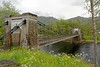
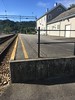
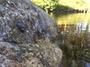
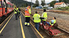

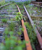
The above images may not be of the site on this page, but were taken nearby. They are loaded from Flickr so please click on them for image credits.
Click here to see more info for this site
Nearby sites
Click here to view sites on an interactive map of the areaKey: Red: member's photo, Blue: 3rd party photo, Yellow: other image, Green: no photo - please go there and take one, Grey: site destroyed
Download sites to:
KML (Google Earth)
GPX (GPS waypoints)
CSV (Garmin/Navman)
CSV (Excel)
To unlock full downloads you need to sign up as a Contributory Member. Otherwise downloads are limited to 50 sites.
Turn off the page maps and other distractions
Nearby sites listing. In the following links * = Image available
4.6km NE 51° Ersdal Pagan Altar* Sculptured Stone
6.4km NW 312° Moi Cemetery* Barrow Cemetery
15.7km W 262° Ålgård Runestone* Carving
20.3km WSW 249° Eiksteinen* Carving
20.6km WSW 248° Katthammar* Rock Art
21.2km WSW 255° Gygro* Standing Stone (Menhir)
21.2km WSW 256° Rosslandsguden* Sculptured Stone
21.3km W 265° Piggsteinsrudlå* Standing Stone (Menhir)
27.3km SSE 168° Mevollen Konge og Dronninghaugen* Round Barrow(s)
31.1km WNW 291° Møgedal Runestone* Carving
31.3km S 184° Sausebakk* Barrow Cemetery
31.3km S 182° Penne (Vest-Agder)* Rock Art
31.6km S 184° Nilsens Minde* Standing Stone (Menhir)
32.5km S 181° Vestre Hauge* Round Barrow(s)
32.9km S 188° Ogmundrøysa* Cairn
33.0km ENE 73° Boningshaugen* Barrow Cemetery
33.5km S 169° Straumsland* Stone Circle
34.3km ESE 102° Krosshaugen* Barrow Cemetery
34.8km E 93° Tingvatn Stone Circles* Stone Circle
34.9km ESE 105° Snartemo* Round Barrow(s)
34.9km S 184° Trihaugan* Round Barrow(s)
35.2km SSE 168° Kjørrefjord* Stone Row / Alignment
36.3km W 275° Stoplesteinane* Stone Circle
36.8km SSE 165° Vakthushaugen* Round Barrow(s)
36.9km SSE 165° Farsundsteinen* Carving
View more nearby sites and additional images


 We would like to know more about this location. Please feel free to add a brief description and any relevant information in your own language.
 Wir möchten mehr über diese Stätte erfahren. Bitte zögern Sie nicht, eine kurze Beschreibung und relevante Informationen in Deutsch hinzuzufügen.
 Nous aimerions en savoir encore un peu sur les lieux. S'il vous plaît n'hesitez pas à ajouter une courte description et tous les renseignements pertinents dans votre propre langue.
 Quisieramos informarnos un poco más de las lugares. No dude en añadir una breve descripción y otros datos relevantes en su propio idioma.