


<< Text Pages >> Lasterer Hügelgrab - Round Barrow(s) in Germany in Rhineland-Palatinate
Submitted by KaiHofmann on Wednesday, 25 November 2015 Page Views: 670
Neolithic and Bronze AgeSite Name: Lasterer HügelgrabCountry: Germany
NOTE: This site is 4.105 km away from the location you searched for.
Land: Rhineland-Palatinate Type: Round Barrow(s)
Nearest Town: Trier Nearest Village: Zemmer
Latitude: 49.889365N Longitude: 6.680493E
Condition:
| 5 | Perfect |
| 4 | Almost Perfect |
| 3 | Reasonable but with some damage |
| 2 | Ruined but still recognisable as an ancient site |
| 1 | Pretty much destroyed, possibly visible as crop marks |
| 0 | No data. |
| -1 | Completely destroyed |
| 5 | Superb |
| 4 | Good |
| 3 | Ordinary |
| 2 | Not Good |
| 1 | Awful |
| 0 | No data. |
| 5 | Can be driven to, probably with disabled access |
| 4 | Short walk on a footpath |
| 3 | Requiring a bit more of a walk |
| 2 | A long walk |
| 1 | In the middle of nowhere, a nightmare to find |
| 0 | No data. |
| 5 | co-ordinates taken by GPS or official recorded co-ordinates |
| 4 | co-ordinates scaled from a detailed map |
| 3 | co-ordinates scaled from a bad map |
| 2 | co-ordinates of the nearest village |
| 1 | co-ordinates of the nearest town |
| 0 | no data |
Internal Links:
External Links:
Round Barrow(s) in Rhineland-Palatinate
Iron age round barrow.
You may be viewing yesterday's version of this page. To see the most up to date information please register for a free account.
Do not use the above information on other web sites or publications without permission of the contributor.
Nearby Images from Flickr
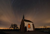
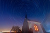

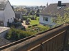
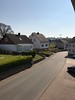
The above images may not be of the site on this page, but were taken nearby. They are loaded from Flickr so please click on them for image credits.
Click here to see more info for this site
Nearby sites
Click here to view sites on an interactive map of the areaKey: Red: member's photo, Blue: 3rd party photo, Yellow: other image, Green: no photo - please go there and take one, Grey: site destroyed
Download sites to:
KML (Google Earth)
GPX (GPS waypoints)
CSV (Garmin/Navman)
CSV (Excel)
To unlock full downloads you need to sign up as a Contributory Member. Otherwise downloads are limited to 50 sites.
Turn off the page maps and other distractions
Nearby sites listing. In the following links * = Image available
1.4km SSE 160° Friedbüsch Hügelgräber Round Barrow(s)
4.2km N 359° Hügelgräberfeld I Herforst Barrow Cemetery
4.4km SSE 162° Burgberg Kaiserhammer Hillfort
4.7km SW 215° Burgberg Ringwall Kordel* Hillfort
5.1km N 356° Hügelgräberfeld II Herforst Round Barrow(s)
6.3km SSE 149° Heiligenborn Schweich* Holy Well or Sacred Spring
7.5km SSW 196° Korpeslei Hillfort
7.6km S 189° Burgwall Auf Soels Hillfort
7.8km E 81° Wallenborn und Viktoriaquelle* Holy Well or Sacred Spring
8.0km S 170° Milo-Kreuz* Ancient Cross
8.0km SSW 204° Pützlöcher* Ancient Mine, Quarry or other Industry
8.1km SSW 196° Geyersley* Rock Outcrop
8.5km SSW 195° Klausnerhoehle* Cave or Rock Shelter
9.1km SSW 195° Hochburg* Promontory Fort / Cliff Castle
9.6km SSW 195° Genovevahoehle* Cave or Rock Shelter
10.1km NE 40° Teufelsstein bei Bruch* Standing Stone (Menhir)
10.9km SW 227° Grabhügelfeld Olk Barrow Cemetery
11.3km WSW 252° Grabhuegelgruppe Eisenach Barrow Cemetery
11.7km NE 53° Werdelstein* Natural Stone / Erratic / Other Natural Feature
11.9km WSW 250° Viereckschanze Eisenach Misc. Earthwork
13.7km SW 228° Langenstein Olk Rock Outcrop
14.3km NE 45° Bergweiler Huegelgraeber Barrow Cemetery
14.7km SE 138° Summstein Mehring* Modern Stone Circle etc
15.0km S 190° Domstein Trier* Early Christian Sculptured Stone
15.1km S 185° Franzensknueppchen* Artificial Mound
View more nearby sites and additional images


 We would like to know more about this location. Please feel free to add a brief description and any relevant information in your own language.
 Wir möchten mehr über diese Stätte erfahren. Bitte zögern Sie nicht, eine kurze Beschreibung und relevante Informationen in Deutsch hinzuzufügen.
 Nous aimerions en savoir encore un peu sur les lieux. S'il vous plaît n'hesitez pas à ajouter une courte description et tous les renseignements pertinents dans votre propre langue.
 Quisieramos informarnos un poco más de las lugares. No dude en añadir una breve descripción y otros datos relevantes en su propio idioma.