


<< Our Photo Pages >> Lothe (Utne) - Round Barrow(s) in Norway in Hordaland
Submitted by kenntha88 on Monday, 19 September 2022 Page Views: 1055
Neolithic and Bronze AgeSite Name: Lothe (Utne)Country: Norway
NOTE: This site is 6.056 km away from the location you searched for.
Fylke: Hordaland Type: Round Barrow(s)
Nearest Village: Kinsarvik
Latitude: 60.424077N Longitude: 6.542741E
Condition:
| 5 | Perfect |
| 4 | Almost Perfect |
| 3 | Reasonable but with some damage |
| 2 | Ruined but still recognisable as an ancient site |
| 1 | Pretty much destroyed, possibly visible as crop marks |
| 0 | No data. |
| -1 | Completely destroyed |
| 5 | Superb |
| 4 | Good |
| 3 | Ordinary |
| 2 | Not Good |
| 1 | Awful |
| 0 | No data. |
| 5 | Can be driven to, probably with disabled access |
| 4 | Short walk on a footpath |
| 3 | Requiring a bit more of a walk |
| 2 | A long walk |
| 1 | In the middle of nowhere, a nightmare to find |
| 0 | No data. |
| 5 | co-ordinates taken by GPS or official recorded co-ordinates |
| 4 | co-ordinates scaled from a detailed map |
| 3 | co-ordinates scaled from a bad map |
| 2 | co-ordinates of the nearest village |
| 1 | co-ordinates of the nearest town |
| 0 | no data |
Internal Links:
External Links:
 (PID:247864)")
In a fruit orchard at the large farm Lothe are two round barrows. The barrows have a very beautiful rounded shape and doesnt seem to have any damage except some racks for fruit trees places partly on top of the barrows.
The barrows are 22 and 16 metres in diameter and 3 and 1,5 metres in height. From the barrows there is a very pretty view over the idyllic Hardanger fjord.
You may be viewing yesterday's version of this page. To see the most up to date information please register for a free account.
 (PID:247865)")
 (PID:247863)")
Do not use the above information on other web sites or publications without permission of the contributor.
Nearby Images from Flickr
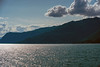
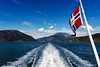
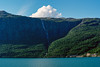
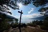
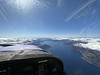
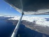
The above images may not be of the site on this page, but were taken nearby. They are loaded from Flickr so please click on them for image credits.
Click here to see more info for this site
Nearby sites
Click here to view sites on an interactive map of the areaKey: Red: member's photo, Blue: 3rd party photo, Yellow: other image, Green: no photo - please go there and take one, Grey: site destroyed
Download sites to:
KML (Google Earth)
GPX (GPS waypoints)
CSV (Garmin/Navman)
CSV (Excel)
To unlock full downloads you need to sign up as a Contributory Member. Otherwise downloads are limited to 50 sites.
Turn off the page maps and other distractions
Nearby sites listing. In the following links * = Image available
7.8km SE 141° Håhaugsteinen Helleristninger* Rock Art
12.5km SW 225° Bakke-Kalhagen Helleristning * Rock Art
13.1km SW 225° Vik-Gamlenaustet* Ancient Village or Settlement
14.5km WSW 256° Leirhaug* Round Barrow(s)
15.3km WSW 253° Rykkje* Rock Art
15.3km WSW 252° Bjelkanes* Cairn
15.3km W 260° Krakahaugen* Round Barrow(s)
15.7km NE 41° Kjerland* Round Barrow(s)
18.2km NE 34° Bårstesteinen* Standing Stone (Menhir)
18.3km NE 34° Endrehaugen* Round Barrow(s)
21.9km WSW 240° Salthammeren Stone Age Carvings* Rock Art
22.0km WSW 240° Salthammeren Bronze Age Carvings* Rock Art
22.6km WSW 255° Grova* Round Barrow(s)
23.5km NNW 337° Ormshaugen* Round Barrow(s)
23.6km NNW 336° Kvåle* Cist
24.2km NNW 345° Rogne* Round Barrow(s)
24.6km N 353° Vetlehaugen* Round Barrow(s)
24.9km N 360° Sledasteinen* Rock Art
25.1km SW 236° Augastad standing stone* Standing Stone (Menhir)
25.3km NNW 332° Byrkjehaugen* Round Barrow(s)
27.5km N 355° Reppavegen* Round Barrow(s)
29.3km E 82° Lægreid Liksteinen* Carving
29.5km SW 227° Vikingnes* Cairn
30.3km E 82° Hæreidsmoen* Barrow Cemetery
31.5km N 354° Grjotland* Barrow Cemetery
View more nearby sites and additional images


 We would like to know more about this location. Please feel free to add a brief description and any relevant information in your own language.
 Wir möchten mehr über diese Stätte erfahren. Bitte zögern Sie nicht, eine kurze Beschreibung und relevante Informationen in Deutsch hinzuzufügen.
 Nous aimerions en savoir encore un peu sur les lieux. S'il vous plaît n'hesitez pas à ajouter une courte description et tous les renseignements pertinents dans votre propre langue.
 Quisieramos informarnos un poco más de las lugares. No dude en añadir una breve descripción y otros datos relevantes en su propio idioma.