


<< Other Photo Pages >> Archaische Spuren - Modern Stone Circle etc in Germany in Rhineland-Palatinate
Submitted by Alta-Falisa on Saturday, 10 May 2014 Page Views: 2601
Modern SitesSite Name: Archaische SpurenCountry: Germany
NOTE: This site is 1.073 km away from the location you searched for.
Land: Rhineland-Palatinate Type: Modern Stone Circle etc
Nearest Town: Konz
Latitude: 49.697781N Longitude: 6.568809E
Condition:
| 5 | Perfect |
| 4 | Almost Perfect |
| 3 | Reasonable but with some damage |
| 2 | Ruined but still recognisable as an ancient site |
| 1 | Pretty much destroyed, possibly visible as crop marks |
| 0 | No data. |
| -1 | Completely destroyed |
| 5 | Superb |
| 4 | Good |
| 3 | Ordinary |
| 2 | Not Good |
| 1 | Awful |
| 0 | No data. |
| 5 | Can be driven to, probably with disabled access |
| 4 | Short walk on a footpath |
| 3 | Requiring a bit more of a walk |
| 2 | A long walk |
| 1 | In the middle of nowhere, a nightmare to find |
| 0 | No data. |
| 5 | co-ordinates taken by GPS or official recorded co-ordinates |
| 4 | co-ordinates scaled from a detailed map |
| 3 | co-ordinates scaled from a bad map |
| 2 | co-ordinates of the nearest village |
| 1 | co-ordinates of the nearest town |
| 0 | no data |
Internal Links:
External Links:
")
Entlang der Obermosel von Konz bis Palzem finden sich 16 Skulpturen von 15 Bildhauern aus Deutschland, Frankreich, Luxemburg, Italien und Österreich. Teil des Skulpturenwegs Rheinland-Pfalz. Direkt unterhalb der Saarbrücke steht die Skulptur „Archaische Spuren“ von Isabelle Federkeil, Ausgangspunkt des Skulpturenwegs.
Source : http://portalibertas.de/objekte/saarburg/kunstobjekte-brunnen/steine-am-fluss-201earchaische-spuren201c-konz
You may be viewing yesterday's version of this page. To see the most up to date information please register for a free account.
Do not use the above information on other web sites or publications without permission of the contributor.
Nearby Images from Flickr
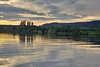
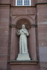
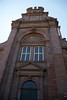
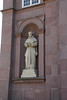
The above images may not be of the site on this page, but were taken nearby. They are loaded from Flickr so please click on them for image credits.
Click here to see more info for this site
Nearby sites
Click here to view sites on an interactive map of the areaKey: Red: member's photo, Blue: 3rd party photo, Yellow: other image, Green: no photo - please go there and take one, Grey: site destroyed
Download sites to:
KML (Google Earth)
GPX (GPS waypoints)
CSV (Garmin/Navman)
CSV (Excel)
To unlock full downloads you need to sign up as a Contributory Member. Otherwise downloads are limited to 50 sites.
Turn off the page maps and other distractions
Nearby sites listing. In the following links * = Image available
834m SSE 148° Weisser Wacken* Standing Stone (Menhir)
4.4km WNW 286° Heidenborn Oberbillig Holy Well or Sacred Spring
5.6km SW 229° Tempelbezirk Tawern* Ancient Temple
6.7km NNE 26° Heideborn* Holy Well or Sacred Spring
8.0km NE 46° Trier Roman Amphitheatre* Ancient Village or Settlement
8.1km NE 42° Rheinisches Landesmuseum Trier* Museum
8.4km NE 39° Domstein Trier* Early Christian Sculptured Stone
9.2km NE 47° Franzensknueppchen* Artificial Mound
9.9km W 275° Pierre du Diable (Manternach) Modern Stone Circle etc
10.5km NNW 347° Kersch Grabhügelgruppe Barrow Cemetery
12.3km N 350° Langenstein Olk Rock Outcrop
13.3km NNE 25° Genovevahoehle* Cave or Rock Shelter
13.8km NNE 24° Hochburg* Promontory Fort / Cliff Castle
13.9km SSE 154° Zerfer Menhir 2* Standing Stone (Menhir)
13.9km N 360° Grabhügelfeld Olk Barrow Cemetery
14.4km NNE 24° Klausnerhoehle* Cave or Rock Shelter
14.4km SSE 155° Zerfer Menhir 1* Standing Stone (Menhir)
14.5km S 177° Widdertshaeuschen* Chambered Tomb
14.7km NNE 23° Geyersley* Rock Outcrop
14.7km NNE 19° Pützlöcher* Ancient Mine, Quarry or other Industry
14.8km S 182° Kastel Felsplateau Ancient Village or Settlement
15.2km S 179° Altfels* Natural Stone / Erratic / Other Natural Feature
15.3km NNE 23° Korpeslei Hillfort
15.4km NNE 26° Burgwall Auf Soels Hillfort
15.7km E 95° Hünengrab Drei Mörder* Chambered Tomb
View more nearby sites and additional images


 We would like to know more about this location. Please feel free to add a brief description and any relevant information in your own language.
 Wir möchten mehr über diese Stätte erfahren. Bitte zögern Sie nicht, eine kurze Beschreibung und relevante Informationen in Deutsch hinzuzufügen.
 Nous aimerions en savoir encore un peu sur les lieux. S'il vous plaît n'hesitez pas à ajouter une courte description et tous les renseignements pertinents dans votre propre langue.
 Quisieramos informarnos un poco más de las lugares. No dude en añadir una breve descripción y otros datos relevantes en su propio idioma.