


<< Our Photo Pages >> Draugsvoll - Round Barrow(s) in Norway in Hordaland
Submitted by kenntha88 on Wednesday, 19 October 2022 Page Views: 267
Neolithic and Bronze AgeSite Name: DraugsvollCountry: Norway
NOTE: This site is 3.147 km away from the location you searched for.
Fylke: Hordaland Type: Round Barrow(s)
Nearest Town: Voss Nearest Village: Vinje
Latitude: 60.789926N Longitude: 6.513458E
Condition:
| 5 | Perfect |
| 4 | Almost Perfect |
| 3 | Reasonable but with some damage |
| 2 | Ruined but still recognisable as an ancient site |
| 1 | Pretty much destroyed, possibly visible as crop marks |
| 0 | No data. |
| -1 | Completely destroyed |
| 5 | Superb |
| 4 | Good |
| 3 | Ordinary |
| 2 | Not Good |
| 1 | Awful |
| 0 | No data. |
| 5 | Can be driven to, probably with disabled access |
| 4 | Short walk on a footpath |
| 3 | Requiring a bit more of a walk |
| 2 | A long walk |
| 1 | In the middle of nowhere, a nightmare to find |
| 0 | No data. |
| 5 | co-ordinates taken by GPS or official recorded co-ordinates |
| 4 | co-ordinates scaled from a detailed map |
| 3 | co-ordinates scaled from a bad map |
| 2 | co-ordinates of the nearest village |
| 1 | co-ordinates of the nearest town |
| 0 | no data |
Internal Links:
External Links:
")
The site consists of two very pretty round barrows located on a small hilltop in an open grassy field just behind a larger farm. A small footpath leads across the field and goes close to both barrows. In the open landscape the barrows are visible from far away. From the large farm it is a short walk across the field along the footpath.
The largest barrow to the west is 20 metres in diameter and 1,5-2 metres in height. It is called "kongshaugen". It has a very pretty shape and profile and doesnt seem to be having any damage. It is covered with short grass and a cluster of larger fir trees. Just next to Kongshaugen is possible remains of another overplown barrow.
To the east is another round barrow close to the road. It is 17 metres in diameter and 2 metres in height. This barrow has a little higher grass vegetation and trees than Kongshaugen but is still easily visible.
You may be viewing yesterday's version of this page. To see the most up to date information please register for a free account.
")
")
")
Do not use the above information on other web sites or publications without permission of the contributor.
Nearby Images from Flickr


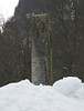
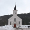
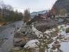
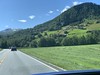
The above images may not be of the site on this page, but were taken nearby. They are loaded from Flickr so please click on them for image credits.
Click here to see more info for this site
Nearby sites
Click here to view sites on an interactive map of the areaKey: Red: member's photo, Blue: 3rd party photo, Yellow: other image, Green: no photo - please go there and take one, Grey: site destroyed
Download sites to:
KML (Google Earth)
GPX (GPS waypoints)
CSV (Garmin/Navman)
CSV (Excel)
To unlock full downloads you need to sign up as a Contributory Member. Otherwise downloads are limited to 50 sites.
Turn off the page maps and other distractions
Nearby sites listing. In the following links * = Image available
2.2km WSW 243° Runakollane* Cairn
7.5km ENE 75° Tinghaugane* Round Barrow(s)
8.5km ENE 76° Lundahovden* Round Barrow(s)
9.5km S 189° Grjotland* Barrow Cemetery
13.3km S 183° Reppavegen* Round Barrow(s)
15.8km S 174° Sledasteinen* Rock Art
16.3km S 184° Vetlehaugen* Round Barrow(s)
17.9km SSW 195° Rogne* Round Barrow(s)
20.6km SSW 202° Kvåle* Cist
20.6km SSW 202° Ormshaugen* Round Barrow(s)
21.1km SSW 209° Byrkjehaugen* Round Barrow(s)
28.1km SSE 155° Endrehaugen* Round Barrow(s)
28.1km SSE 155° Bårstesteinen* Standing Stone (Menhir)
31.2km SSE 157° Kjerland* Round Barrow(s)
31.8km N 6° Moahaugane* Barrow Cemetery
32.5km N 6° Vik Barrows* Round Barrow(s)
33.2km ENE 77° Flåmdalsvegen* Cist
33.2km ENE 78° Lunden i Flåm* Standing Stone (Menhir)
33.4km E 79° Flåmselvi* Standing Stones
38.7km ENE 71° Leikarvollen* Round Barrow(s)
38.8km N 2° Målhaugen* Barrow Cemetery
39.3km ENE 71° Sogn Hagebruksskule* Round Barrow(s)
39.4km ENE 71° Skuleveien* Round Barrow(s)
39.5km ENE 71° Kaffihaugen-Ospehaugen* Round Barrow(s)
40.7km S 178° Lothe (Utne)* Round Barrow(s)
View more nearby sites and additional images


 We would like to know more about this location. Please feel free to add a brief description and any relevant information in your own language.
 Wir möchten mehr über diese Stätte erfahren. Bitte zögern Sie nicht, eine kurze Beschreibung und relevante Informationen in Deutsch hinzuzufügen.
 Nous aimerions en savoir encore un peu sur les lieux. S'il vous plaît n'hesitez pas à ajouter une courte description et tous les renseignements pertinents dans votre propre langue.
 Quisieramos informarnos un poco más de las lugares. No dude en añadir una breve descripción y otros datos relevantes en su propio idioma.