


<< Text Pages >> Rances Schalensteine - Rock Art in Switzerland in Waadt
Submitted by AlexHunger on Saturday, 18 February 2006 Page Views: 3061
Rock ArtSite Name: Rances SchalensteineCountry: Switzerland
NOTE: This site is 4.957 km away from the location you searched for.
Canton: Waadt Type: Rock Art
Nearest Town: Lausanne Nearest Village: Rances
Latitude: 46.761220N Longitude: 6.531100E
Condition:
| 5 | Perfect |
| 4 | Almost Perfect |
| 3 | Reasonable but with some damage |
| 2 | Ruined but still recognisable as an ancient site |
| 1 | Pretty much destroyed, possibly visible as crop marks |
| 0 | No data. |
| -1 | Completely destroyed |
| 5 | Superb |
| 4 | Good |
| 3 | Ordinary |
| 2 | Not Good |
| 1 | Awful |
| 0 | No data. |
| 5 | Can be driven to, probably with disabled access |
| 4 | Short walk on a footpath |
| 3 | Requiring a bit more of a walk |
| 2 | A long walk |
| 1 | In the middle of nowhere, a nightmare to find |
| 0 | No data. |
| 5 | co-ordinates taken by GPS or official recorded co-ordinates |
| 4 | co-ordinates scaled from a detailed map |
| 3 | co-ordinates scaled from a bad map |
| 2 | co-ordinates of the nearest village |
| 1 | co-ordinates of the nearest town |
| 0 | no data |
Internal Links:
External Links:
Cuphole stones in Waadt
IMPORTANT NOTE: Site believed to be near this position. 2 cuphole stones in front of Church from nearby Bronze Age settlement.
Address: Sous-L'Église,
You may be viewing yesterday's version of this page. To see the most up to date information please register for a free account.
Do not use the above information on other web sites or publications without permission of the contributor.
Nearby Images from Flickr
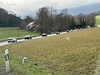
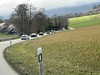
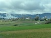
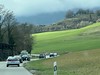
The above images may not be of the site on this page, but were taken nearby. They are loaded from Flickr so please click on them for image credits.
Click here to see more info for this site
Nearby sites
Click here to view sites on an interactive map of the areaKey: Red: member's photo, Blue: 3rd party photo, Yellow: other image, Green: no photo - please go there and take one, Grey: site destroyed
Download sites to:
KML (Google Earth)
GPX (GPS waypoints)
CSV (Garmin/Navman)
CSV (Excel)
To unlock full downloads you need to sign up as a Contributory Member. Otherwise downloads are limited to 50 sites.
Turn off the page maps and other distractions
Nearby sites listing. In the following links * = Image available
2.4km W 279° Pierre du Bon Château Rock Art
7.6km ENE 58° Menhir de Crusilles-Dessus* Modern Stone Circle etc
9.8km ENE 77° Clendy Steinalleen* Stone Row / Alignment
10.8km NE 55° Grandson Menhir* Standing Stone (Menhir)
11.4km SSW 202° Pierre à Camille* Modern Stone Circle etc
13.4km NE 51° Bonvillars Menhir* Standing Stone (Menhir)
13.7km SSW 214° La Praz Steinkreis* Stone Circle
15.4km NE 52° Praz Berthoud (Onnens)* Burial Chamber or Dolmen
15.6km SW 215° Mont-la-Ville Schalenstein Rock Art
16.3km NE 53° Pierres Longues de Corcelles* Standing Stones
18.7km WNW 298° Pierre qui Tourne (Les Grangettes) Rock Art
19.7km NE 51° Concise Schalenstein* Rock Art
21.6km NE 52° Erratic Stone La Grande-Béroche* Natural Stone / Erratic / Other Natural Feature
22.0km NE 51° Les Devens Menhir de St. Aubin* Standing Stone (Menhir)
24.2km ENE 68° Pierre du Mariage* Natural Stone / Erratic / Other Natural Feature
24.3km NE 49° Pierres de Guégenou* Standing Stones
24.3km NE 48° Les Devens Menhir de Gorgier* Standing Stone (Menhir)
27.0km NE 48° Vauroux Menhir* Standing Stone (Menhir)
27.6km SSE 163° Musee cantonal de Lausanne* Museum
27.8km NE 49° Menhir Bevaix/Treytel* Modern Stone Circle etc
28.8km SE 136° Pierre du dos á l'âne* Standing Stone (Menhir)
30.7km SSW 201° Erratic Stone Corcelles-Cormondrèche* Natural Stone / Erratic / Other Natural Feature
30.7km SSW 201° Menhir de La Varnette* Standing Stone (Menhir)
31.0km SSE 158° Lutry Menhirs* Stone Circle
32.0km SSW 210° Pierre du Bois Cabrol Rock Art
View more nearby sites and additional images


 We would like to know more about this location. Please feel free to add a brief description and any relevant information in your own language.
 Wir möchten mehr über diese Stätte erfahren. Bitte zögern Sie nicht, eine kurze Beschreibung und relevante Informationen in Deutsch hinzuzufügen.
 Nous aimerions en savoir encore un peu sur les lieux. S'il vous plaît n'hesitez pas à ajouter une courte description et tous les renseignements pertinents dans votre propre langue.
 Quisieramos informarnos un poco más de las lugares. No dude en añadir una breve descripción y otros datos relevantes en su propio idioma.