


<< Our Photo Pages >> Vik-Gamlenaustet - Ancient Village or Settlement in Norway in Rogaland
Submitted by kenntha88 on Sunday, 16 August 2020 Page Views: 494
Multi-periodSite Name: Vik-GamlenaustetCountry: Norway
NOTE: This site is 5.509 km away from the location you searched for.
Fylke: Rogaland Type: Ancient Village or Settlement
Nearest Village: Herand
Latitude: 60.340455N Longitude: 6.374962E
Condition:
| 5 | Perfect |
| 4 | Almost Perfect |
| 3 | Reasonable but with some damage |
| 2 | Ruined but still recognisable as an ancient site |
| 1 | Pretty much destroyed, possibly visible as crop marks |
| 0 | No data. |
| -1 | Completely destroyed |
| 5 | Superb |
| 4 | Good |
| 3 | Ordinary |
| 2 | Not Good |
| 1 | Awful |
| 0 | No data. |
| 5 | Can be driven to, probably with disabled access |
| 4 | Short walk on a footpath |
| 3 | Requiring a bit more of a walk |
| 2 | A long walk |
| 1 | In the middle of nowhere, a nightmare to find |
| 0 | No data. |
| 5 | co-ordinates taken by GPS or official recorded co-ordinates |
| 4 | co-ordinates scaled from a detailed map |
| 3 | co-ordinates scaled from a bad map |
| 2 | co-ordinates of the nearest village |
| 1 | co-ordinates of the nearest town |
| 0 | no data |
Internal Links:
External Links:
")
This site is a very well preserved remains of a boat house, probably for longships probably from viking age. The marks are clearly visible and can be observed from the main road going east to west just above the site.
The walls of the boat house are around 15 metres in length and around 0,5 metres deep in the terrain, they are covered only with short grass and are easy to see.
You may be viewing yesterday's version of this page. To see the most up to date information please register for a free account.
")
Do not use the above information on other web sites or publications without permission of the contributor.
Nearby Images from Flickr
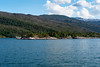
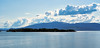
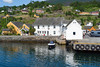
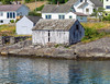
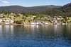
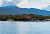
The above images may not be of the site on this page, but were taken nearby. They are loaded from Flickr so please click on them for image credits.
Click here to see more info for this site
Nearby sites
Click here to view sites on an interactive map of the areaKey: Red: member's photo, Blue: 3rd party photo, Yellow: other image, Green: no photo - please go there and take one, Grey: site destroyed
Download sites to:
KML (Google Earth)
GPX (GPS waypoints)
CSV (Garmin/Navman)
CSV (Excel)
To unlock full downloads you need to sign up as a Contributory Member. Otherwise downloads are limited to 50 sites.
Turn off the page maps and other distractions
Nearby sites listing. In the following links * = Image available
631m NE 35° Bakke-Kalhagen Helleristning * Rock Art
7.1km NW 311° Bjelkanes* Cairn
7.2km NW 312° Rykkje* Rock Art
7.5km NW 320° Leirhaug* Round Barrow(s)
8.8km NW 318° Krakahaugen* Round Barrow(s)
9.9km W 260° Salthammeren Stone Age Carvings* Rock Art
9.9km W 259° Salthammeren Bronze Age Carvings* Rock Art
12.4km WSW 247° Augastad standing stone* Standing Stone (Menhir)
13.1km NE 45° Lothe (Utne)* Round Barrow(s)
13.1km WNW 286° Grova* Round Barrow(s)
14.5km ENE 77° Håhaugsteinen Helleristninger* Rock Art
16.4km SW 229° Vikingnes* Cairn
28.8km NE 43° Kjerland* Round Barrow(s)
30.9km N 360° Ormshaugen* Round Barrow(s)
31.0km N 359° Kvåle* Cist
31.1km NE 38° Bårstesteinen* Standing Stone (Menhir)
31.3km NE 38° Endrehaugen* Round Barrow(s)
31.7km N 355° Byrkjehaugen* Round Barrow(s)
32.8km N 5° Rogne* Round Barrow(s)
34.3km N 11° Vetlehaugen* Round Barrow(s)
35.4km NNE 15° Sledasteinen* Rock Art
37.3km N 11° Reppavegen* Round Barrow(s)
38.1km SSE 165° Sandvin Standing Stone* Standing Stone (Menhir)
40.5km ENE 70° Lægreid Liksteinen* Carving
41.1km N 8° Grjotland* Barrow Cemetery
View more nearby sites and additional images


 We would like to know more about this location. Please feel free to add a brief description and any relevant information in your own language.
 Wir möchten mehr über diese Stätte erfahren. Bitte zögern Sie nicht, eine kurze Beschreibung und relevante Informationen in Deutsch hinzuzufügen.
 Nous aimerions en savoir encore un peu sur les lieux. S'il vous plaît n'hesitez pas à ajouter une courte description et tous les renseignements pertinents dans votre propre langue.
 Quisieramos informarnos un poco más de las lugares. No dude en añadir una breve descripción y otros datos relevantes en su propio idioma.