 with our Megalithic Portal iPhone app")


<< Text Pages >> Ortsgeschichtliches Museum Inden - Museum in Germany in North Rhine-Westphalia
Submitted by Harald_Platta on Tuesday, 15 August 2017 Page Views: 746
MuseumsSite Name: Ortsgeschichtliches Museum IndenCountry: Germany
NOTE: This site is 9.144 km away from the location you searched for.
Land: North Rhine-Westphalia Type: Museum
Nearest Town: Inden
Latitude: 50.844687N Longitude: 6.374066E
Condition:
| 5 | Perfect |
| 4 | Almost Perfect |
| 3 | Reasonable but with some damage |
| 2 | Ruined but still recognisable as an ancient site |
| 1 | Pretty much destroyed, possibly visible as crop marks |
| 0 | No data. |
| -1 | Completely destroyed |
| 5 | Superb |
| 4 | Good |
| 3 | Ordinary |
| 2 | Not Good |
| 1 | Awful |
| 0 | No data. |
| 5 | Can be driven to, probably with disabled access |
| 4 | Short walk on a footpath |
| 3 | Requiring a bit more of a walk |
| 2 | A long walk |
| 1 | In the middle of nowhere, a nightmare to find |
| 0 | No data. |
| 5 | co-ordinates taken by GPS or official recorded co-ordinates |
| 4 | co-ordinates scaled from a detailed map |
| 3 | co-ordinates scaled from a bad map |
| 2 | co-ordinates of the nearest village |
| 1 | co-ordinates of the nearest town |
| 0 | no data |
Internal Links:
External Links:
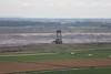
The Ortsgeschichtliches Museum Inden is a local history museum in Inden (North Rhine-Westphalia/Germany). It presents finds and models of the Neolithic settlements that were discovered in Inden as well as finds from the Romans and the Franks.
Homepage: Ortsgeschichtliches Museum Inden
You may be viewing yesterday's version of this page. To see the most up to date information please register for a free account.
Do not use the above information on other web sites or publications without permission of the contributor.
Nearby Images from Flickr
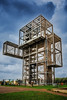
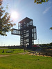

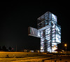
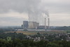
The above images may not be of the site on this page, but were taken nearby. They are loaded from Flickr so please click on them for image credits.
Click here to see more info for this site
Nearby sites
Click here to view sites on an interactive map of the areaKey: Red: member's photo, Blue: 3rd party photo, Yellow: other image, Green: no photo - please go there and take one, Grey: site destroyed
Download sites to:
KML (Google Earth)
GPX (GPS waypoints)
CSV (Garmin/Navman)
CSV (Excel)
To unlock full downloads you need to sign up as a Contributory Member. Otherwise downloads are limited to 50 sites.
Turn off the page maps and other distractions
Nearby sites listing. In the following links * = Image available
791m NW 319° Neolithic Settlemets Inden* Ancient Village or Settlement
5.5km WNW 289° Tempelbezirk Eschweiler-Fronhoven* Ancient Temple
17.2km SE 142° Heiliger Pütz* Holy Well or Sacred Spring
18.0km SW 225° Varnenum* Ancient Temple
20.3km SSE 157° Steinplatte Mittelberg Rock Art
21.2km NE 51° Informationszentrum Schloss Pfaffendorf* Museum
21.6km WSW 253° Lousberg Flint Quarry* Ancient Mine, Quarry or other Industry
23.9km SW 235° Zyklopensteine* Natural Stone / Erratic / Other Natural Feature
25.0km SE 139° Chlodwig-Stele* Modern Stone Circle etc
25.7km WSW 242° Grabhügelgruppe Ginsterbrückweg Barrow Cemetery
25.9km WSW 240° Klausberg Hügelgrab* Round Barrow(s)
25.9km WSW 244° Grabhügelgruppe Unterer Backertsweg Barrow Cemetery
26.8km WSW 249° Grafheuvel Vaals (47150) Round Barrow(s)
28.3km WSW 254° Lambertusbron Holy Well or Sacred Spring
28.4km NNE 31° Willibrordus Heilbrunnen Holy Well or Sacred Spring
29.0km S 179° Heilsteinquelle* Holy Well or Sacred Spring
29.4km WSW 251° Grafheuvel Vijlenerbos (47148) Round Barrow(s)
30.9km E 97° Summstein Lechenich Modern Stone Circle etc
31.4km NNE 29° Summstein Stadtparkinsel Modern Stone Circle etc
31.8km SSE 148° Menhir aus Dottel Standing Stone (Menhir)
32.4km SSW 202° Kaiser Karls Bettstatt Natural Stone / Erratic / Other Natural Feature
33.0km N 359° Archäologisches Museum Wasserturm Rheindahlen* Museum
34.7km SE 141° Katzensteine* Cave or Rock Shelter
35.8km NNW 335° Grabhügel Vickesheider Weg Round Barrow(s)
35.9km NNW 335° Grabhügelgruppe Rödger Bahn Barrow Cemetery
View more nearby sites and additional images


 We would like to know more about this location. Please feel free to add a brief description and any relevant information in your own language.
 Wir möchten mehr über diese Stätte erfahren. Bitte zögern Sie nicht, eine kurze Beschreibung und relevante Informationen in Deutsch hinzuzufügen.
 Nous aimerions en savoir encore un peu sur les lieux. S'il vous plaît n'hesitez pas à ajouter une courte description et tous les renseignements pertinents dans votre propre langue.
 Quisieramos informarnos un poco más de las lugares. No dude en añadir una breve descripción y otros datos relevantes en su propio idioma.