

<< Text Pages >> Prümzurlay Schleifmulden - Polissoir in Germany in Rhineland-Palatinate
Submitted by KaiHofmann on Wednesday, 01 March 2017 Page Views: 681
Neolithic and Bronze AgeSite Name: Prümzurlay SchleifmuldenCountry: Germany
NOTE: This site is 2.786 km away from the location you searched for.
Land: Rhineland-Palatinate Type: Polissoir
Nearest Town: Trier Nearest Village: Prümzurlay
Latitude: 49.867605N Longitude: 6.443193E
Condition:
| 5 | Perfect |
| 4 | Almost Perfect |
| 3 | Reasonable but with some damage |
| 2 | Ruined but still recognisable as an ancient site |
| 1 | Pretty much destroyed, possibly visible as crop marks |
| 0 | No data. |
| -1 | Completely destroyed |
| 5 | Superb |
| 4 | Good |
| 3 | Ordinary |
| 2 | Not Good |
| 1 | Awful |
| 0 | No data. |
| 5 | Can be driven to, probably with disabled access |
| 4 | Short walk on a footpath |
| 3 | Requiring a bit more of a walk |
| 2 | A long walk |
| 1 | In the middle of nowhere, a nightmare to find |
| 0 | No data. |
| 5 | co-ordinates taken by GPS or official recorded co-ordinates |
| 4 | co-ordinates scaled from a detailed map |
| 3 | co-ordinates scaled from a bad map |
| 2 | co-ordinates of the nearest village |
| 1 | co-ordinates of the nearest town |
| 0 | no data |
Internal Links:
External Links:
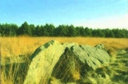
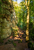
Polissoir in Rhineland-Palatinate
Probable neolithic human made furrows for stone axe sharpening techniques - a polissoir on a rock besides the road.
You may be viewing yesterday's version of this page. To see the most up to date information please register for a free account.
Do not use the above information on other web sites or publications without permission of the contributor.
Nearby Images from Flickr
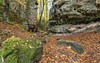
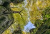
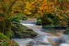

The above images may not be of the site on this page, but were taken nearby. They are loaded from Flickr so please click on them for image credits.
Click here to see more info for this site
Nearby sites
Click here to view sites on an interactive map of the areaKey: Red: member's photo, Blue: 3rd party photo, Yellow: other image, Green: no photo - please go there and take one, Grey: site destroyed
Download sites to:
KML (Google Earth)
GPX (GPS waypoints)
CSV (Garmin/Navman)
CSV (Excel)
To unlock full downloads you need to sign up as a Contributory Member. Otherwise downloads are limited to 50 sites.
Turn off the page maps and other distractions
Nearby sites listing. In the following links * = Image available
2.3km WNW 302° Holsthum Druidenstein* Standing Stone (Menhir)
3.1km NW 309° Holsthum Graeberfeld Rock Cut Tomb
3.6km WSW 258° Diesburgerhof Steinstele Natural Stone / Erratic / Other Natural Feature
3.6km WNW 294° Langenstein Holsthum* Standing Stone (Menhir)
4.3km WSW 252° Kiesgraeber* Rock Cut Tomb
4.6km SW 224° Schweigestelle* Carving
4.9km WSW 237° Niederburg Bollendorf* Hillfort
5.0km SW 235° Bollendorf Opferaltar* Natural Stone / Erratic / Other Natural Feature
5.1km W 263° Druidenstein Bollendorf* Standing Stone (Menhir)
5.2km W 278° Fraubillenkreuz* Standing Stone (Menhir)
5.3km SW 233° Dianadenkmal* Rock Art
5.4km W 266° Wolfsschluff Menhir Standing Stone (Menhir)
5.6km W 279° Standing Stone Fragments near Ferschweiler* Standing Stone (Menhir)
5.6km WNW 283° Nusbaumer Menhire* Standing Stones
5.7km NW 317° Hartberg Steinkistengrab* Chambered Tomb
5.7km WNW 288° Schankweiler Huegelgraeber* Barrow Cemetery
5.8km WSW 249° Grenzstein im Burghof Bollendorf* Standing Stone (Menhir)
5.8km WNW 288° Schankweiler Wikingerburg* Hillfort
6.1km ESE 106° Viereckschanze Eisenach Misc. Earthwork
6.2km SSW 194° Willibrordus Brunnen Echternach* Holy Well or Sacred Spring
6.4km E 100° Grabhuegelgruppe Eisenach Barrow Cemetery
6.8km WSW 248° Kalekapp* Cave or Rock Shelter
8.2km W 274° Wallendorf Voelkerhoehle Cave or Rock Shelter
9.6km SE 134° Langenstein Olk Rock Outcrop
10.3km ESE 119° Grabhügelfeld Olk Barrow Cemetery
View more nearby sites and additional images


 We would like to know more about this location. Please feel free to add a brief description and any relevant information in your own language.
 Wir möchten mehr über diese Stätte erfahren. Bitte zögern Sie nicht, eine kurze Beschreibung und relevante Informationen in Deutsch hinzuzufügen.
 Nous aimerions en savoir encore un peu sur les lieux. S'il vous plaît n'hesitez pas à ajouter une courte description et tous les renseignements pertinents dans votre propre langue.
 Quisieramos informarnos un poco más de las lugares. No dude en añadir una breve descripción y otros datos relevantes en su propio idioma.