


<< Text Pages >> SiegfriedMuseum Xanten - Museum in Germany in North Rhine-Westphalia
Submitted by Harald_Platta on Thursday, 18 August 2022 Page Views: 584
MuseumsSite Name: SiegfriedMuseum XantenCountry: Germany
NOTE: This site is 3.384 km away from the location you searched for.
Land: North Rhine-Westphalia Type: Museum
Nearest Town: Xanten
Latitude: 51.661513N Longitude: 6.452585E
Condition:
| 5 | Perfect |
| 4 | Almost Perfect |
| 3 | Reasonable but with some damage |
| 2 | Ruined but still recognisable as an ancient site |
| 1 | Pretty much destroyed, possibly visible as crop marks |
| 0 | No data. |
| -1 | Completely destroyed |
| 5 | Superb |
| 4 | Good |
| 3 | Ordinary |
| 2 | Not Good |
| 1 | Awful |
| 0 | No data. |
| 5 | Can be driven to, probably with disabled access |
| 4 | Short walk on a footpath |
| 3 | Requiring a bit more of a walk |
| 2 | A long walk |
| 1 | In the middle of nowhere, a nightmare to find |
| 0 | No data. |
| 5 | co-ordinates taken by GPS or official recorded co-ordinates |
| 4 | co-ordinates scaled from a detailed map |
| 3 | co-ordinates scaled from a bad map |
| 2 | co-ordinates of the nearest village |
| 1 | co-ordinates of the nearest town |
| 0 | no data |
Internal Links:
External Links:
The SiegfriedMuseum Xanten deals with the mythological Germanic hero Siegfried (Sigurd), who was supposed to stem from Xanten.
The museum presentation points out the historic persons that possibly inspired the Siegfried figure and also discusses the different presentations from early carvings on rune stones from Sweden and stone crosses from the British Isles, over the Nibelungenlied and the Poetic Edda to the sometimes problematic perception in the 19th/20th century.
The museum is located in the historic location of the medieval fortifications and is part of a historic walk through the old town of Xanten.
Homepage: SiegfriedMuseum Xanten
You may be viewing yesterday's version of this page. To see the most up to date information please register for a free account.
Do not use the above information on other web sites or publications without permission of the contributor.
Nearby Images from Flickr
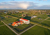
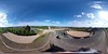
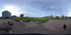
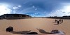
The above images may not be of the site on this page, but were taken nearby. They are loaded from Flickr so please click on them for image credits.
Click here to see more info for this site
Nearby sites
Click here to view sites on an interactive map of the areaKey: Red: member's photo, Blue: 3rd party photo, Yellow: other image, Green: no photo - please go there and take one, Grey: site destroyed
Download sites to:
KML (Google Earth)
GPX (GPS waypoints)
CSV (Garmin/Navman)
CSV (Excel)
To unlock full downloads you need to sign up as a Contributory Member. Otherwise downloads are limited to 50 sites.
Turn off the page maps and other distractions
Nearby sites listing. In the following links * = Image available
123m NNE 19° Batimodus Stein* Early Christian Sculptured Stone
655m WNW 303° Matronenheiligtum Colonia Ulpia Traiana* Ancient Temple
1.0km WNW 302° LVR Archaeologischer Park Xanten* Museum
6.8km WNW 300° Grabhügelfeld Marienbaum* Barrow Cemetery
7.7km NE 54° Grabhügelfeld Diersfordt Barrow Cemetery
12.4km S 175° Grabhügelgruppe Bönninghardt* Barrow Cemetery
16.2km W 275° Grabhügelfeld Kalbeck* Barrow Cemetery
16.7km WSW 239° Niederrheinisches Museum Kevelaer* Museum
19.7km NE 38° Grabhügel Biemenhorst Round Barrow(s)
21.9km ENE 75° Teufelsstein Schermbeck Natural Stone / Erratic / Other Natural Feature
21.9km ENE 76° Kelwigstein Natural Stone / Erratic / Other Natural Feature
22.5km SSE 152° Summstein Jungborn Modern Stone Circle etc
25.3km SW 230° Grafheuvel Wellerlooi (45084)* Round Barrow(s)
26.4km ESE 103° Teufelsteine Hünxe* Natural Stone / Erratic / Other Natural Feature
27.1km WNW 303° Grabhügelfeld Donsbrüggen Barrow Cemetery
27.2km ENE 62° Wodanstein in Lanzenhagen* Rock Art
27.8km NNW 329° Berghse Kei* Modern Stone Circle etc
27.9km NNE 22° Grabhügel Hemden Round Barrow(s)
28.0km NW 307° Mars-Camulus-Stein* Early Christian Sculptured Stone
29.3km ENE 65° Braunkohlenquarzit-Findling Raesfeld* Natural Stone / Erratic / Other Natural Feature
29.7km ENE 72° Gerichtsplatz an der Femeiche* Natural Stone / Erratic / Other Natural Feature
30.0km NE 56° Grabhügel Westenborken 2 Round Barrow(s)
30.1km NE 56° Grabhügel Westenborken 1 Round Barrow(s)
30.5km NE 51° Grabhügelfeld Am Kaninchenberg Barrow Cemetery
31.4km ENE 71° Erler Teufelsstein* Natural Stone / Erratic / Other Natural Feature
View more nearby sites and additional images


 We would like to know more about this location. Please feel free to add a brief description and any relevant information in your own language.
 Wir möchten mehr über diese Stätte erfahren. Bitte zögern Sie nicht, eine kurze Beschreibung und relevante Informationen in Deutsch hinzuzufügen.
 Nous aimerions en savoir encore un peu sur les lieux. S'il vous plaît n'hesitez pas à ajouter une courte description et tous les renseignements pertinents dans votre propre langue.
 Quisieramos informarnos un poco más de las lugares. No dude en añadir una breve descripción y otros datos relevantes en su propio idioma.