


<< Our Photo Pages >> Skjonghelleren - Cave or Rock Shelter in Norway in Møre og Romsdal
Submitted by kenntha88 on Tuesday, 11 September 2012 Page Views: 3988
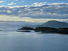
Natural PlacesSite Name: Skjonghelleren Alternative Name: DaumannshellerenCountry: Norway Fylke: Møre og Romsdal Type: Cave or Rock Shelter
Nearest Town: Ålesund Nearest Village: Vigra
Latitude: 62.519542N Longitude: 6.103506E
Condition:
| 5 | Perfect |
| 4 | Almost Perfect |
| 3 | Reasonable but with some damage |
| 2 | Ruined but still recognisable as an ancient site |
| 1 | Pretty much destroyed, possibly visible as crop marks |
| 0 | No data. |
| -1 | Completely destroyed |
| 5 | Superb |
| 4 | Good |
| 3 | Ordinary |
| 2 | Not Good |
| 1 | Awful |
| 0 | No data. |
| 5 | Can be driven to, probably with disabled access |
| 4 | Short walk on a footpath |
| 3 | Requiring a bit more of a walk |
| 2 | A long walk |
| 1 | In the middle of nowhere, a nightmare to find |
| 0 | No data. |
| 5 | co-ordinates taken by GPS or official recorded co-ordinates |
| 4 | co-ordinates scaled from a detailed map |
| 3 | co-ordinates scaled from a bad map |
| 2 | co-ordinates of the nearest village |
| 1 | co-ordinates of the nearest town |
| 0 | no data |
Internal Links:
External Links:
")
The cave extends 70 metres, but the fractured zone filled with loose material extends about 140 metres into the mountain.
Finds which have so far been made in this material include animal bones up to 30000 years old. Skjonghelleren is an archive which can tell us stories from far back in time. The climate here 30 000 years ago was about the same as that of Svalbard and the coast of Finnmark today. No traces of people from such an early date have been found, but it is in caves like Skjonghelleren that such finds may possible be made.
Arrowheads and spearheads, combs and remains of cooking implements like clay pots and bone spoons are among the items which have been dug out. Unfortunately most of the thick layer from the time of human settlement was removed in the last century. Some of the finds have hovewer been saved, including four bone arrowheads and two spindles of fired clay. A human jawbone and the cranium of a large animal were also found.
The bones of 42 species of birds have been found in the cave. This is one of the richest finds in Norway and has increased our knowledge about the fauna of the interglacial period and the climate of that time. The most numerous bird species are little auk, brunnicks guillemot and ivory gull, all of which now nest of Svalbard. There were also otter, arctic fox and ringed seal. fish bones found in the vace show 18 times as many bones from cod than from coalfish. This supports the theory that people stayed in Skjonghelleren in winter, when there were prolific supplies of cod.
The known history of human habitation in Norway goes back no further than to the last ice age, 10--12000 years ago. The first known "norwegians" were hunters, who lived of what nature provided. The oldest definite traces of human activity in Skjonghelleren are 2000 years old.
Traces of permanent settlement may be found in the cleared area of land below Skjonghelleren. there are a number of heaps of stones here which indicate the clearing of the area for agriculture. Dating indicates that this area was cleared about 3000 years ago, during a period of expansive cultivation.
Otherwise, the area around Skjonghelleren is rich in areas of settlement and burial mounds. The most easily seen are the three restored mounds at Kvennhusvika.
Close to Skjonghelleren are two other very noticable stone caves called Dødmannshola (dead man`s hole) and Trollkjelen (The trolls kettle).
You may be viewing yesterday's version of this page. To see the most up to date information please register for a free account.
")
")
")
Do not use the above information on other web sites or publications without permission of the contributor.
Nearby Images from Flickr

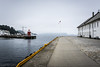
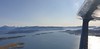
The above images may not be of the site on this page, but were taken nearby. They are loaded from Flickr so please click on them for image credits.
Click here to see more info for this site
Nearby sites
Click here to view sites on an interactive map of the areaKey: Red: member's photo, Blue: 3rd party photo, Yellow: other image, Green: no photo - please go there and take one, Grey: site destroyed
Download sites to:
KML (Google Earth)
GPX (GPS waypoints)
CSV (Garmin/Navman)
CSV (Excel)
To unlock full downloads you need to sign up as a Contributory Member. Otherwise downloads are limited to 50 sites.
Turn off the page maps and other distractions
Nearby sites listing. In the following links * = Image available
2.9km SW 227° Mjeltehaugen Barrow* Artificial Mound
3.6km SW 230° Giske standing stone* Standing Stone (Menhir)
4.4km WNW 299° Synes standing stone* Standing Stone (Menhir)
5.7km NNW 336° Blimshaugen mound* Round Barrow(s)
5.8km NNW 334° Sjøskardet standing stone* Standing Stone (Menhir)
6.9km SSW 213° Eilifrøysa Gravhaug* Cairn
7.0km SSW 212° Hogsteinneset standing stones* Standing Stones
7.7km WSW 241° Alnestrøya standing stone* Standing Stone (Menhir)
17.3km SSW 193° Hareid standing stones* Standing Stones
18.8km S 185° Hjørungavåg standing stones* Standing Stones
23.0km SW 219° Laberget standing stone* Standing Stone (Menhir)
23.1km SW 219° Ryssholmen Standing Stone* Standing Stone (Menhir)
24.0km SW 216° Oshaugen cairn* Cairn
24.1km SW 216° Osnes Standing Stone* Standing Stone (Menhir)
32.2km SSW 203° Selvåg standing stone* Standing Stone (Menhir)
33.0km S 191° Steinneset standing stones* Standing Stones
39.1km ENE 70° Naustvollen* Standing Stone (Menhir)
44.5km SW 219° Larsnes Standing Stones* Standing Stones
48.0km NE 48° Korsbø-Smøla* Standing Stones
49.8km NE 55° Tangen (Aukra)* Round Barrow(s)
50.7km NE 54° Prestegardsskogen* Round Barrow(s)
53.3km E 79° Kråkneset Cairns* Cairn
55.0km NE 52° Hoksnes* Standing Stone (Menhir)
57.5km NE 54° Reithaugen Round Barrow(s)
60.7km NE 45° Gule* Standing Stone (Menhir)
View more nearby sites and additional images


 We would like to know more about this location. Please feel free to add a brief description and any relevant information in your own language.
 Wir möchten mehr über diese Stätte erfahren. Bitte zögern Sie nicht, eine kurze Beschreibung und relevante Informationen in Deutsch hinzuzufügen.
 Nous aimerions en savoir encore un peu sur les lieux. S'il vous plaît n'hesitez pas à ajouter une courte description et tous les renseignements pertinents dans votre propre langue.
 Quisieramos informarnos un poco más de las lugares. No dude en añadir una breve descripción y otros datos relevantes en su propio idioma.