


<< Our Photo Pages >> Trondehaugen - Round Barrow(s) in Norway in Sogn og Fjordane
Submitted by kenntha88 on Monday, 11 October 2021 Page Views: 260
Neolithic and Bronze AgeSite Name: TrondehaugenCountry: Norway
NOTE: This site is 2.086 km away from the location you searched for.
Fylke: Sogn og Fjordane Type: Round Barrow(s)
Nearest Village: Sandane
Latitude: 61.760618N Longitude: 6.188479E
Condition:
| 5 | Perfect |
| 4 | Almost Perfect |
| 3 | Reasonable but with some damage |
| 2 | Ruined but still recognisable as an ancient site |
| 1 | Pretty much destroyed, possibly visible as crop marks |
| 0 | No data. |
| -1 | Completely destroyed |
| 5 | Superb |
| 4 | Good |
| 3 | Ordinary |
| 2 | Not Good |
| 1 | Awful |
| 0 | No data. |
| 5 | Can be driven to, probably with disabled access |
| 4 | Short walk on a footpath |
| 3 | Requiring a bit more of a walk |
| 2 | A long walk |
| 1 | In the middle of nowhere, a nightmare to find |
| 0 | No data. |
| 5 | co-ordinates taken by GPS or official recorded co-ordinates |
| 4 | co-ordinates scaled from a detailed map |
| 3 | co-ordinates scaled from a bad map |
| 2 | co-ordinates of the nearest village |
| 1 | co-ordinates of the nearest town |
| 0 | no data |
Internal Links:
External Links:
")
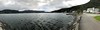
The barrow has a very pretty rounded top and doesn't seem to have the typical crater on top. A flag pole has been put up just at the top of the barrow. The barrow is 25 metres in diameter and 3 metres in height and only covered with grass, making it easy to see from far away.
You may be viewing yesterday's version of this page. To see the most up to date information please register for a free account.
")
")
Do not use the above information on other web sites or publications without permission of the contributor.
Nearby Images from Flickr
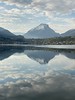
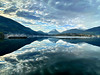
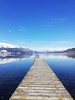
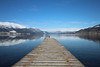

The above images may not be of the site on this page, but were taken nearby. They are loaded from Flickr so please click on them for image credits.
Click here to see more info for this site
Nearby sites
Click here to view sites on an interactive map of the areaKey: Red: member's photo, Blue: 3rd party photo, Yellow: other image, Green: no photo - please go there and take one, Grey: site destroyed
Download sites to:
KML (Google Earth)
GPX (GPS waypoints)
CSV (Garmin/Navman)
CSV (Excel)
To unlock full downloads you need to sign up as a Contributory Member. Otherwise downloads are limited to 50 sites.
Turn off the page maps and other distractions
Nearby sites listing. In the following links * = Image available
366m ESE 108° Mardal* Barrow Cemetery
2.9km N 355° Karnil's Mound* Round Barrow(s)
2.9km N 2° Austrheim standing stone* Standing Stone (Menhir)
4.8km NNW 338° Tystad Standing Stone* Standing Stone (Menhir)
5.8km NNW 339° Vereide barrow cemetery* Barrow Cemetery
11.1km NNW 329° Heksesteinen* Carving
19.6km NNW 328° Myklebust Round Barrows* Round Barrow(s)
24.9km NW 314° Naustdal standing stone* Standing Stone (Menhir)
24.9km NW 315° Viljane standing stone* Standing Stone (Menhir)
32.8km SSW 202° Furebø Standing Stone* Standing Stone (Menhir)
32.9km ENE 60° Vellane standing stone* Standing Stone (Menhir)
38.0km SSW 202° Lølandsterrassen Gravfelt* Barrow Cemetery
47.1km W 278° Vingen* Rock Art
47.3km ENE 67° Nibba Standing Stone* Standing Stone (Menhir)
47.4km S 183° Fyling standing stone* Standing Stone (Menhir)
50.9km SW 214° Tussehaugen Mound* Round Barrow(s)
53.0km NNW 348° Steinneset standing stones* Standing Stones
53.3km WNW 300° Korsneset standing stone* Standing Stone (Menhir)
53.5km WNW 301° Hornsetra standing stone* Standing Stone (Menhir)
53.5km WNW 301° Barmen Runestone* Carving
53.7km WSW 243° Ausevik Rock Art* Rock Art
54.4km NW 306° Selje barrow cemetery* Barrow Cemetery
54.6km ENE 70° Guddal Jøtulstaven* Standing Stone (Menhir)
57.5km NNW 343° Selvåg standing stone* Standing Stone (Menhir)
59.2km NNW 327° Larsnes Standing Stones* Standing Stones
View more nearby sites and additional images


 We would like to know more about this location. Please feel free to add a brief description and any relevant information in your own language.
 Wir möchten mehr über diese Stätte erfahren. Bitte zögern Sie nicht, eine kurze Beschreibung und relevante Informationen in Deutsch hinzuzufügen.
 Nous aimerions en savoir encore un peu sur les lieux. S'il vous plaît n'hesitez pas à ajouter une courte description et tous les renseignements pertinents dans votre propre langue.
 Quisieramos informarnos un poco más de las lugares. No dude en añadir una breve descripción y otros datos relevantes en su propio idioma.