


<< Text Pages >> Dorpsterp Oostrum - Ancient Village or Settlement in Netherlands in Friesland
Submitted by XIII on Wednesday, 20 April 2016 Page Views: 1223
Multi-periodSite Name: Dorpsterp Oostrum Alternative Name: EastrumCountry: Netherlands
NOTE: This site is 8.968 km away from the location you searched for.
Province: Friesland Type: Ancient Village or Settlement
Nearest Town: Dokkum Nearest Village: Oostrum
Latitude: 53.332317N Longitude: 6.062011E
Condition:
| 5 | Perfect |
| 4 | Almost Perfect |
| 3 | Reasonable but with some damage |
| 2 | Ruined but still recognisable as an ancient site |
| 1 | Pretty much destroyed, possibly visible as crop marks |
| 0 | No data. |
| -1 | Completely destroyed |
| 5 | Superb |
| 4 | Good |
| 3 | Ordinary |
| 2 | Not Good |
| 1 | Awful |
| 0 | No data. |
| 5 | Can be driven to, probably with disabled access |
| 4 | Short walk on a footpath |
| 3 | Requiring a bit more of a walk |
| 2 | A long walk |
| 1 | In the middle of nowhere, a nightmare to find |
| 0 | No data. |
| 5 | co-ordinates taken by GPS or official recorded co-ordinates |
| 4 | co-ordinates scaled from a detailed map |
| 3 | co-ordinates scaled from a bad map |
| 2 | co-ordinates of the nearest village |
| 1 | co-ordinates of the nearest town |
| 0 | no data |
Be the first person to rate this site - see the 'Contribute!' box in the right hand menu.
Internal Links:
External Links:
Ancient Village or Settlement in Friesland
During excavation of the dorpsterp (village mound) in 2006, remains were found of a
funnelbeaker culture settlement which was dated to 3400-2850 BC
Rijksmonument (national monument) number: 45193
You may be viewing yesterday's version of this page. To see the most up to date information please register for a free account.
Do not use the above information on other web sites or publications without permission of the contributor.
Nearby Images from Flickr
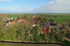

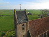
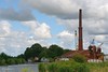
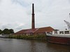
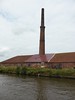
The above images may not be of the site on this page, but were taken nearby. They are loaded from Flickr so please click on them for image credits.
Click here to see more info for this site
Nearby sites
Click here to view sites on an interactive map of the areaKey: Red: member's photo, Blue: 3rd party photo, Yellow: other image, Green: no photo - please go there and take one, Grey: site destroyed
Download sites to:
KML (Google Earth)
GPX (GPS waypoints)
CSV (Garmin/Navman)
CSV (Excel)
To unlock full downloads you need to sign up as a Contributory Member. Otherwise downloads are limited to 50 sites.
Turn off the page maps and other distractions
Nearby sites listing. In the following links * = Image available
4.1km WSW 254° Bonifatiusbron Holy Well Holy Well or Sacred Spring
9.9km SSE 149° Ijstijdenmuseum Museum
14.1km W 272° Terp Hegebeintum (45523) Ancient Village or Settlement
16.4km SSW 198° Poppestien* Natural Stone / Erratic / Other Natural Feature
24.4km SE 141° Zwerfsteen Mienscheer* Natural Stone / Erratic / Other Natural Feature
34.3km SE 137° D1 Steenbergen* Passage Grave
35.1km SSE 154° Donkerbroek (45873) Ancient Village or Settlement
35.1km SSE 154° Waskemeer (45872) Ancient Village or Settlement
35.1km SSE 154° Oosterwolde (45877) Ancient Village or Settlement
35.4km SSE 153° Waskemeer (45871) Ancient Village or Settlement
35.5km SSE 152° Waskemeer (45870) Ancient Village or Settlement
36.7km S 180° Museum Opsterlân Museum
38.2km SSE 159° Donkerbroek (45875) Ancient Village or Settlement
39.0km SSE 154° Oosterwolde (45874) Ancient Village or Settlement
39.8km SSE 168° Twijtel (45879) Ancient Village or Settlement
39.8km SE 138° Norg Kerk Hunebed* Natural Stone / Erratic / Other Natural Feature
40.0km SE 140° D2 Westervelde* Passage Grave
40.7km ESE 121° Grafheuvel Eelde (45394) Round Barrow(s)
42.2km SSE 162° Langedijke (45878) Ancient Village or Settlement
43.4km SE 134° D5 Zeijen* Passage Grave
43.4km ESE 117° G4 Onner Es Chambered Tomb
43.6km SE 127° Gebroken Cirkel* Modern Stone Circle etc
44.3km ESE 120° G3 Glimmer Es* Chambered Tomb
44.4km ESE 120° G2 Glimmer Es Passage Grave
44.7km SE 129° Zwerfsteen Vries* Natural Stone / Erratic / Other Natural Feature
View more nearby sites and additional images


 We would like to know more about this location. Please feel free to add a brief description and any relevant information in your own language.
 Wir möchten mehr über diese Stätte erfahren. Bitte zögern Sie nicht, eine kurze Beschreibung und relevante Informationen in Deutsch hinzuzufügen.
 Nous aimerions en savoir encore un peu sur les lieux. S'il vous plaît n'hesitez pas à ajouter une courte description et tous les renseignements pertinents dans votre propre langue.
 Quisieramos informarnos un poco más de las lugares. No dude en añadir una breve descripción y otros datos relevantes en su propio idioma.